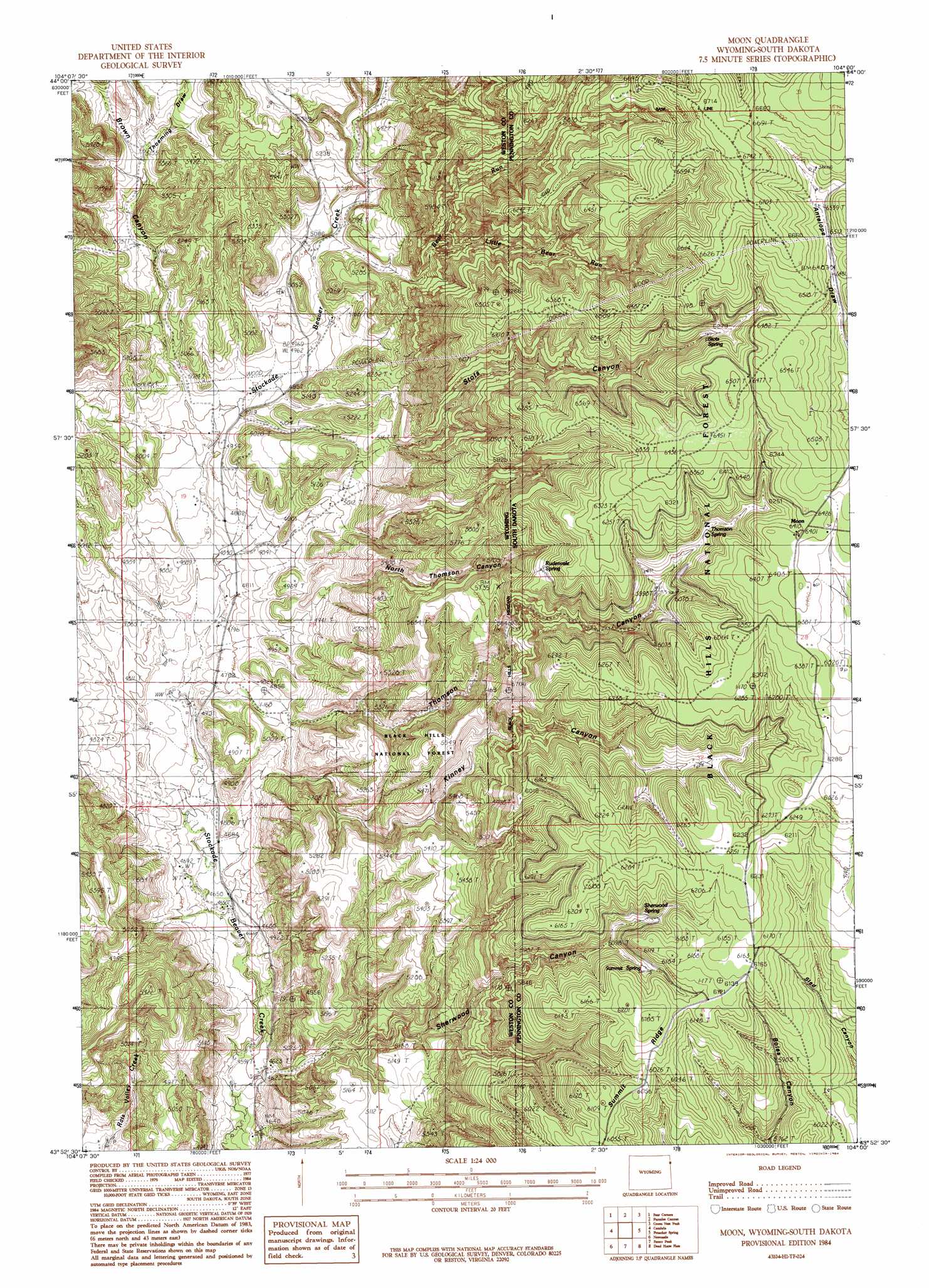
Moon Topo Map Wyoming
To zoom in, hover over the map of Moon
USGS Topo Quad 43104h1 - 1:24,000 scale
| Topo Map Name: | Moon |
| USGS Topo Quad ID: | 43104h1 |
| Print Size: | ca. 21 1/4" wide x 27" high |
| Southeast Coordinates: | 43.875° N latitude / 104° W longitude |
| Map Center Coordinates: | 43.9375° N latitude / 104.0625° W longitude |
| U.S. States: | WY, SD |
| Filename: | o43104h1.jpg |
| Download Map JPG Image: | Moon topo map 1:24,000 scale |
| Map Type: | Topographic |
| Topo Series: | 7.5´ |
| Map Scale: | 1:24,000 |
| Source of Map Images: | United States Geological Survey (USGS) |
| Alternate Map Versions: |
Moon SD 1984, updated 1984 Download PDF Buy paper map Moon SD 2012 Download PDF Buy paper map Moon SD 2015 Download PDF Buy paper map |
| FStopo: | US Forest Service topo Moon is available: Download FStopo PDF Download FStopo TIF |
1:24,000 Topo Quads surrounding Moon
Inyan Kara Mountain |
Dry Draw |
Buckhorn |
Crooks Tower |
Nahant |
Skull Creek |
Four Corners |
Parmlee Canyon |
Crows Nest Peak |
Deerfield |
Pedro |
Cambria |
Moon |
Preacher Spring |
Ditch Creek |
Osage Se |
Newcastle |
Fanny Peak |
Dead Horse Flats |
Signal Hill |
Morrisey Ne |
Owens |
Clifton |
Jewel Cave Nw |
Jewel Cave |
> Back to 43104e1 at 1:100,000 scale
> Back to 43104a1 at 1:250,000 scale
> Back to U.S. Topo Maps home
Moon topo map: Gazetteer
Moon: Dams
Dolores Number 1 Dam elevation 1638m 5374′Jordon Dam elevation 1553m 5095′
Martin Thompson Dam elevation 1440m 4724′
Moon: Mines
Last Chance Filler Pit Mine elevation 1542m 5059′Moon: Populated Places
Moon elevation 1951m 6400′Moon: Reservoirs
Dolores Number 1 Reservoir elevation 1638m 5374′Jordon Reservoir elevation 1553m 5095′
Martin Thompson Reservoir elevation 1440m 4724′
Moon: Ridges
Sherwood-Kinney Divide elevation 1916m 6286′Thomson-Kinney Divide elevation 1902m 6240′
Moon: Springs
Antelope Springs elevation 2001m 6564′Rudenvale Spring elevation 1844m 6049′
Sherwood Spring elevation 1578m 5177′
Stots Spring elevation 1936m 6351′
Summit Spring elevation 1852m 6076′
Thomson Spring elevation 1856m 6089′
Moon: Streams
Bear Run elevation 1548m 5078′Little Bear Run elevation 1628m 5341′
Moon: Valleys
Brown Canyon elevation 1497m 4911′Kinney Canyon elevation 1451m 4760′
North Thomson Canyon elevation 1483m 4865′
Sherwood Canyon elevation 1410m 4625′
Stots Canyon elevation 1495m 4904′
Thoeming Draw elevation 1568m 5144′
Thomson Canyon elevation 1510m 4954′
Moon digital topo map on disk
Buy this Moon topo map showing relief, roads, GPS coordinates and other geographical features, as a high-resolution digital map file on DVD:
Eastern Wyoming & Western South Dakota
Buy digital topo maps: Eastern Wyoming & Western South Dakota