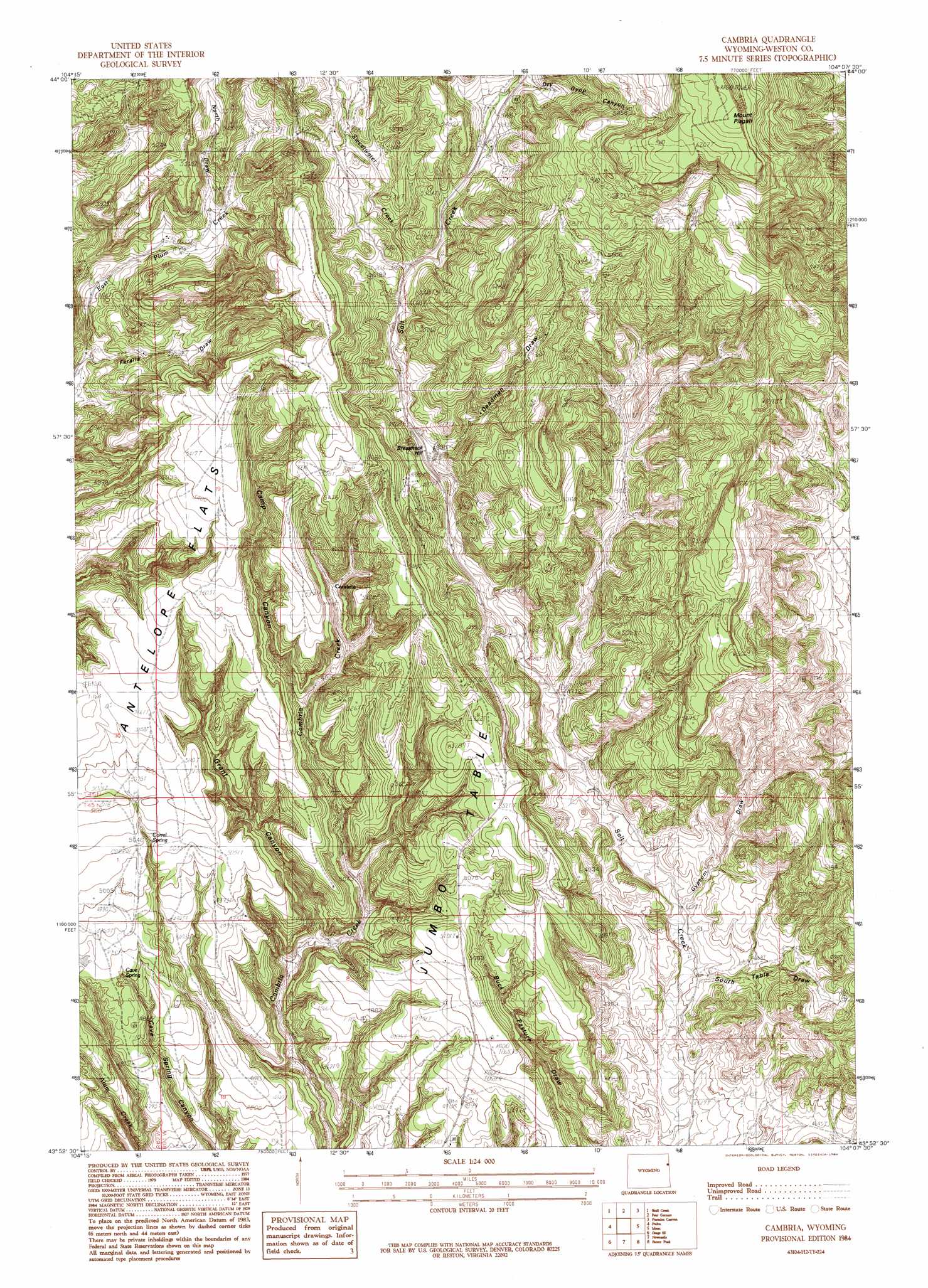
Cambria Topo Map Wyoming
To zoom in, hover over the map of Cambria
USGS Topo Quad 43104h2 - 1:24,000 scale
| Topo Map Name: | Cambria |
| USGS Topo Quad ID: | 43104h2 |
| Print Size: | ca. 21 1/4" wide x 27" high |
| Southeast Coordinates: | 43.875° N latitude / 104.125° W longitude |
| Map Center Coordinates: | 43.9375° N latitude / 104.1875° W longitude |
| U.S. State: | WY |
| Filename: | o43104h2.jpg |
| Download Map JPG Image: | Cambria topo map 1:24,000 scale |
| Map Type: | Topographic |
| Topo Series: | 7.5´ |
| Map Scale: | 1:24,000 |
| Source of Map Images: | United States Geological Survey (USGS) |
| Alternate Map Versions: |
Cambria WY 1984, updated 1984 Download PDF Buy paper map Cambria WY 2012 Download PDF Buy paper map Cambria WY 2015 Download PDF Buy paper map |
1:24,000 Topo Quads surrounding Cambria
Sheldon Creek |
Inyan Kara Mountain |
Dry Draw |
Buckhorn |
Crooks Tower |
Clay Spur |
Skull Creek |
Four Corners |
Parmlee Canyon |
Crows Nest Peak |
Osage |
Pedro |
Cambria |
Moon |
Preacher Spring |
Klodt Reservoir |
Osage Se |
Newcastle |
Fanny Peak |
Dead Horse Flats |
Timber Creek |
Morrisey Ne |
Owens |
Clifton |
Jewel Cave Nw |
> Back to 43104e1 at 1:100,000 scale
> Back to 43104a1 at 1:250,000 scale
> Back to U.S. Topo Maps home
Cambria topo map: Gazetteer
Cambria: Flats
Antelope Flats elevation 1616m 5301′Cambria: Populated Places
Cambria (historical) elevation 1561m 5121′Cambria: Springs
Cave Spring elevation 1498m 4914′Salt Spring elevation 1543m 5062′
Cambria: Streams
Sweetwater Creek elevation 1536m 5039′Cambria: Summits
Breakneck Hill elevation 1510m 4954′Jumbo Table elevation 1568m 5144′
Mount Pisgah elevation 1949m 6394′
Cambria: Valleys
Camp Canyon elevation 1499m 4917′Deadman Draw elevation 1524m 5000′
Dry Gypp Canyon elevation 1606m 5269′
Feralla Draw elevation 1470m 4822′
Grant Canyon elevation 1424m 4671′
Gypsum Draw elevation 1409m 4622′
North Draw elevation 1556m 5104′
South Table Draw elevation 1407m 4616′
Cambria digital topo map on disk
Buy this Cambria topo map showing relief, roads, GPS coordinates and other geographical features, as a high-resolution digital map file on DVD:
Eastern Wyoming & Western South Dakota
Buy digital topo maps: Eastern Wyoming & Western South Dakota