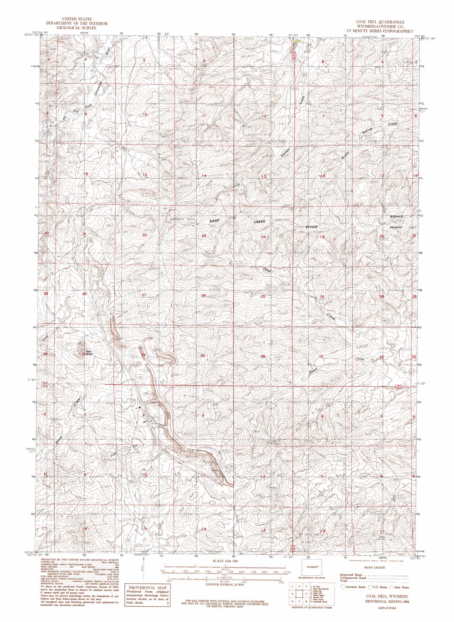
Coal Hill Topo Map Wyoming
To zoom in, hover over the map of Coal Hill
USGS Topo Quad 43105a7 - 1:24,000 scale
| Topo Map Name: | Coal Hill |
| USGS Topo Quad ID: | 43105a7 |
| Print Size: | ca. 21 1/4" wide x 27" high |
| Southeast Coordinates: | 43° N latitude / 105.75° W longitude |
| Map Center Coordinates: | 43.0625° N latitude / 105.8125° W longitude |
| U.S. State: | WY |
| Filename: | o43105a7.jpg |
| Download Map JPG Image: | Coal Hill topo map 1:24,000 scale |
| Map Type: | Topographic |
| Topo Series: | 7.5´ |
| Map Scale: | 1:24,000 |
| Source of Map Images: | United States Geological Survey (USGS) |
| Alternate Map Versions: |
Coal Hill WY 1984, updated 1984 Download PDF Buy paper map Coal Hill WY 2012 Download PDF Buy paper map Coal Hill WY 2015 Download PDF Buy paper map |
1:24,000 Topo Quads surrounding Coal Hill
Gillam Draw East |
Marsh Draw |
Thompson Draw |
Bear Creek |
Coal Draw South |
Seven L Creek East |
Fly Draw |
South Fork Reservoir |
Suicide Hill |
Red Hill |
Beauchamp Reservoir |
Gumbo Hill |
Coal Hill |
Holdup Hollow |
Whipple Hollow |
Campbell Hill |
Glenrock Nw |
Hylton Ranch |
Leuenberger Ranch |
Gilbert Lake |
Lockett |
Parkerton |
Glenrock |
Careyhurst |
Orpha |
> Back to 43105a1 at 1:100,000 scale
> Back to 43104a1 at 1:250,000 scale
> Back to U.S. Topo Maps home
Coal Hill topo map: Gazetteer
Coal Hill: Mines
Badger Mine elevation 1783m 5849′Dave Johnston Mine elevation 1747m 5731′
Coal Hill: Ridges
Sage Creek Divide elevation 1804m 5918′Coal Hill: Streams
South Fork Sage Creek elevation 1670m 5479′Coal Hill: Summits
Coal Hill elevation 1744m 5721′Red Butte elevation 1800m 5905′
Coal Hill digital topo map on disk
Buy this Coal Hill topo map showing relief, roads, GPS coordinates and other geographical features, as a high-resolution digital map file on DVD:
Eastern Wyoming & Western South Dakota
Buy digital topo maps: Eastern Wyoming & Western South Dakota