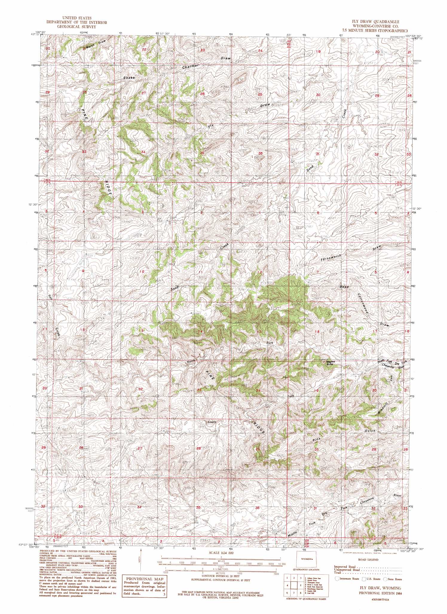
Fly Draw Topo Map Wyoming
To zoom in, hover over the map of Fly Draw
USGS Topo Quad 43105b8 - 1:24,000 scale
| Topo Map Name: | Fly Draw |
| USGS Topo Quad ID: | 43105b8 |
| Print Size: | ca. 21 1/4" wide x 27" high |
| Southeast Coordinates: | 43.125° N latitude / 105.875° W longitude |
| Map Center Coordinates: | 43.1875° N latitude / 105.9375° W longitude |
| U.S. State: | WY |
| Filename: | o43105b8.jpg |
| Download Map JPG Image: | Fly Draw topo map 1:24,000 scale |
| Map Type: | Topographic |
| Topo Series: | 7.5´ |
| Map Scale: | 1:24,000 |
| Source of Map Images: | United States Geological Survey (USGS) |
| Alternate Map Versions: |
Fly Draw WY 1984, updated 1984 Download PDF Buy paper map Fly Draw WY 2012 Download PDF Buy paper map Fly Draw WY 2015 Download PDF Buy paper map |
1:24,000 Topo Quads surrounding Fly Draw
Edgerton |
Sawmill Canyon |
Ross |
Ross Flat |
Macken Draw |
Gillam Draw West |
Gillam Draw East |
Marsh Draw |
Thompson Draw |
Bear Creek |
Seven L Creek West |
Seven L Creek East |
Fly Draw |
South Fork Reservoir |
Suicide Hill |
Mckenzie Flat |
Beauchamp Reservoir |
Gumbo Hill |
Coal Hill |
Holdup Hollow |
Pratts Soda Lakes |
Campbell Hill |
Glenrock Nw |
Hylton Ranch |
Leuenberger Ranch |
> Back to 43105a1 at 1:100,000 scale
> Back to 43104a1 at 1:250,000 scale
> Back to U.S. Topo Maps home
Fly Draw topo map: Gazetteer
Fly Draw: Streams
North Fork Dry Fork Cheyenne River elevation 1683m 5521′South Fork Dry Fork Cheyenne River elevation 1683m 5521′
Fly Draw: Valleys
Fly Draw elevation 1694m 5557′Fly Draw digital topo map on disk
Buy this Fly Draw topo map showing relief, roads, GPS coordinates and other geographical features, as a high-resolution digital map file on DVD:
Eastern Wyoming & Western South Dakota
Buy digital topo maps: Eastern Wyoming & Western South Dakota