Dugout Creek South Topo Map Wyoming
To zoom in, hover over the map of Dugout Creek South
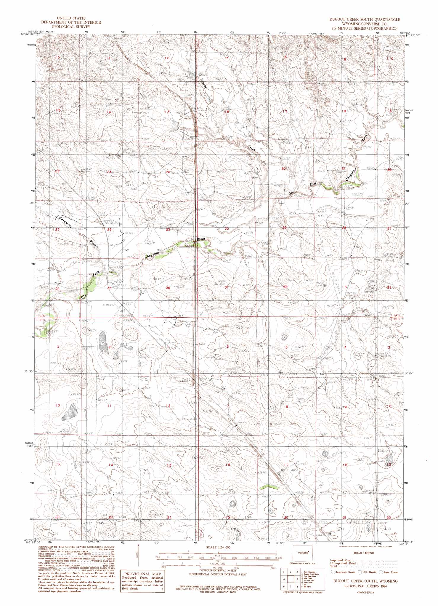
USGS Topo Quad 43105c3 - 1:24,000 scale
| Topo Map Name: | Dugout Creek South |
| USGS Topo Quad ID: | 43105c3 |
| Print Size: | ca. 21 1/4" wide x 27" high |
| Southeast Coordinates: | 43.25° N latitude / 105.25° W longitude |
| Map Center Coordinates: | 43.3125° N latitude / 105.3125° W longitude |
| U.S. State: | WY |
| Filename: | o43105c3.jpg |
| Download Map JPG Image: | Dugout Creek South topo map 1:24,000 scale |
| Map Type: | Topographic |
| Topo Series: | 7.5´ |
| Map Scale: | 1:24,000 |
| Source of Map Images: | United States Geological Survey (USGS) |
| Alternate Map Versions: |
Dugout Creek South WY 1984, updated 1984 Download PDF Buy paper map Dugout Creek South WY 2012 Download PDF Buy paper map Dugout Creek South WY 2015 Download PDF Buy paper map |
| FStopo: | US Forest Service topo Dugout Creek South is available: Download FStopo PDF Download FStopo TIF |
1:24,000 Topo Quads surrounding Dugout Creek South
Reno Flats |
Teckla Sw |
Teckla |
Piney Canyon Sw |
Piney Canyon Se |
Coal Draw North |
Betty Reservoir |
Dugout Creek North |
Coal Bank Draw |
Fiddleback Ranch |
Coal Draw South |
Alta Creek |
Dugout Creek South |
Tin Can Lake |
Esau Spring |
Red Hill |
Patsy Draw |
Bill |
Bill 4 Nw |
Bill 4 Ne |
Whipple Hollow |
Bobby Draw |
Bill Se |
Bill 4 Sw |
Bill 4 Se |
> Back to 43105a1 at 1:100,000 scale
> Back to 43104a1 at 1:250,000 scale
> Back to U.S. Topo Maps home
Dugout Creek South topo map: Gazetteer
Dugout Creek South: Streams
Dugout Creek elevation 1391m 4563′Dugout Creek South: Valleys
Calamity Gulch elevation 1405m 4609′Dugout Creek South digital topo map on disk
Buy this Dugout Creek South topo map showing relief, roads, GPS coordinates and other geographical features, as a high-resolution digital map file on DVD:
Eastern Wyoming & Western South Dakota
Buy digital topo maps: Eastern Wyoming & Western South Dakota