Baker Spring Topo Map Wyoming
To zoom in, hover over the map of Baker Spring
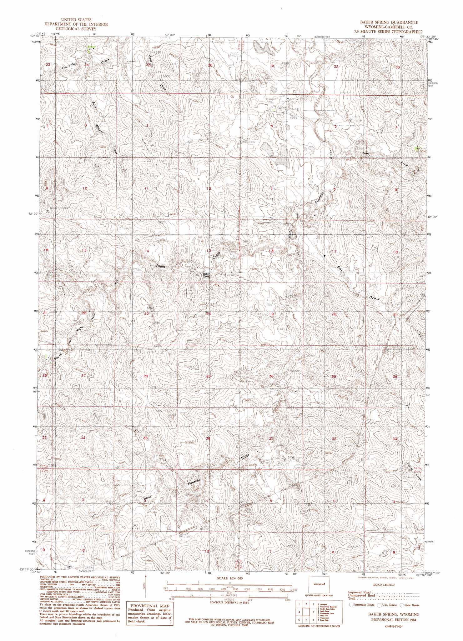
USGS Topo Quad 43105f6 - 1:24,000 scale
| Topo Map Name: | Baker Spring |
| USGS Topo Quad ID: | 43105f6 |
| Print Size: | ca. 21 1/4" wide x 27" high |
| Southeast Coordinates: | 43.625° N latitude / 105.625° W longitude |
| Map Center Coordinates: | 43.6875° N latitude / 105.6875° W longitude |
| U.S. State: | WY |
| Filename: | o43105f6.jpg |
| Download Map JPG Image: | Baker Spring topo map 1:24,000 scale |
| Map Type: | Topographic |
| Topo Series: | 7.5´ |
| Map Scale: | 1:24,000 |
| Source of Map Images: | United States Geological Survey (USGS) |
| Alternate Map Versions: |
Baker Spring WY 1984, updated 1984 Download PDF Buy paper map Baker Spring WY 2012 Download PDF Buy paper map Baker Spring WY 2015 Download PDF Buy paper map |
| FStopo: | US Forest Service topo Baker Spring is available: Download FStopo PDF Download FStopo TIF |
1:24,000 Topo Quads surrounding Baker Spring
Fats Draw |
Wags Pinnacle |
Pepsson Draw |
Threemile Creek Reservoir |
Eagle Rock |
North Butte |
Savageton |
Greasewood Reservoir |
Rocky Butte Gulch |
Reno Junction |
Rolling Pin Ranch |
South Butte |
Baker Spring |
Rattlesnake Draw |
Little Thunder Reservoir |
Artesian Draw |
Pine Tree |
Turnercrest |
Reno Flats |
Teckla Sw |
Ross |
Ross Flat |
Macken Draw |
Coal Draw North |
Betty Reservoir |
> Back to 43105e1 at 1:100,000 scale
> Back to 43104a1 at 1:250,000 scale
> Back to U.S. Topo Maps home
Baker Spring topo map: Gazetteer
Baker Spring: Springs
Baker Spring elevation 1537m 5042′Baker Spring: Streams
All Night Creek elevation 1524m 5000′South All Night Creek elevation 1556m 5104′
Baker Spring: Valleys
Cousins Draw elevation 1518m 4980′K Bar Draw elevation 1524m 5000′
Soft Water Draw elevation 1522m 4993′
Tree Draw elevation 1515m 4970′
Baker Spring digital topo map on disk
Buy this Baker Spring topo map showing relief, roads, GPS coordinates and other geographical features, as a high-resolution digital map file on DVD:
Eastern Wyoming & Western South Dakota
Buy digital topo maps: Eastern Wyoming & Western South Dakota