Reno Junction Topo Map Wyoming
To zoom in, hover over the map of Reno Junction
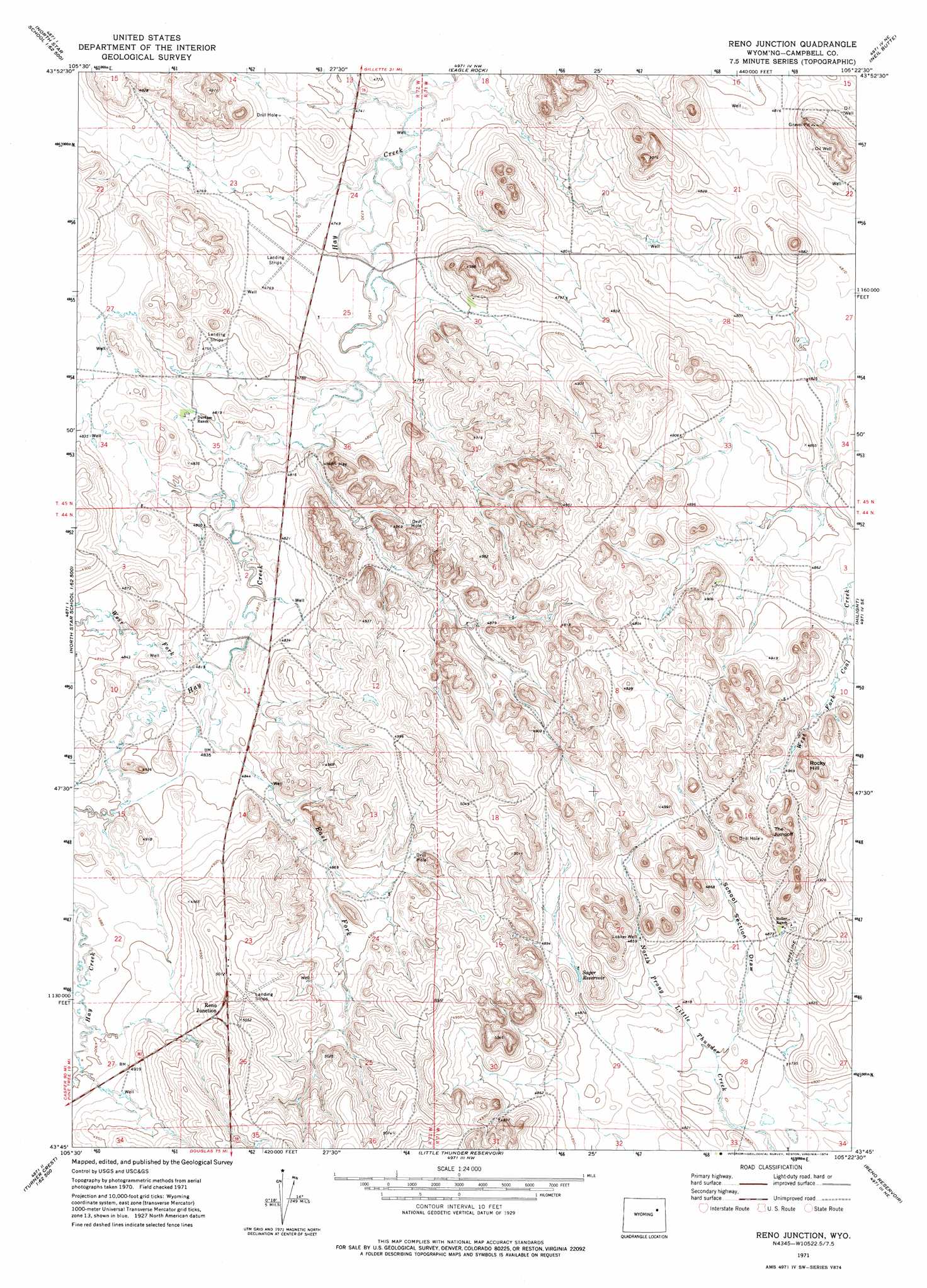
USGS Topo Quad 43105g4 - 1:24,000 scale
| Topo Map Name: | Reno Junction |
| USGS Topo Quad ID: | 43105g4 |
| Print Size: | ca. 21 1/4" wide x 27" high |
| Southeast Coordinates: | 43.75° N latitude / 105.375° W longitude |
| Map Center Coordinates: | 43.8125° N latitude / 105.4375° W longitude |
| U.S. State: | WY |
| Filename: | o43105g4.jpg |
| Download Map JPG Image: | Reno Junction topo map 1:24,000 scale |
| Map Type: | Topographic |
| Topo Series: | 7.5´ |
| Map Scale: | 1:24,000 |
| Source of Map Images: | United States Geological Survey (USGS) |
| Alternate Map Versions: |
Reno Junction WY 1971, updated 1974 Download PDF Buy paper map Reno Junction WY 2012 Download PDF Buy paper map Reno Junction WY 2015 Download PDF Buy paper map |
1:24,000 Topo Quads surrounding Reno Junction
Pleasantdale |
Scaper Reservoir |
The Gap Sw |
Saddle Horse Butte |
Whitetail Creek |
Pepsson Draw |
Threemile Creek Reservoir |
Eagle Rock |
Neil Butte |
Rough Creek |
Greasewood Reservoir |
Rocky Butte Gulch |
Reno Junction |
Hilight |
Open A Ranch |
Baker Spring |
Rattlesnake Draw |
Little Thunder Reservoir |
Reno Reservoir |
Piney Canyon Nw |
Turnercrest |
Reno Flats |
Teckla Sw |
Teckla |
Piney Canyon Sw |
> Back to 43105e1 at 1:100,000 scale
> Back to 43104a1 at 1:250,000 scale
> Back to U.S. Topo Maps home
Reno Junction topo map: Gazetteer
Reno Junction: Cliffs
The Jumpoff elevation 1521m 4990′Reno Junction: Mines
Meadowlark Number Six Pit elevation 1547m 5075′Reno Junction: Reservoirs
Sager Reservoir elevation 1489m 4885′Reno Junction: Streams
East Fork Hay Creek elevation 1469m 4819′West Fork Hay Creek elevation 1467m 4812′
Reno Junction: Summits
Rocky Hill elevation 1521m 4990′Reno Junction: Valleys
School Section Draw elevation 1470m 4822′Reno Junction: Wells
Lokker Well elevation 1490m 4888′Reno Junction digital topo map on disk
Buy this Reno Junction topo map showing relief, roads, GPS coordinates and other geographical features, as a high-resolution digital map file on DVD:
Eastern Wyoming & Western South Dakota
Buy digital topo maps: Eastern Wyoming & Western South Dakota