Jim Creek Topo Map Wyoming
To zoom in, hover over the map of Jim Creek
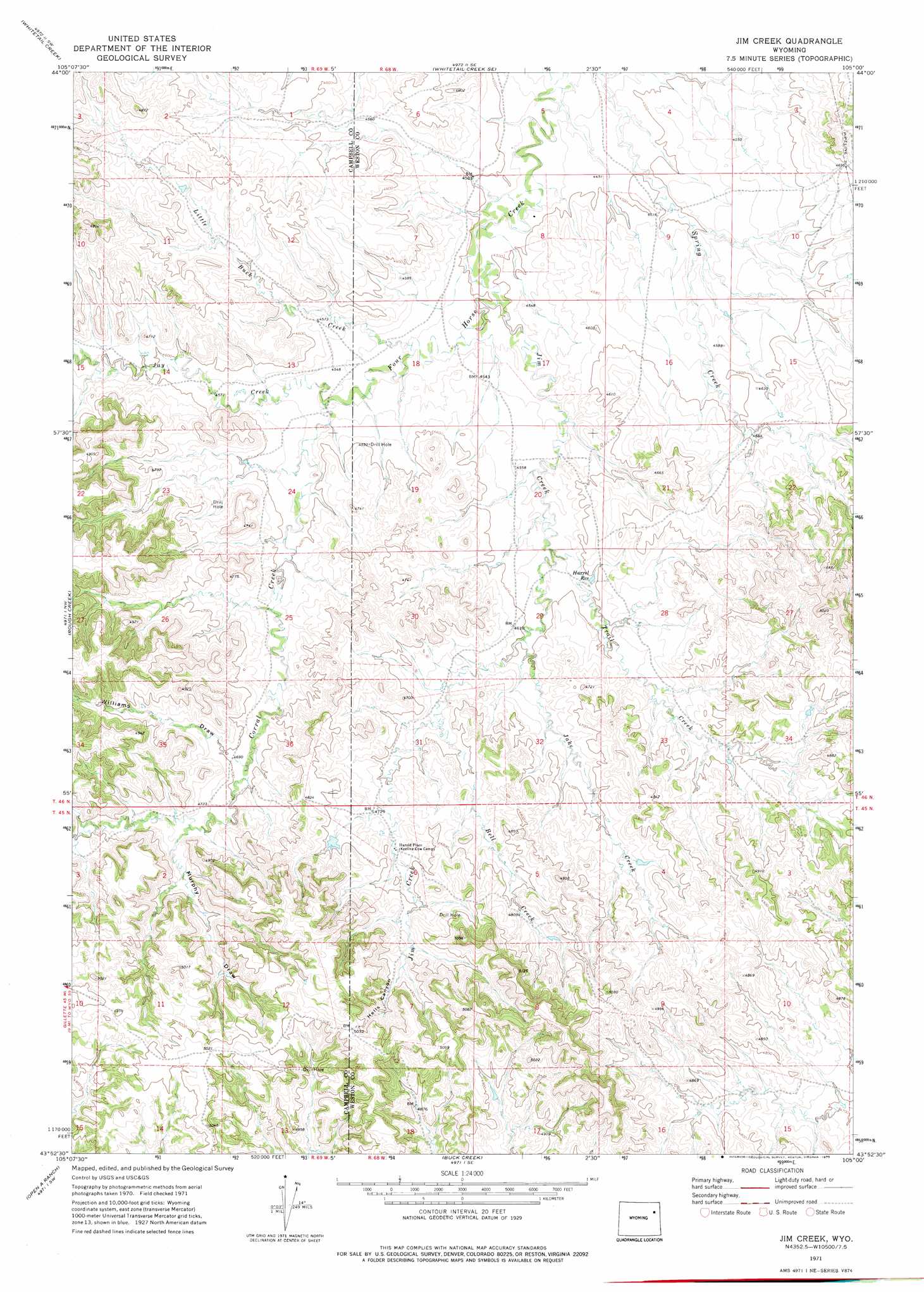
USGS Topo Quad 43105h1 - 1:24,000 scale
| Topo Map Name: | Jim Creek |
| USGS Topo Quad ID: | 43105h1 |
| Print Size: | ca. 21 1/4" wide x 27" high |
| Southeast Coordinates: | 43.875° N latitude / 105° W longitude |
| Map Center Coordinates: | 43.9375° N latitude / 105.0625° W longitude |
| U.S. State: | WY |
| Filename: | o43105h1.jpg |
| Download Map JPG Image: | Jim Creek topo map 1:24,000 scale |
| Map Type: | Topographic |
| Topo Series: | 7.5´ |
| Map Scale: | 1:24,000 |
| Source of Map Images: | United States Geological Survey (USGS) |
| Alternate Map Versions: |
Jim Creek WY 1971, updated 1975 Download PDF Buy paper map Jim Creek WY 2012 Download PDF Buy paper map Jim Creek WY 2015 Download PDF Buy paper map |
1:24,000 Topo Quads surrounding Jim Creek
Coyote Draw |
Coon Track Creek |
Whitetail Creek Ne |
Spyglass Hill |
Freda Creek |
Saddle Horse Butte |
Whitetail Creek |
Whitetail Creek Se |
Cedar Draw |
Soda Butte |
Neil Butte |
Rough Creek |
Jim Creek |
Raven |
West Fork Buffalo Creek |
Hilight |
Open A Ranch |
Buck Creek |
Wildlife Draw West |
Wildlife Draw East |
Reno Reservoir |
Piney Canyon Nw |
Piney Canyon Ne |
Darlington Draw West |
Darlington Draw East |
> Back to 43105e1 at 1:100,000 scale
> Back to 43104a1 at 1:250,000 scale
> Back to U.S. Topo Maps home
Jim Creek topo map: Gazetteer
Jim Creek: Reservoirs
Harrel Reservoir elevation 1396m 4580′Jim Creek: Streams
Bell Creek elevation 1420m 4658′Corral Creek elevation 1387m 4550′
Jake Creek elevation 1403m 4603′
Jay Creek elevation 1384m 4540′
Jim Creek elevation 1372m 4501′
Little Buck Creek elevation 1378m 4520′
Trail Creek elevation 1391m 4563′
Jim Creek: Valleys
Hells Canyon elevation 1481m 4858′Murphy Draw elevation 1444m 4737′
Williams Draw elevation 1433m 4701′
Jim Creek digital topo map on disk
Buy this Jim Creek topo map showing relief, roads, GPS coordinates and other geographical features, as a high-resolution digital map file on DVD:
Eastern Wyoming & Western South Dakota
Buy digital topo maps: Eastern Wyoming & Western South Dakota