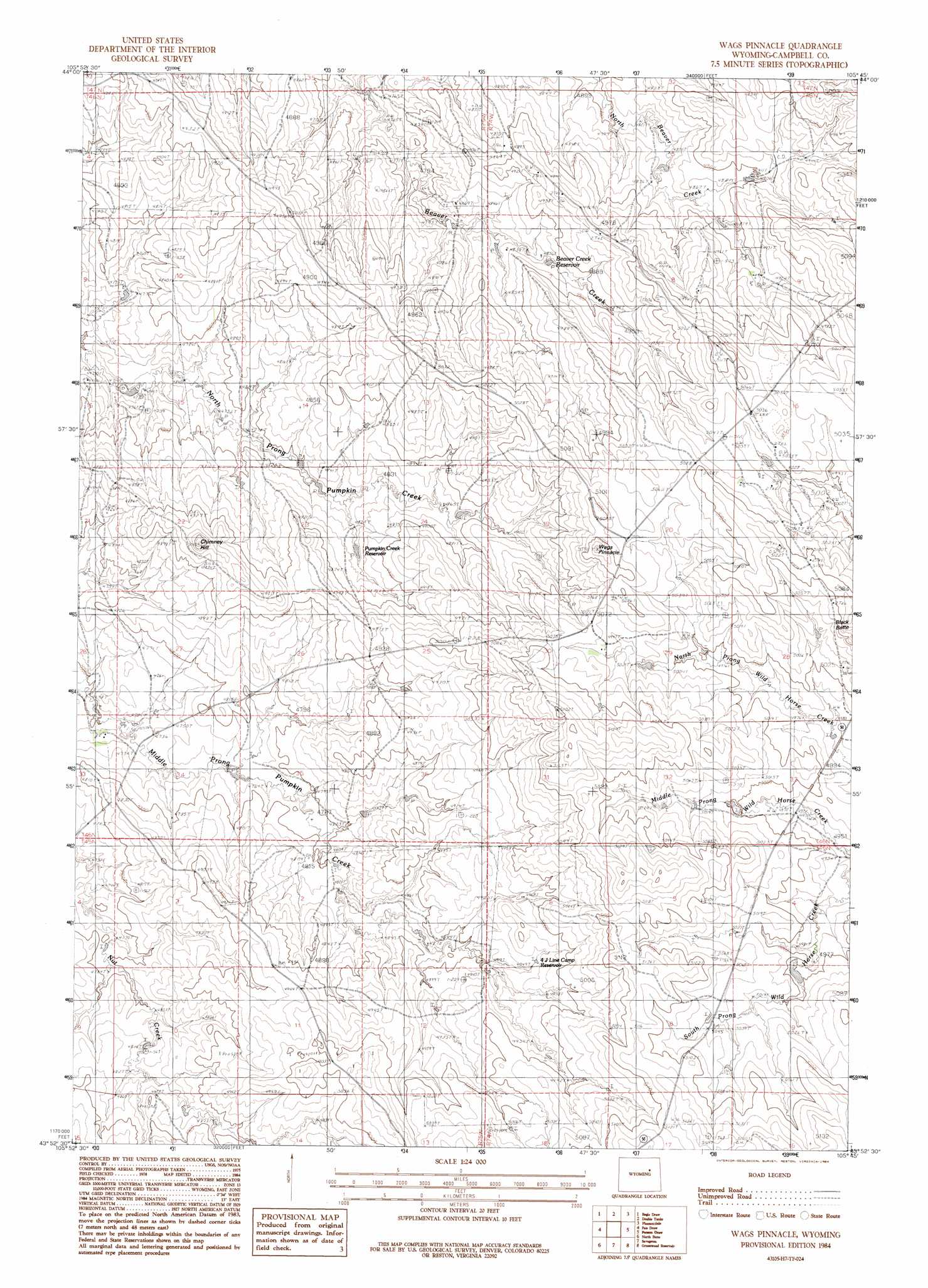
Wags Pinnacle Topo Map Wyoming
To zoom in, hover over the map of Wags Pinnacle
USGS Topo Quad 43105h7 - 1:24,000 scale
| Topo Map Name: | Wags Pinnacle |
| USGS Topo Quad ID: | 43105h7 |
| Print Size: | ca. 21 1/4" wide x 27" high |
| Southeast Coordinates: | 43.875° N latitude / 105.75° W longitude |
| Map Center Coordinates: | 43.9375° N latitude / 105.8125° W longitude |
| U.S. State: | WY |
| Filename: | o43105h7.jpg |
| Download Map JPG Image: | Wags Pinnacle topo map 1:24,000 scale |
| Map Type: | Topographic |
| Topo Series: | 7.5´ |
| Map Scale: | 1:24,000 |
| Source of Map Images: | United States Geological Survey (USGS) |
| Alternate Map Versions: |
Wags Pinnacle WY 1984, updated 1984 Download PDF Buy paper map Wags Pinnacle WY 2012 Download PDF Buy paper map Wags Pinnacle WY 2015 Download PDF Buy paper map |
1:24,000 Topo Quads surrounding Wags Pinnacle
Laskie Draw |
Morgan Draw |
Scott Dam |
Four Bar J Ranch |
Appel Butte |
Negro Butte |
Bogie Draw |
Double Tanks |
Pleasantdale |
Scaper Reservoir |
The Nipple |
Fats Draw |
Wags Pinnacle |
Pepsson Draw |
Threemile Creek Reservoir |
Fort Reno Se |
North Butte |
Savageton |
Greasewood Reservoir |
Rocky Butte Gulch |
Dry Fork Ranch |
Rolling Pin Ranch |
South Butte |
Baker Spring |
Rattlesnake Draw |
> Back to 43105e1 at 1:100,000 scale
> Back to 43104a1 at 1:250,000 scale
> Back to U.S. Topo Maps home
Wags Pinnacle topo map: Gazetteer
Wags Pinnacle: Dams
Innes Dam elevation 1451m 4760′Wags Pinnacle: Pillars
Wags Pinnacle elevation 1577m 5173′Wags Pinnacle: Reservoirs
Beaver Creek Reservoir elevation 1482m 4862′Four-4 Line Camp Reservoir elevation 1505m 4937′
Innes Reservoir elevation 1451m 4760′
Pumpkin Creek Reservoir elevation 1477m 4845′
Wags Pinnacle: Summits
Chimney Hill elevation 1524m 5000′Wild Horse Slope elevation 1546m 5072′
Wags Pinnacle digital topo map on disk
Buy this Wags Pinnacle topo map showing relief, roads, GPS coordinates and other geographical features, as a high-resolution digital map file on DVD:
Eastern Wyoming & Western South Dakota
Buy digital topo maps: Eastern Wyoming & Western South Dakota