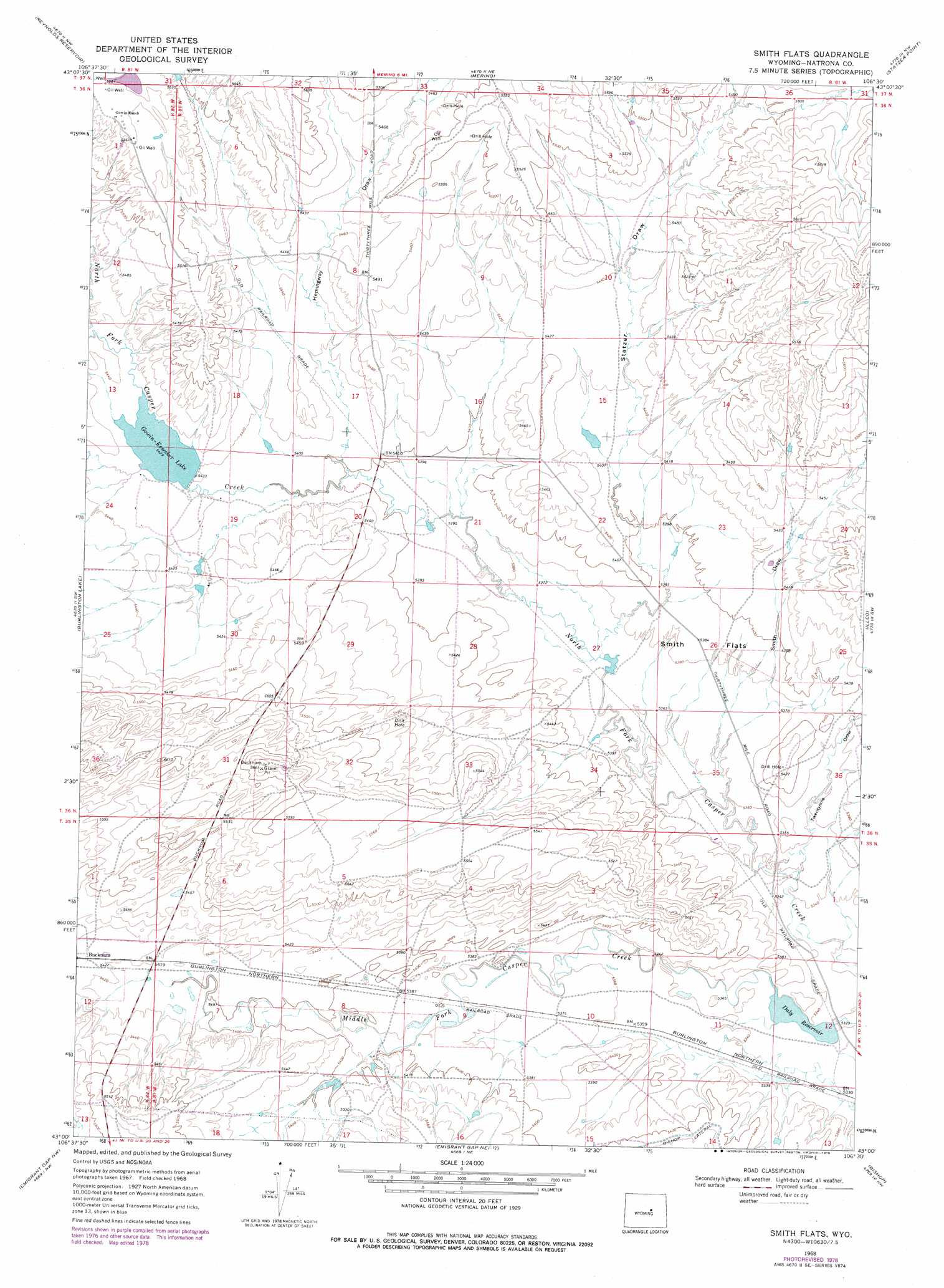
Smith Flats Topo Map Wyoming
To zoom in, hover over the map of Smith Flats
USGS Topo Quad 43106a5 - 1:24,000 scale
| Topo Map Name: | Smith Flats |
| USGS Topo Quad ID: | 43106a5 |
| Print Size: | ca. 21 1/4" wide x 27" high |
| Southeast Coordinates: | 43° N latitude / 106.5° W longitude |
| Map Center Coordinates: | 43.0625° N latitude / 106.5625° W longitude |
| U.S. State: | WY |
| Filename: | o43106a5.jpg |
| Download Map JPG Image: | Smith Flats topo map 1:24,000 scale |
| Map Type: | Topographic |
| Topo Series: | 7.5´ |
| Map Scale: | 1:24,000 |
| Source of Map Images: | United States Geological Survey (USGS) |
| Alternate Map Versions: |
Smith Flats WY 1968, updated 1973 Download PDF Buy paper map Smith Flats WY 1968, updated 1978 Download PDF Buy paper map Smith Flats WY 2012 Download PDF Buy paper map Smith Flats WY 2015 Download PDF Buy paper map |
1:24,000 Topo Quads surrounding Smith Flats
Big Sulfur Draw |
Fiftymile Flat |
Camel Hump Reservoir |
Big Gulch |
Salt Creek |
Anderson Draw |
Reynolds Reservoir |
Merino |
Statzer Point |
Teapot Rock |
Natrona |
Burlington Lake |
Smith Flats |
Illco |
Mcpherson Draw |
Reid Canyon |
Emigrant Gap Nw |
Emigrant Gap Ne |
Bishop |
The Reefs |
Poison Spider |
Oil Mountain |
Emigrant Gap |
Goose Egg |
Casper |
> Back to 43106a1 at 1:100,000 scale
> Back to 43106a1 at 1:250,000 scale
> Back to U.S. Topo Maps home
Smith Flats topo map: Gazetteer
Smith Flats: Canals
Bishop Lateral elevation 1655m 5429′Smith Flats: Dams
Daly Dam elevation 1628m 5341′G K Dam elevation 1656m 5433′
Smith Flats: Flats
Smith Flats elevation 1641m 5383′Smith Flats: Reservoirs
Daly Reservoir elevation 1628m 5341′Daly Reservoir elevation 1623m 5324′
G K Reservoir elevation 1656m 5433′
Gowin-Kesecker Lake elevation 1656m 5433′
Smith Flats: Valleys
Hemingway Draw elevation 1647m 5403′Smith Draw elevation 1633m 5357′
Statzer Draw elevation 1638m 5374′
Twentymile Draw elevation 1629m 5344′
Smith Flats digital topo map on disk
Buy this Smith Flats topo map showing relief, roads, GPS coordinates and other geographical features, as a high-resolution digital map file on DVD:
Eastern Wyoming & Western South Dakota
Buy digital topo maps: Eastern Wyoming & Western South Dakota