Gillam Draw West Topo Map Wyoming
To zoom in, hover over the map of Gillam Draw West
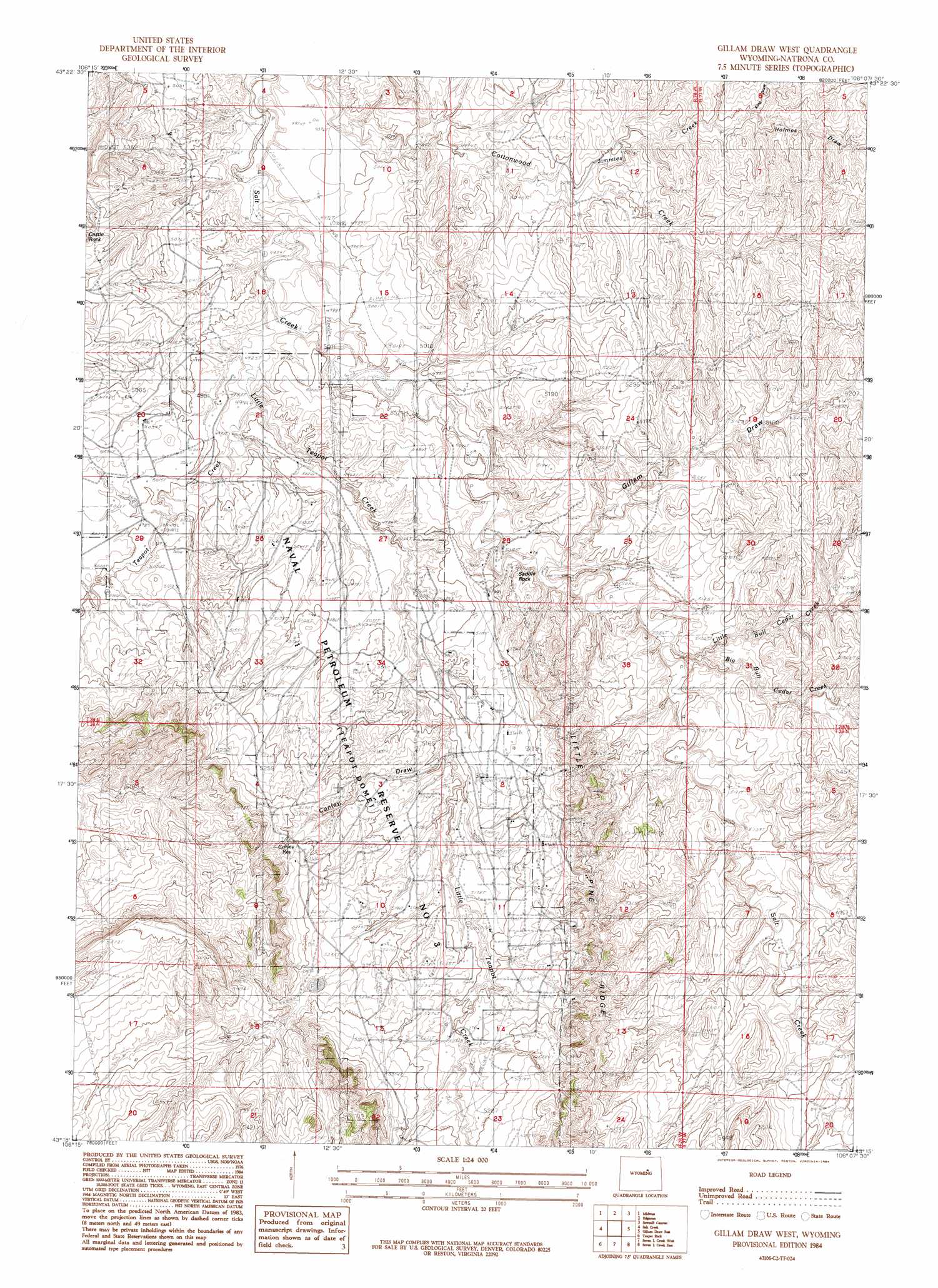
USGS Topo Quad 43106c2 - 1:24,000 scale
| Topo Map Name: | Gillam Draw West |
| USGS Topo Quad ID: | 43106c2 |
| Print Size: | ca. 21 1/4" wide x 27" high |
| Southeast Coordinates: | 43.25° N latitude / 106.125° W longitude |
| Map Center Coordinates: | 43.3125° N latitude / 106.1875° W longitude |
| U.S. State: | WY |
| Filename: | o43106c2.jpg |
| Download Map JPG Image: | Gillam Draw West topo map 1:24,000 scale |
| Map Type: | Topographic |
| Topo Series: | 7.5´ |
| Map Scale: | 1:24,000 |
| Source of Map Images: | United States Geological Survey (USGS) |
| Alternate Map Versions: |
Gillam Draw West WY 1984, updated 1984 Download PDF Buy paper map Gillam Draw West WY 2012 Download PDF Buy paper map Gillam Draw West WY 2015 Download PDF Buy paper map |
1:24,000 Topo Quads surrounding Gillam Draw West
Dugout Ranch |
Dead Woman Crossing |
Linch |
Taylor Ranch |
Artesian Draw |
Government Creek |
Midwest |
Edgerton |
Sawmill Canyon |
Ross |
Big Gulch |
Salt Creek |
Gillam Draw West |
Gillam Draw East |
Marsh Draw |
Statzer Point |
Teapot Rock |
Seven L Creek West |
Seven L Creek East |
Fly Draw |
Illco |
Mcpherson Draw |
Mckenzie Flat |
Beauchamp Reservoir |
Gumbo Hill |
> Back to 43106a1 at 1:100,000 scale
> Back to 43106a1 at 1:250,000 scale
> Back to U.S. Topo Maps home
Gillam Draw West topo map: Gazetteer
Gillam Draw West: Dams
C B Richardson Dam elevation 1551m 5088′Conley Dam elevation 1615m 5298′
S C Pryor Number 1 Dam elevation 1528m 5013′
Teapot Dam elevation 1617m 5305′
Gillam Draw West: Oilfields
East Teapot Dome Oil Field elevation 1611m 5285′Naval Petroleum Reserve Number 3 elevation 1570m 5150′
Gillam Draw West: Reservoirs
C B Richardson Number 1 Reservoir elevation 1551m 5088′Conley Reservoir elevation 1613m 5291′
S C Pryor Number 1 Reservoir elevation 1528m 5013′
Teapot Reservoir elevation 1617m 5305′
Gillam Draw West: Ridges
Little Pine Ridge elevation 1669m 5475′Gillam Draw West: Streams
Big Bull Cedar Creek elevation 1549m 5082′Jimmies Creek elevation 1550m 5085′
Little Bull Cedar Creek elevation 1552m 5091′
Little Teapot Creek elevation 1506m 4940′
Teapot Creek elevation 1503m 4931′
Gillam Draw West: Summits
Saddle Rock elevation 1550m 5085′Gillam Draw West: Valleys
Conley Draw elevation 1549m 5082′Gillam Draw elevation 1534m 5032′
Holmes Draw elevation 1579m 5180′
Gillam Draw West digital topo map on disk
Buy this Gillam Draw West topo map showing relief, roads, GPS coordinates and other geographical features, as a high-resolution digital map file on DVD:
Eastern Wyoming & Western South Dakota
Buy digital topo maps: Eastern Wyoming & Western South Dakota