Salt Creek Topo Map Wyoming
To zoom in, hover over the map of Salt Creek
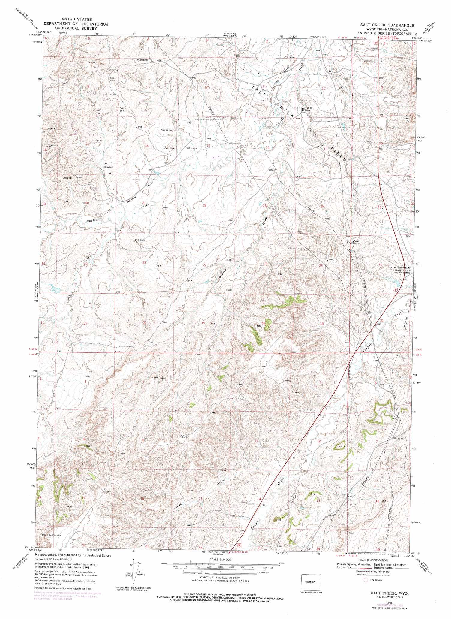
USGS Topo Quad 43106c3 - 1:24,000 scale
| Topo Map Name: | Salt Creek |
| USGS Topo Quad ID: | 43106c3 |
| Print Size: | ca. 21 1/4" wide x 27" high |
| Southeast Coordinates: | 43.25° N latitude / 106.25° W longitude |
| Map Center Coordinates: | 43.3125° N latitude / 106.3125° W longitude |
| U.S. State: | WY |
| Filename: | o43106c3.jpg |
| Download Map JPG Image: | Salt Creek topo map 1:24,000 scale |
| Map Type: | Topographic |
| Topo Series: | 7.5´ |
| Map Scale: | 1:24,000 |
| Source of Map Images: | United States Geological Survey (USGS) |
| Alternate Map Versions: |
Salt Creek WY 1968, updated 1972 Download PDF Buy paper map Salt Creek WY 1968, updated 1978 Download PDF Buy paper map Salt Creek WY 2012 Download PDF Buy paper map Salt Creek WY 2015 Download PDF Buy paper map |
1:24,000 Topo Quads surrounding Salt Creek
Wall Creek |
Dugout Ranch |
Dead Woman Crossing |
Linch |
Taylor Ranch |
Salt Canyon |
Government Creek |
Midwest |
Edgerton |
Sawmill Canyon |
Camel Hump Reservoir |
Big Gulch |
Salt Creek |
Gillam Draw West |
Gillam Draw East |
Merino |
Statzer Point |
Teapot Rock |
Seven L Creek West |
Seven L Creek East |
Smith Flats |
Illco |
Mcpherson Draw |
Mckenzie Flat |
Beauchamp Reservoir |
> Back to 43106a1 at 1:100,000 scale
> Back to 43106a1 at 1:250,000 scale
> Back to U.S. Topo Maps home
Salt Creek topo map: Gazetteer
Salt Creek: Dams
Consolidated Number 3 Dam elevation 1519m 4983′Fensland Number 2 Dam elevation 1544m 5065′
Midwest Number 12 Dam elevation 1492m 4895′
Snyder Dam elevation 1518m 4980′
Salt Creek: Mines
Casper Mountain Asbestos Deposits elevation 1543m 5062′Salt Creek: Populated Places
Salt Creek (historical) elevation 1516m 4973′Salt Creek: Reservoirs
Consolidated Reservoir Number 3 elevation 1519m 4983′Fensland Number 2 Reservoir elevation 1544m 5065′
Midwest Number 12 Reservoir elevation 1492m 4895′
Snyder Reservoir elevation 1518m 4980′
Salt Creek: Streams
South Fork Castle Creek elevation 1527m 5009′Salt Creek: Summits
Castle Rock elevation 1617m 5305′Salt Creek: Valleys
Brown Draw elevation 1496m 4908′Stove Gulch elevation 1559m 5114′
Salt Creek digital topo map on disk
Buy this Salt Creek topo map showing relief, roads, GPS coordinates and other geographical features, as a high-resolution digital map file on DVD:
Eastern Wyoming & Western South Dakota
Buy digital topo maps: Eastern Wyoming & Western South Dakota