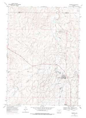
Midwest Topo Map Wyoming
To zoom in, hover over the map of Midwest
USGS Topo Quad 43106d3 - 1:24,000 scale
| Topo Map Name: | Midwest |
| USGS Topo Quad ID: | 43106d3 |
| Print Size: | ca. 21 1/4" wide x 27" high |
| Southeast Coordinates: | 43.375° N latitude / 106.25° W longitude |
| Map Center Coordinates: | 43.4375° N latitude / 106.3125° W longitude |
| U.S. State: | WY |
| Filename: | o43106d3.jpg |
| Download Map JPG Image: | Midwest topo map 1:24,000 scale |
| Map Type: | Topographic |
| Topo Series: | 7.5´ |
| Map Scale: | 1:24,000 |
| Source of Map Images: | United States Geological Survey (USGS) |
| Alternate Map Versions: |
Midwest WY 1968, updated 1972 Download PDF Buy paper map Midwest WY 1968, updated 1978 Download PDF Buy paper map Midwest WY 2012 Download PDF Buy paper map Midwest WY 2015 Download PDF Buy paper map |
1:24,000 Topo Quads surrounding Midwest
> Back to 43106a1 at 1:100,000 scale
> Back to 43106a1 at 1:250,000 scale
> Back to U.S. Topo Maps home
Midwest topo map: Gazetteer
Midwest: Dams
Lower Salt Creek Dam elevation 1449m 4753′Midwest Number 23 Dam elevation 1476m 4842′
Wyoming Associated Number 17 Dam elevation 1469m 4819′
Midwest: Mines
Steele Formation Mine elevation 1518m 4980′Midwest: Oilfields
Salt Creek Oil Field elevation 1512m 4960′Shannon Pool Oil Field elevation 1472m 4829′
Midwest: Populated Places
Midwest elevation 1478m 4849′Midwest: Reservoirs
Lower Salt Creek Reservoir elevation 1449m 4753′MacReas Reservoir elevation 1488m 4881′
Midwest Number 23 Reservoir elevation 1476m 4842′
Wyoming Associated Reservoir Number 17 elevation 1469m 4819′
Midwest: Streams
Castle Creek elevation 1466m 4809′Sherwood Creek elevation 1450m 4757′
Midwest: Valleys
Bothwell Draw elevation 1456m 4776′Coal Draw elevation 1452m 4763′
Midwest digital topo map on disk
Buy this Midwest topo map showing relief, roads, GPS coordinates and other geographical features, as a high-resolution digital map file on DVD:
Eastern Wyoming & Western South Dakota
Buy digital topo maps: Eastern Wyoming & Western South Dakota


