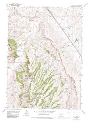
Wall Creek Topo Map Wyoming
To zoom in, hover over the map of Wall Creek
USGS Topo Quad 43106e5 - 1:24,000 scale
| Topo Map Name: | Wall Creek |
| USGS Topo Quad ID: | 43106e5 |
| Print Size: | ca. 21 1/4" wide x 27" high |
| Southeast Coordinates: | 43.5° N latitude / 106.5° W longitude |
| Map Center Coordinates: | 43.5625° N latitude / 106.5625° W longitude |
| U.S. State: | WY |
| Filename: | o43106e5.jpg |
| Download Map JPG Image: | Wall Creek topo map 1:24,000 scale |
| Map Type: | Topographic |
| Topo Series: | 7.5´ |
| Map Scale: | 1:24,000 |
| Source of Map Images: | United States Geological Survey (USGS) |
| Alternate Map Versions: |
Wall Creek WY 1961, updated 1965 Download PDF Buy paper map Wall Creek WY 1961, updated 1982 Download PDF Buy paper map Wall Creek WY 2012 Download PDF Buy paper map Wall Creek WY 2015 Download PDF Buy paper map |
1:24,000 Topo Quads surrounding Wall Creek
> Back to 43106e1 at 1:100,000 scale
> Back to 43106a1 at 1:250,000 scale
> Back to U.S. Topo Maps home
Wall Creek topo map: Gazetteer
Wall Creek: Cliffs
The Wall elevation 1630m 5347′Wall Creek: Dams
Andrus Dam elevation 1445m 4740′North Dam elevation 1562m 5124′
Robertson Dam elevation 1434m 4704′
Wall Creek: Flats
Linstead Flats elevation 1476m 4842′Wall Creek: Mines
Kaycee Bentonite Corporation Number Eighteen Mine elevation 1576m 5170′Kaycee Bentonite Corporation Number Eleven Mine elevation 1576m 5170′
Kaycee Bentonite Corporation Number Fifteen Mine elevation 1566m 5137′
Kaycee Bentonite Corporation Number Fourteen Mine elevation 1598m 5242′
Kaycee Bentonite Corporation Number Seventeen Mine elevation 1603m 5259′
Kaycee Bentonite Corporation Number Sixteen Mine elevation 1707m 5600′
Kaycee Bentonite Corporation Number Ten Mine elevation 1571m 5154′
Kaycee Bentonite Corporation Number Three Mine elevation 1602m 5255′
Kaycee Bentonite Corporation Number Twelve Mine elevation 1643m 5390′
Kaycee Bentonite Corporation Number Twenty-five Mine elevation 1541m 5055′
Kaycee Bentonite Corporation Number Twenty-four Mine elevation 1544m 5065′
Kaycee Bentonite Corporation Number Twenty-one Mine elevation 1563m 5127′
Kaycee Bentonite Corporation Number Twenty-six Mine elevation 1510m 4954′
Kaycee Bentonite Corporation Number Twenty-three Mine elevation 1567m 5141′
Kaycee Bentonite Corporation Number Twenty-two Mine elevation 1578m 5177′
South Fork Powder River Mine elevation 1408m 4619′
Tisdale Number Four Mine elevation 1608m 5275′
Tisdale Number Nine Mine elevation 1619m 5311′
Tisdale Number One Mine elevation 1550m 5085′
Tisdale Number Seven Mine elevation 1604m 5262′
Tisdale Number Six Mine elevation 1597m 5239′
Tisdale Number Ten Mine elevation 1527m 5009′
Tisdale Number Three Mine elevation 1660m 5446′
Tisdale Number Two Mine elevation 1632m 5354′
Wall Creek: Oilfields
East Tisdale Oil Field elevation 1741m 5711′North Tisdale Oil Field elevation 1647m 5403′
Wall Creek: Populated Places
Linstead Place elevation 1484m 4868′Wall Creek: Reservoirs
Andrus Reservoir elevation 1445m 4740′North Reservoir elevation 1562m 5124′
Robertson Reservoir elevation 1434m 4704′
Wall Creek: Streams
Hot Water Creek elevation 1496m 4908′Million Creek elevation 1511m 4957′
Thomas Creek elevation 1505m 4937′
Wall Creek elevation 1414m 4639′
Wall Creek: Summits
Frewens Castle elevation 1599m 5246′Tisdale Mountain elevation 1772m 5813′
Wall Creek: Valleys
Beach Draw elevation 1637m 5370′Frewens Draw elevation 1434m 4704′
Gierse Draw elevation 1551m 5088′
North Terry Draw elevation 1425m 4675′
Pine Grove Gulch elevation 1467m 4812′
Wall Creek: Wells
Shiloh Well elevation 1676m 5498′Wall Creek digital topo map on disk
Buy this Wall Creek topo map showing relief, roads, GPS coordinates and other geographical features, as a high-resolution digital map file on DVD:
Eastern Wyoming & Western South Dakota
Buy digital topo maps: Eastern Wyoming & Western South Dakota


