Fort Reno Topo Map Wyoming
To zoom in, hover over the map of Fort Reno
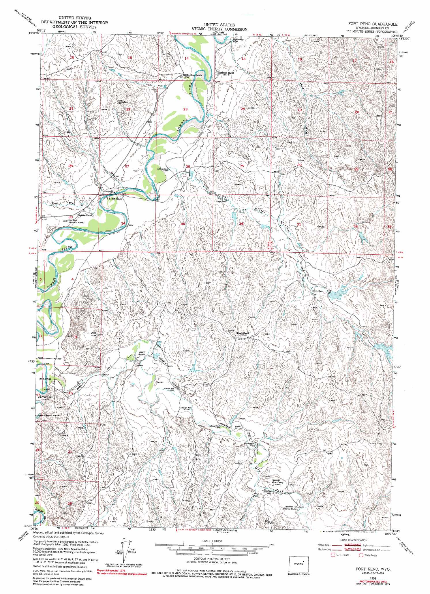
USGS Topo Quad 43106g2 - 1:24,000 scale
| Topo Map Name: | Fort Reno |
| USGS Topo Quad ID: | 43106g2 |
| Print Size: | ca. 21 1/4" wide x 27" high |
| Southeast Coordinates: | 43.75° N latitude / 106.125° W longitude |
| Map Center Coordinates: | 43.8125° N latitude / 106.1875° W longitude |
| U.S. State: | WY |
| Filename: | o43106g2.jpg |
| Download Map JPG Image: | Fort Reno topo map 1:24,000 scale |
| Map Type: | Topographic |
| Topo Series: | 7.5´ |
| Map Scale: | 1:24,000 |
| Source of Map Images: | United States Geological Survey (USGS) |
| Alternate Map Versions: |
Fort Reno WY 1953, updated 1954 Download PDF Buy paper map Fort Reno WY 1953, updated 1972 Download PDF Buy paper map Fort Reno WY 1953, updated 1985 Download PDF Buy paper map Fort Reno WY 2012 Download PDF Buy paper map Fort Reno WY 2015 Download PDF Buy paper map |
1:24,000 Topo Quads surrounding Fort Reno
Brown Ranch |
Boon |
Bowman Flat |
Negro Butte |
Bogie Draw |
Elaine Draw |
Provence Ranch |
Hoe Ranch |
The Nipple |
Fats Draw |
Fourmile Reservoir |
Soldier Creek |
Fort Reno |
Fort Reno Se |
North Butte |
Figure 8 Reservoir |
Sussex |
House Creek |
Dry Fork Ranch |
Rolling Pin Ranch |
Dugout Ranch |
Dead Woman Crossing |
Linch |
Taylor Ranch |
Artesian Draw |
> Back to 43106e1 at 1:100,000 scale
> Back to 43106a1 at 1:250,000 scale
> Back to U.S. Topo Maps home
Fort Reno topo map: Gazetteer
Fort Reno: Dams
Streeter Dam elevation 1378m 4520′Fort Reno: Mines
Lucky Seven Mine elevation 1412m 4632′Fort Reno: Reservoirs
Reno Reservoir elevation 1321m 4333′Streeter Reservoir elevation 1378m 4520′
Fort Reno: Streams
Dry Fork Powder River elevation 1307m 4288′Little Willow Creek elevation 1300m 4265′
Soldier Creek elevation 1306m 4284′
Fort Reno: Valleys
Fort Reno Draw elevation 1303m 4274′Holler Draw elevation 1342m 4402′
Reno Draw elevation 1298m 4258′
Fort Reno digital topo map on disk
Buy this Fort Reno topo map showing relief, roads, GPS coordinates and other geographical features, as a high-resolution digital map file on DVD:
Eastern Wyoming & Western South Dakota
Buy digital topo maps: Eastern Wyoming & Western South Dakota