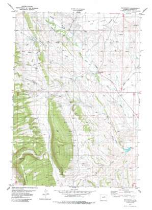
Mayoworth Topo Map Wyoming
To zoom in, hover over the map of Mayoworth
USGS Topo Quad 43106g7 - 1:24,000 scale
| Topo Map Name: | Mayoworth |
| USGS Topo Quad ID: | 43106g7 |
| Print Size: | ca. 21 1/4" wide x 27" high |
| Southeast Coordinates: | 43.75° N latitude / 106.75° W longitude |
| Map Center Coordinates: | 43.8125° N latitude / 106.8125° W longitude |
| U.S. State: | WY |
| Filename: | o43106g7.jpg |
| Download Map JPG Image: | Mayoworth topo map 1:24,000 scale |
| Map Type: | Topographic |
| Topo Series: | 7.5´ |
| Map Scale: | 1:24,000 |
| Source of Map Images: | United States Geological Survey (USGS) |
| Alternate Map Versions: |
Mayoworth WY 1979, updated 1987 Download PDF Buy paper map Mayoworth WY 2012 Download PDF Buy paper map Mayoworth WY 2015 Download PDF Buy paper map |
1:24,000 Topo Quads surrounding Mayoworth
> Back to 43106e1 at 1:100,000 scale
> Back to 43106a1 at 1:250,000 scale
> Back to U.S. Topo Maps home
Mayoworth topo map: Gazetteer
Mayoworth: Canals
Barrett Ditch elevation 1653m 5423′Capitola Ditch elevation 1610m 5282′
Morgareidge Ditch elevation 1667m 5469′
Roseberry Ditch elevation 1560m 5118′
Strickler Rinker Ditch elevation 1585m 5200′
Mayoworth: Dams
Pass Dam elevation 1575m 5167′Smith Number 2 Dam elevation 1682m 5518′
Mayoworth: Gaps
Dull Knife Pass elevation 1836m 6023′Mayoworth: Mines
Gorden Pit elevation 1658m 5439′Kaycee Bentonite Corporation Number Ninety-six Mine elevation 1559m 5114′
Mayoworth Number Ten Mine elevation 1623m 5324′
Pass Reservoir Area Mine elevation 1613m 5291′
Red Fork Powder River Area Number One Mine elevation 1654m 5426′
Red Fork Powder River Area Number Two Mine elevation 1637m 5370′
Slate Ridge Number Five Mine elevation 1595m 5232′
Slate Ridge Numbers One-eleven Mines elevation 1562m 5124′
Mayoworth: Populated Places
Mayoworth elevation 1593m 5226′Mayoworth: Reservoirs
Pass Reservoir elevation 1549m 5082′Smith Number 2 Reservoir elevation 1682m 5518′
Mayoworth: Streams
North Fork Pass Creek elevation 1560m 5118′South Willow Creek elevation 1667m 5469′
Willow Creek elevation 1597m 5239′
Mayoworth: Summits
Blue Hill elevation 1725m 5659′E K Mountain elevation 1949m 6394′
Lander Hill elevation 1750m 5741′
The Mesa elevation 1723m 5652′
Mayoworth: Valleys
Alkali Draw elevation 1596m 5236′Charlie House Draw elevation 1631m 5351′
Martin Draw elevation 1558m 5111′
Pass Creek Canyon elevation 1645m 5396′
Sackett Canyon elevation 1728m 5669′
Mayoworth digital topo map on disk
Buy this Mayoworth topo map showing relief, roads, GPS coordinates and other geographical features, as a high-resolution digital map file on DVD:
Eastern Wyoming & Western South Dakota
Buy digital topo maps: Eastern Wyoming & Western South Dakota


