The Nipple Topo Map Wyoming
To zoom in, hover over the map of The Nipple
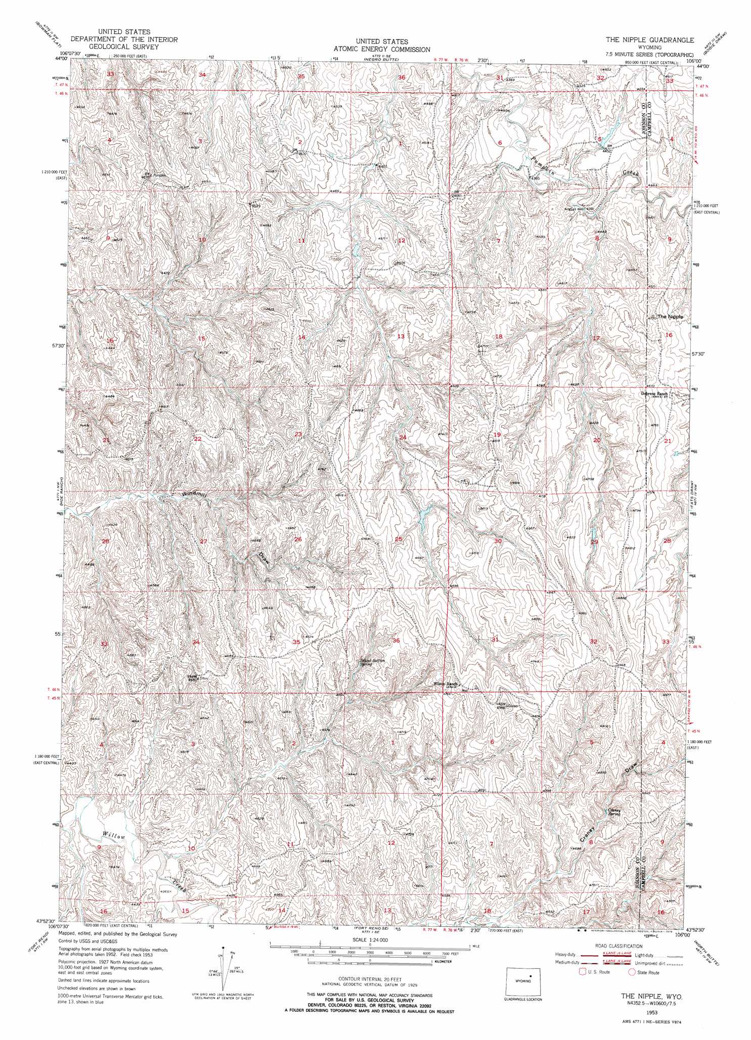
USGS Topo Quad 43106h1 - 1:24,000 scale
| Topo Map Name: | The Nipple |
| USGS Topo Quad ID: | 43106h1 |
| Print Size: | ca. 21 1/4" wide x 27" high |
| Southeast Coordinates: | 43.875° N latitude / 106° W longitude |
| Map Center Coordinates: | 43.9375° N latitude / 106.0625° W longitude |
| U.S. State: | WY |
| Filename: | o43106h1.jpg |
| Download Map JPG Image: | The Nipple topo map 1:24,000 scale |
| Map Type: | Topographic |
| Topo Series: | 7.5´ |
| Map Scale: | 1:24,000 |
| Source of Map Images: | United States Geological Survey (USGS) |
| Alternate Map Versions: |
The Nipple WY 1953, updated 1954 Download PDF Buy paper map The Nipple WY 1953, updated 1976 Download PDF Buy paper map The Nipple WY 2012 Download PDF Buy paper map The Nipple WY 2015 Download PDF Buy paper map |
1:24,000 Topo Quads surrounding The Nipple
Ploessers Draw |
Juniper Draw |
Laskie Draw |
Morgan Draw |
Scott Dam |
Boon |
Bowman Flat |
Negro Butte |
Bogie Draw |
Double Tanks |
Provence Ranch |
Hoe Ranch |
The Nipple |
Fats Draw |
Wags Pinnacle |
Soldier Creek |
Fort Reno |
Fort Reno Se |
North Butte |
Savageton |
Sussex |
House Creek |
Dry Fork Ranch |
Rolling Pin Ranch |
South Butte |
> Back to 43106e1 at 1:100,000 scale
> Back to 43106a1 at 1:250,000 scale
> Back to U.S. Topo Maps home
The Nipple topo map: Gazetteer
The Nipple: Mines
Betsey Bass Claim elevation 1432m 4698′Craney Draw Mine elevation 1433m 4701′
Forest Group Mine elevation 1454m 4770′
Kershner Pit elevation 1410m 4625′
P Claim Mine elevation 1439m 4721′
The Nipple: Springs
Craney Spring elevation 1414m 4639′School Section Spring elevation 1404m 4606′
The Nipple: Summits
The Nipple elevation 1434m 4704′The Nipple digital topo map on disk
Buy this The Nipple topo map showing relief, roads, GPS coordinates and other geographical features, as a high-resolution digital map file on DVD:
Eastern Wyoming & Western South Dakota
Buy digital topo maps: Eastern Wyoming & Western South Dakota