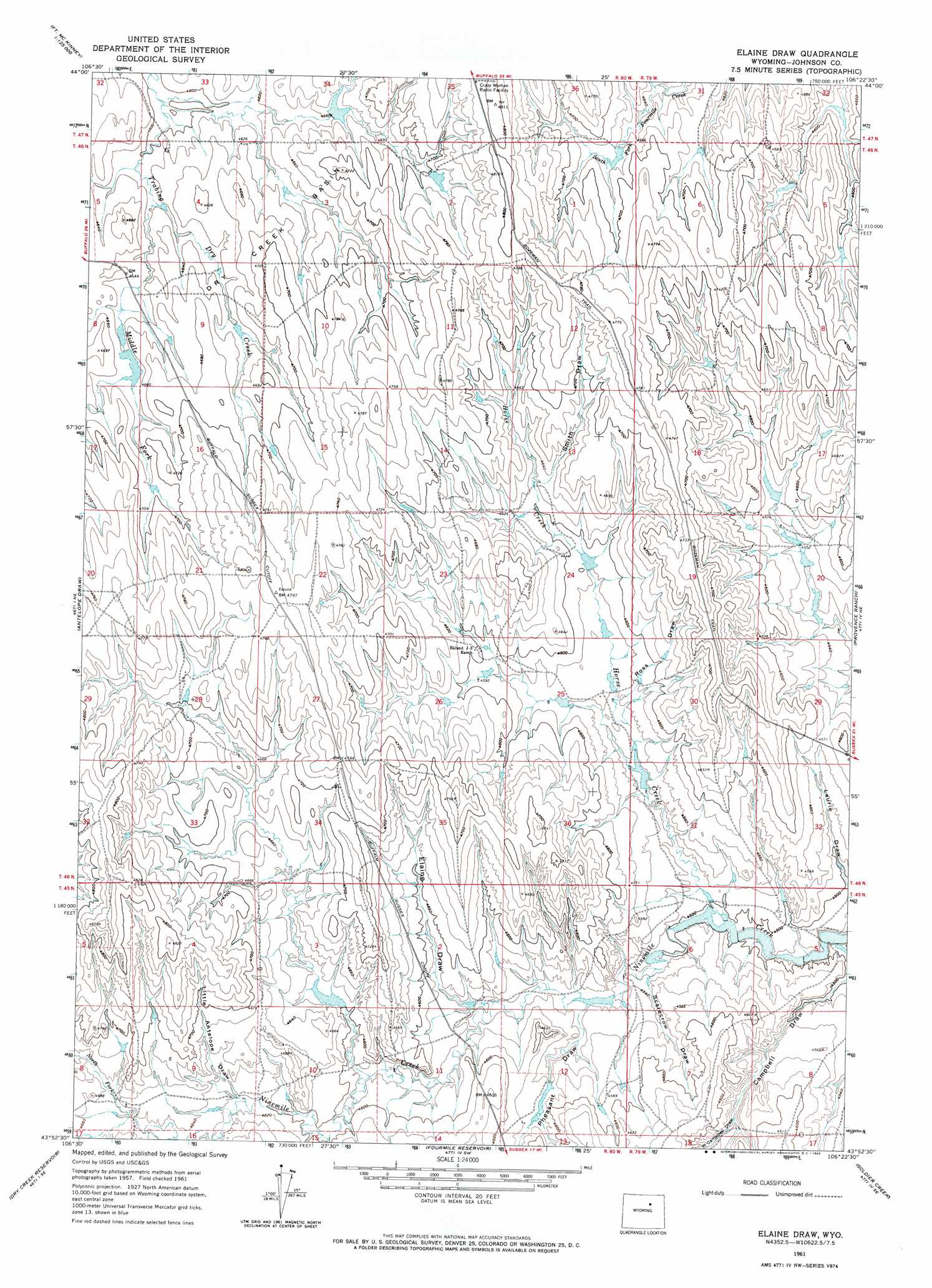
Elaine Draw Topo Map Wyoming
To zoom in, hover over the map of Elaine Draw
USGS Topo Quad 43106h4 - 1:24,000 scale
| Topo Map Name: | Elaine Draw |
| USGS Topo Quad ID: | 43106h4 |
| Print Size: | ca. 21 1/4" wide x 27" high |
| Southeast Coordinates: | 43.875° N latitude / 106.375° W longitude |
| Map Center Coordinates: | 43.9375° N latitude / 106.4375° W longitude |
| U.S. State: | WY |
| Filename: | o43106h4.jpg |
| Download Map JPG Image: | Elaine Draw topo map 1:24,000 scale |
| Map Type: | Topographic |
| Topo Series: | 7.5´ |
| Map Scale: | 1:24,000 |
| Source of Map Images: | United States Geological Survey (USGS) |
| Alternate Map Versions: |
Elaine Draw WY 1961, updated 1965 Download PDF Buy paper map Elaine Draw WY 2012 Download PDF Buy paper map Elaine Draw WY 2015 Download PDF Buy paper map |
1:24,000 Topo Quads surrounding Elaine Draw
T A Ranch |
Ta Ranch Ne |
Crazy Woman Ranch |
Ploessers Draw |
Juniper Draw |
Purdy Reservoir |
Trabing |
Brown Ranch |
Boon |
Bowman Flat |
Schlicht Draw |
Antelope Draw |
Elaine Draw |
Provence Ranch |
Hoe Ranch |
Hibbard Draw |
Dry Creek Reservoir |
Fourmile Reservoir |
Soldier Creek |
Fort Reno |
Kaycee |
Kaycee Ne |
Figure 8 Reservoir |
Sussex |
House Creek |
> Back to 43106e1 at 1:100,000 scale
> Back to 43106a1 at 1:250,000 scale
> Back to U.S. Topo Maps home
Elaine Draw topo map: Gazetteer
Elaine Draw: Basins
Dry Creek Basin elevation 1428m 4685′Elaine Draw: Streams
Horse Creek elevation 1373m 4504′Middle Fork Trabing Dry Creek elevation 1406m 4612′
North Fork Ninemile Creek elevation 1414m 4639′
Elaine Draw: Valleys
Campbell Draw elevation 1372m 4501′Elaine Draw elevation 1390m 4560′
Little Antelope Draw elevation 1407m 4616′
Pheasant Draw elevation 1383m 4537′
Ross Draw elevation 1391m 4563′
Scarecrow Draw elevation 1378m 4520′
Smith Draw elevation 1411m 4629′
West Campbell Draw elevation 1386m 4547′
Elaine Draw digital topo map on disk
Buy this Elaine Draw topo map showing relief, roads, GPS coordinates and other geographical features, as a high-resolution digital map file on DVD:
Eastern Wyoming & Western South Dakota
Buy digital topo maps: Eastern Wyoming & Western South Dakota