Arminto Nw Topo Map Wyoming
To zoom in, hover over the map of Arminto Nw
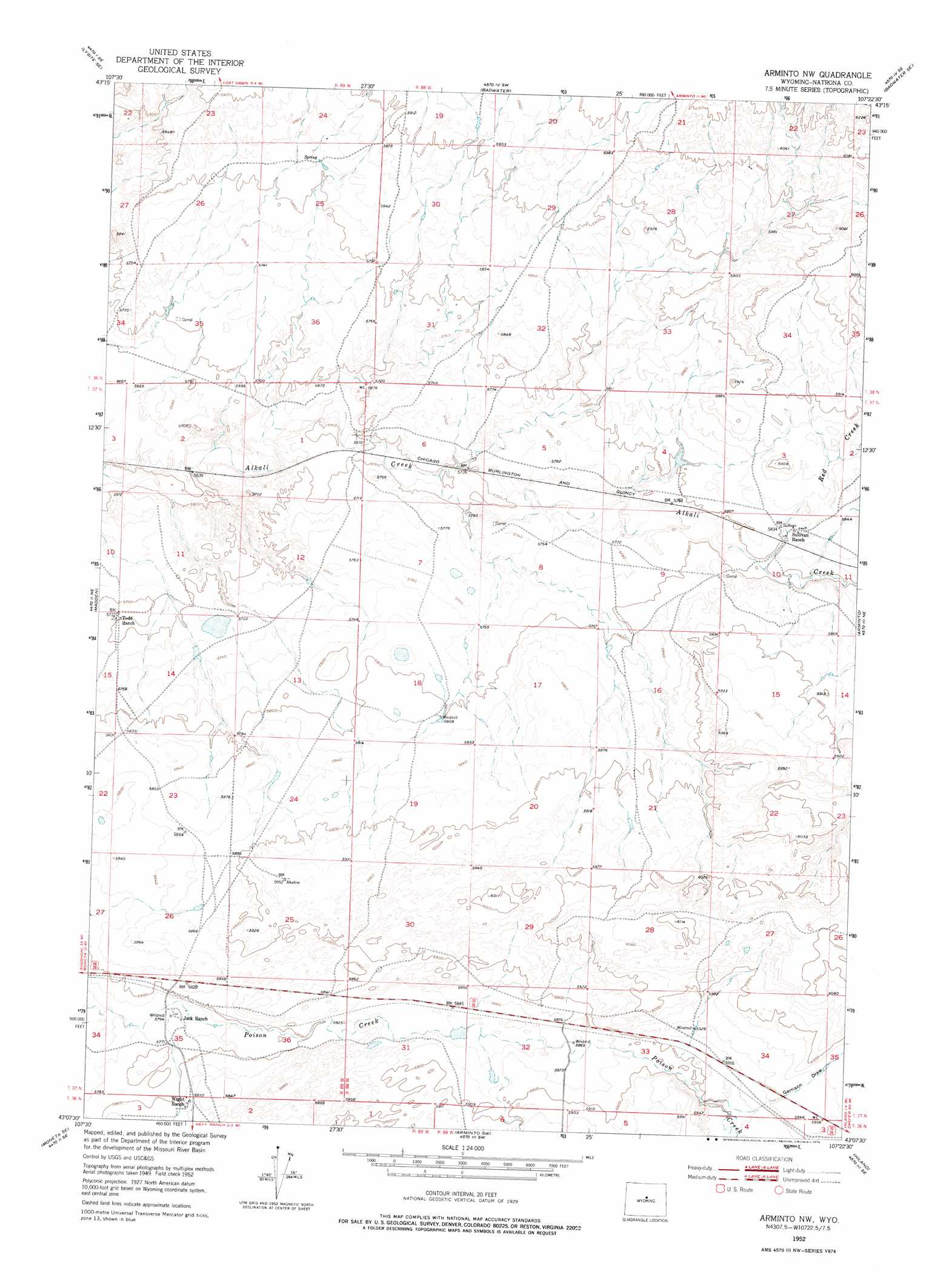
USGS Topo Quad 43107b4 - 1:24,000 scale
| Topo Map Name: | Arminto Nw |
| USGS Topo Quad ID: | 43107b4 |
| Print Size: | ca. 21 1/4" wide x 27" high |
| Southeast Coordinates: | 43.125° N latitude / 107.375° W longitude |
| Map Center Coordinates: | 43.1875° N latitude / 107.4375° W longitude |
| U.S. State: | WY |
| Filename: | o43107b4.jpg |
| Download Map JPG Image: | Arminto Nw topo map 1:24,000 scale |
| Map Type: | Topographic |
| Topo Series: | 7.5´ |
| Map Scale: | 1:24,000 |
| Source of Map Images: | United States Geological Survey (USGS) |
| Alternate Map Versions: |
Arminto NW WY 1952, updated 1953 Download PDF Buy paper map Arminto NW WY 1952, updated 1976 Download PDF Buy paper map Arminto NW WY 2012 Download PDF Buy paper map Arminto NW WY 2015 Download PDF Buy paper map |
1:24,000 Topo Quads surrounding Arminto Nw
Arapahoe Butte |
Cottonwood Pass |
Sioux Pass |
Badwater Ne |
Grave Spring |
Lysite |
Lysite Se |
Badwater |
Badwater Se |
Deadman Butte |
Moneta |
Madden |
Arminto Nw |
Arminto |
Waltman Nw |
Seventy One Reservoir |
Moneta Se |
Arminto Sw |
Hiland |
Waltman |
Love Ranch |
Miles Ranch |
Ervay Basin |
Mcrae Gap |
Broad Mesa |
> Back to 43107a1 at 1:100,000 scale
> Back to 43106a1 at 1:250,000 scale
> Back to U.S. Topo Maps home
Arminto Nw topo map: Gazetteer
Arminto Nw: Dams
Fossil Dam elevation 1813m 5948′Jack Dam elevation 1791m 5875′
Arminto Nw: Mines
Hope Number One Mine elevation 1836m 6023′Hope Number Two Mine elevation 1844m 6049′
Arminto Nw: Reservoirs
Fossil Reservoir elevation 1813m 5948′Jack Reservoir elevation 1791m 5875′
Arminto Nw: Streams
Red Creek elevation 1769m 5803′Arminto Nw: Valleys
Garrison Draw elevation 1799m 5902′Arminto Nw digital topo map on disk
Buy this Arminto Nw topo map showing relief, roads, GPS coordinates and other geographical features, as a high-resolution digital map file on DVD:
Eastern Wyoming & Western South Dakota
Buy digital topo maps: Eastern Wyoming & Western South Dakota