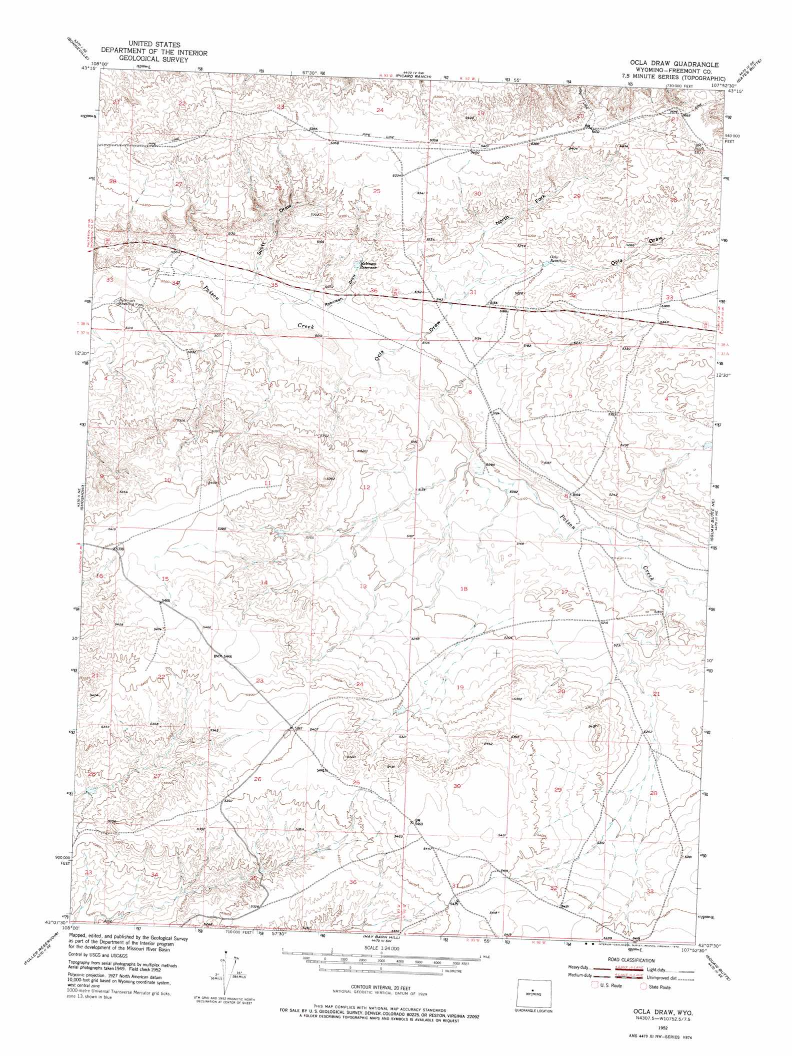
Ocla Draw Topo Map Wyoming
To zoom in, hover over the map of Ocla Draw
USGS Topo Quad 43107b8 - 1:24,000 scale
| Topo Map Name: | Ocla Draw |
| USGS Topo Quad ID: | 43107b8 |
| Print Size: | ca. 21 1/4" wide x 27" high |
| Southeast Coordinates: | 43.125° N latitude / 107.875° W longitude |
| Map Center Coordinates: | 43.1875° N latitude / 107.9375° W longitude |
| U.S. State: | WY |
| Filename: | o43107b8.jpg |
| Download Map JPG Image: | Ocla Draw topo map 1:24,000 scale |
| Map Type: | Topographic |
| Topo Series: | 7.5´ |
| Map Scale: | 1:24,000 |
| Source of Map Images: | United States Geological Survey (USGS) |
| Alternate Map Versions: |
Ocla Draw WY 1952, updated 1953 Download PDF Buy paper map Ocla Draw WY 1952, updated 1976 Download PDF Buy paper map Ocla Draw WY 2012 Download PDF Buy paper map Ocla Draw WY 2015 Download PDF Buy paper map |
1:24,000 Topo Quads surrounding Ocla Draw
Boysen |
Birdseye Pass |
Guffy Peak |
De Pass |
Arapahoe Butte |
Bonneville Sw |
Bonneville |
Picard Ranch |
Gates Butte |
Lysite |
Hidden Valley |
Shoshoni |
Ocla Draw |
Squaw Butte Ne |
Moneta |
Indian Butte |
Fuller Reservoir |
Haybarn Hill |
Squaw Butte |
Seventy One Reservoir |
Alkali Butte |
Campbell Ridge |
Double Butte |
Butte Well |
Love Ranch |
> Back to 43107a1 at 1:100,000 scale
> Back to 43106a1 at 1:250,000 scale
> Back to U.S. Topo Maps home
Ocla Draw topo map: Gazetteer
Ocla Draw: Dams
Ocla Dam elevation 1633m 5357′Ocla Draw: Reservoirs
Ocla Reservoir elevation 1633m 5357′Ocla Reservoir elevation 1587m 5206′
Robinson Reservoir elevation 1566m 5137′
Ocla Draw: Valleys
North Fork Ocla Draw elevation 1568m 5144′Ocla Draw elevation 1541m 5055′
Robinson Draw elevation 1530m 5019′
Scott Draw elevation 1531m 5022′
Ocla Draw digital topo map on disk
Buy this Ocla Draw topo map showing relief, roads, GPS coordinates and other geographical features, as a high-resolution digital map file on DVD:
Eastern Wyoming & Western South Dakota
Buy digital topo maps: Eastern Wyoming & Western South Dakota