Deadman Butte Topo Map Wyoming
To zoom in, hover over the map of Deadman Butte
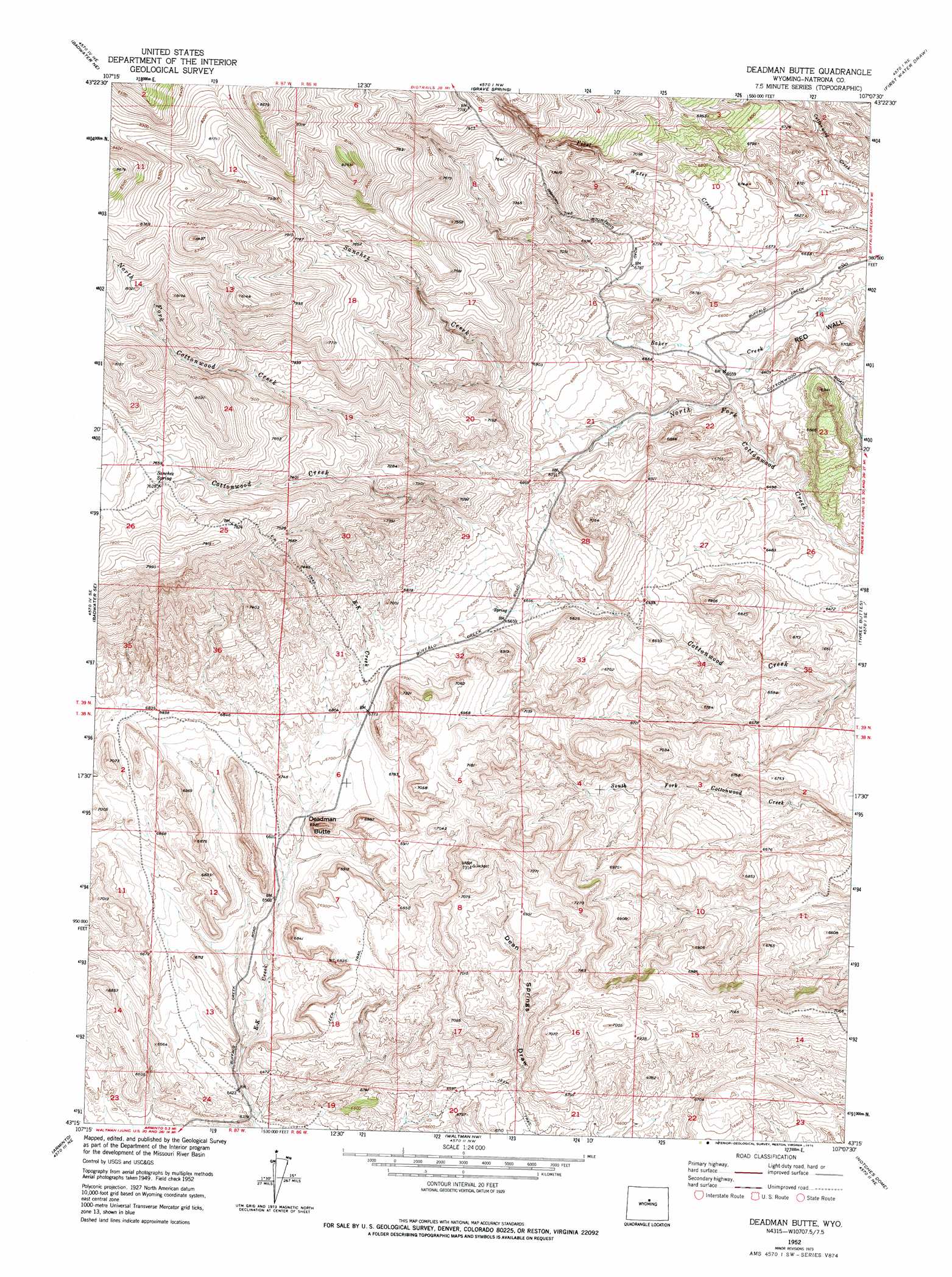
USGS Topo Quad 43107c2 - 1:24,000 scale
| Topo Map Name: | Deadman Butte |
| USGS Topo Quad ID: | 43107c2 |
| Print Size: | ca. 21 1/4" wide x 27" high |
| Southeast Coordinates: | 43.25° N latitude / 107.125° W longitude |
| Map Center Coordinates: | 43.3125° N latitude / 107.1875° W longitude |
| U.S. State: | WY |
| Filename: | o43107c2.jpg |
| Download Map JPG Image: | Deadman Butte topo map 1:24,000 scale |
| Map Type: | Topographic |
| Topo Series: | 7.5´ |
| Map Scale: | 1:24,000 |
| Source of Map Images: | United States Geological Survey (USGS) |
| Alternate Map Versions: |
Deadman Butte WY 1952, updated 1953 Download PDF Buy paper map Deadman Butte WY 1952, updated 1975 Download PDF Buy paper map Deadman Butte WY 2012 Download PDF Buy paper map Deadman Butte WY 2015 Download PDF Buy paper map |
1:24,000 Topo Quads surrounding Deadman Butte
Cornell Gulch |
Lost Creek |
Cherry Creek Hill |
Gordon Creek |
Poker Butte |
Sioux Pass |
Badwater Ne |
Grave Spring |
First Water Draw |
Roughlock Hill |
Badwater |
Badwater Se |
Deadman Butte |
Three Buttes |
Flat Top Hill |
Arminto Nw |
Arminto |
Waltman Nw |
Notches Dome |
Cave Gulch Reservoir |
Arminto Sw |
Hiland |
Waltman |
Hells Half Acre |
Powder River |
> Back to 43107a1 at 1:100,000 scale
> Back to 43106a1 at 1:250,000 scale
> Back to U.S. Topo Maps home
Deadman Butte topo map: Gazetteer
Deadman Butte: Springs
Sanchez Spring elevation 2324m 7624′Deadman Butte: Streams
Sanchez Creek elevation 2031m 6663′Deadman Butte: Summits
Deadman Butte elevation 2122m 6961′Deadman Butte digital topo map on disk
Buy this Deadman Butte topo map showing relief, roads, GPS coordinates and other geographical features, as a high-resolution digital map file on DVD:
Eastern Wyoming & Western South Dakota
Buy digital topo maps: Eastern Wyoming & Western South Dakota