First Water Draw Topo Map Wyoming
To zoom in, hover over the map of First Water Draw
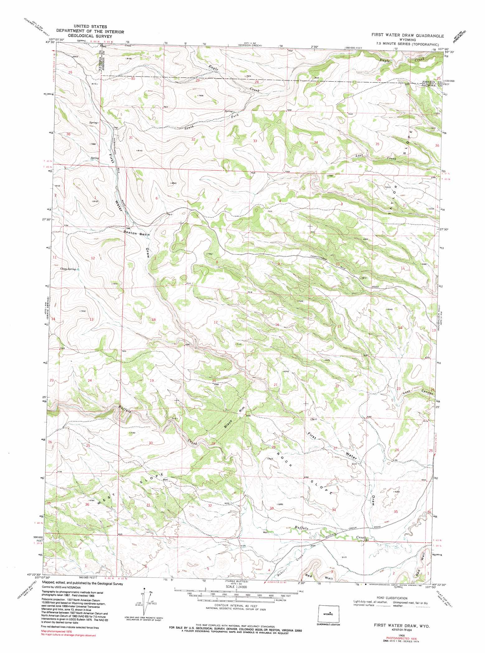
USGS Topo Quad 43107d1 - 1:24,000 scale
| Topo Map Name: | First Water Draw |
| USGS Topo Quad ID: | 43107d1 |
| Print Size: | ca. 21 1/4" wide x 27" high |
| Southeast Coordinates: | 43.375° N latitude / 107° W longitude |
| Map Center Coordinates: | 43.4375° N latitude / 107.0625° W longitude |
| U.S. State: | WY |
| Filename: | o43107d1.jpg |
| Download Map JPG Image: | First Water Draw topo map 1:24,000 scale |
| Map Type: | Topographic |
| Topo Series: | 7.5´ |
| Map Scale: | 1:24,000 |
| Source of Map Images: | United States Geological Survey (USGS) |
| Alternate Map Versions: |
First Water Draw WY 1968, updated 1972 Download PDF Buy paper map First Water Draw WY 1968, updated 1991 Download PDF Buy paper map First Water Draw WY 2012 Download PDF Buy paper map First Water Draw WY 2015 Download PDF Buy paper map |
1:24,000 Topo Quads surrounding First Water Draw
Mahogany Butte |
Horse Butte |
Turk Springs |
Barnum |
Red Fork Powder River |
Lost Creek |
Cherry Creek Hill |
Gordon Creek |
Poker Butte |
Hole-In-The-Wall |
Badwater Ne |
Grave Spring |
First Water Draw |
Roughlock Hill |
Willow Creek School |
Badwater Se |
Deadman Butte |
Three Buttes |
Flat Top Hill |
Big Sulfur Draw |
Arminto |
Waltman Nw |
Notches Dome |
Cave Gulch Reservoir |
Anderson Draw |
> Back to 43107a1 at 1:100,000 scale
> Back to 43106a1 at 1:250,000 scale
> Back to U.S. Topo Maps home
First Water Draw topo map: Gazetteer
First Water Draw: Basins
Beaton Basin elevation 2294m 7526′First Water Draw: Cliffs
Black Rim elevation 2030m 6660′First Water Draw: Flats
Rock Slope elevation 1936m 6351′Taylor Slope elevation 2129m 6984′
West Slope elevation 2046m 6712′
First Water Draw: Springs
Clapp Spring elevation 2337m 7667′First Water Draw: Streams
Baker Creek elevation 1861m 6105′South Fork Eagle Creek elevation 2230m 7316′
First Water Draw: Valleys
First Water Draw elevation 1842m 6043′First Water Draw digital topo map on disk
Buy this First Water Draw topo map showing relief, roads, GPS coordinates and other geographical features, as a high-resolution digital map file on DVD:
Eastern Wyoming & Western South Dakota
Buy digital topo maps: Eastern Wyoming & Western South Dakota