Sioux Pass Topo Map Wyoming
To zoom in, hover over the map of Sioux Pass
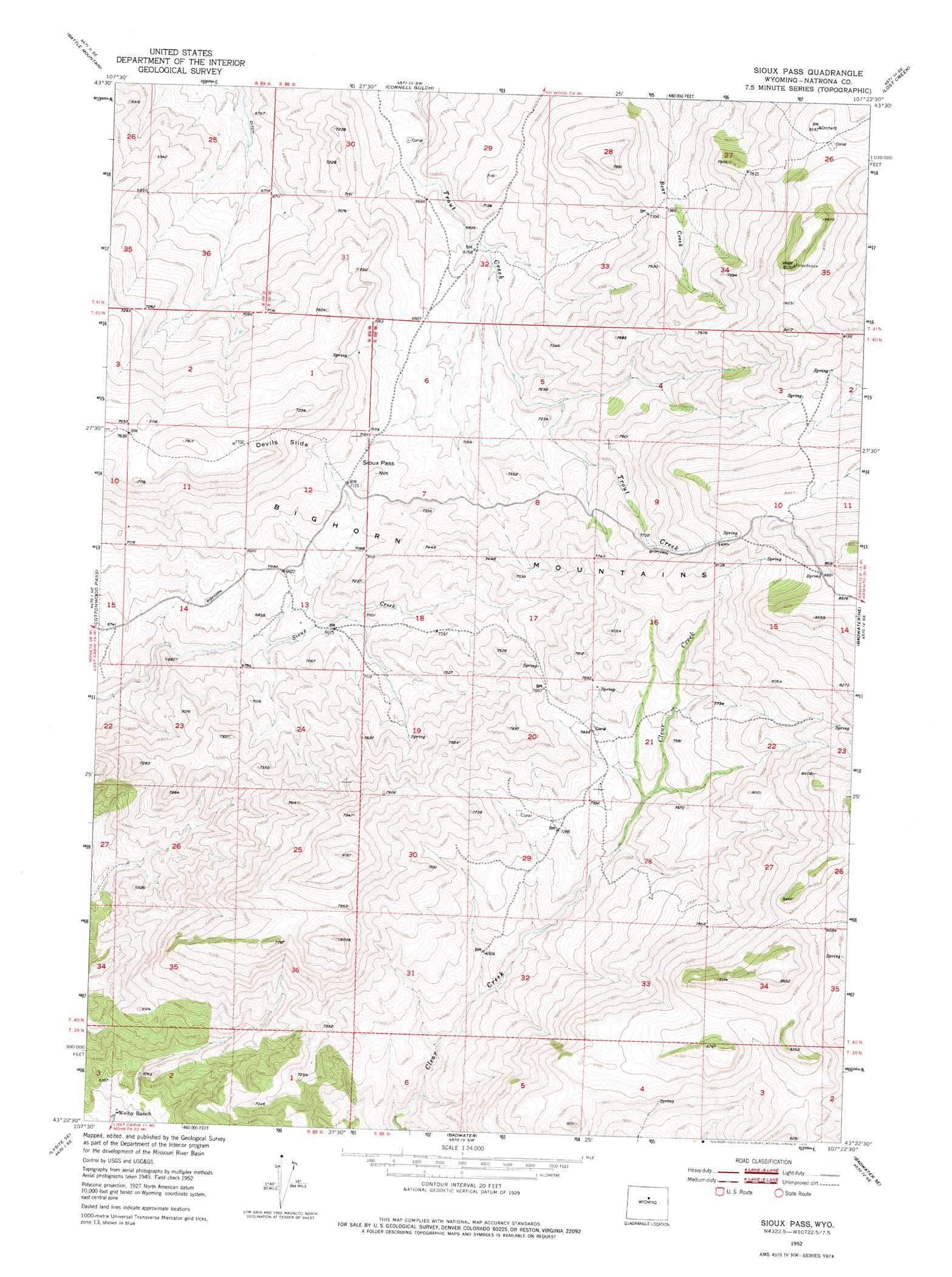
USGS Topo Quad 43107d4 - 1:24,000 scale
| Topo Map Name: | Sioux Pass |
| USGS Topo Quad ID: | 43107d4 |
| Print Size: | ca. 21 1/4" wide x 27" high |
| Southeast Coordinates: | 43.375° N latitude / 107.375° W longitude |
| Map Center Coordinates: | 43.4375° N latitude / 107.4375° W longitude |
| U.S. State: | WY |
| Filename: | o43107d4.jpg |
| Download Map JPG Image: | Sioux Pass topo map 1:24,000 scale |
| Map Type: | Topographic |
| Topo Series: | 7.5´ |
| Map Scale: | 1:24,000 |
| Source of Map Images: | United States Geological Survey (USGS) |
| Alternate Map Versions: |
Sioux Pass WY 1952, updated 1953 Download PDF Buy paper map Sioux Pass WY 1952, updated 1975 Download PDF Buy paper map Sioux Pass WY 2012 Download PDF Buy paper map Sioux Pass WY 2015 Download PDF Buy paper map |
1:24,000 Topo Quads surrounding Sioux Pass
Bader Draw |
Sand Point |
Lightning Ridge |
Mahogany Butte |
Horse Butte |
Bull Mountain |
Battle Mountain |
Cornell Gulch |
Lost Creek |
Cherry Creek Hill |
Arapahoe Butte |
Cottonwood Pass |
Sioux Pass |
Badwater Ne |
Grave Spring |
Lysite |
Lysite Se |
Badwater |
Badwater Se |
Deadman Butte |
Moneta |
Madden |
Arminto Nw |
Arminto |
Waltman Nw |
> Back to 43107a1 at 1:100,000 scale
> Back to 43106a1 at 1:250,000 scale
> Back to U.S. Topo Maps home
Sioux Pass topo map: Gazetteer
Sioux Pass: Cliffs
Devils Slide elevation 2292m 7519′Sioux Pass: Gaps
Sioux Pass elevation 2178m 7145′Sioux Pass digital topo map on disk
Buy this Sioux Pass topo map showing relief, roads, GPS coordinates and other geographical features, as a high-resolution digital map file on DVD:
Eastern Wyoming & Western South Dakota
Buy digital topo maps: Eastern Wyoming & Western South Dakota