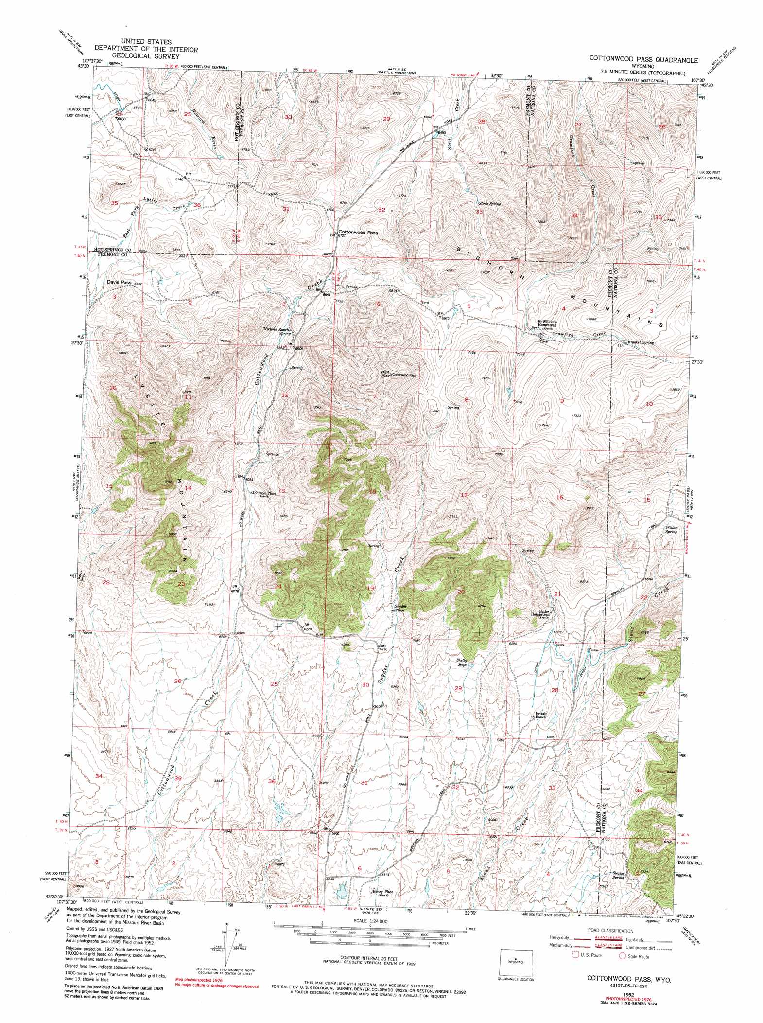
Cottonwood Pass Topo Map Wyoming
To zoom in, hover over the map of Cottonwood Pass
USGS Topo Quad 43107d5 - 1:24,000 scale
| Topo Map Name: | Cottonwood Pass |
| USGS Topo Quad ID: | 43107d5 |
| Print Size: | ca. 21 1/4" wide x 27" high |
| Southeast Coordinates: | 43.375° N latitude / 107.5° W longitude |
| Map Center Coordinates: | 43.4375° N latitude / 107.5625° W longitude |
| U.S. State: | WY |
| Filename: | o43107d5.jpg |
| Download Map JPG Image: | Cottonwood Pass topo map 1:24,000 scale |
| Map Type: | Topographic |
| Topo Series: | 7.5´ |
| Map Scale: | 1:24,000 |
| Source of Map Images: | United States Geological Survey (USGS) |
| Alternate Map Versions: |
Cottonwood Pass WY 1952, updated 1953 Download PDF Buy paper map Cottonwood Pass WY 1952, updated 1976 Download PDF Buy paper map Cottonwood Pass WY 1952, updated 1985 Download PDF Buy paper map Cottonwood Pass WY 2012 Download PDF Buy paper map Cottonwood Pass WY 2015 Download PDF Buy paper map |
1:24,000 Topo Quads surrounding Cottonwood Pass
Packsaddle Creek |
Bader Draw |
Sand Point |
Lightning Ridge |
Mahogany Butte |
Rathbun Ranch |
Bull Mountain |
Battle Mountain |
Cornell Gulch |
Lost Creek |
De Pass |
Arapahoe Butte |
Cottonwood Pass |
Sioux Pass |
Badwater Ne |
Gates Butte |
Lysite |
Lysite Se |
Badwater |
Badwater Se |
Squaw Butte Ne |
Moneta |
Madden |
Arminto Nw |
Arminto |
> Back to 43107a1 at 1:100,000 scale
> Back to 43106a1 at 1:250,000 scale
> Back to U.S. Topo Maps home
Cottonwood Pass topo map: Gazetteer
Cottonwood Pass: Gaps
Cottonwood Pass elevation 2050m 6725′Davis Pass elevation 2021m 6630′
Cottonwood Pass: Mines
Ellsworth Claim elevation 1822m 5977′Cottonwood Pass: Populated Places
Snyder Place elevation 1928m 6325′Cottonwood Pass: Springs
Brasket Spring elevation 2233m 7326′Shelly Seeps elevation 1885m 6184′
Stove Spring elevation 2036m 6679′
Swaim Spring elevation 1920m 6299′
Willow Spring elevation 2032m 6666′
Cottonwood Pass: Summits
Lysite Mountain elevation 2187m 7175′Cottonwood Pass digital topo map on disk
Buy this Cottonwood Pass topo map showing relief, roads, GPS coordinates and other geographical features, as a high-resolution digital map file on DVD:
Eastern Wyoming & Western South Dakota
Buy digital topo maps: Eastern Wyoming & Western South Dakota