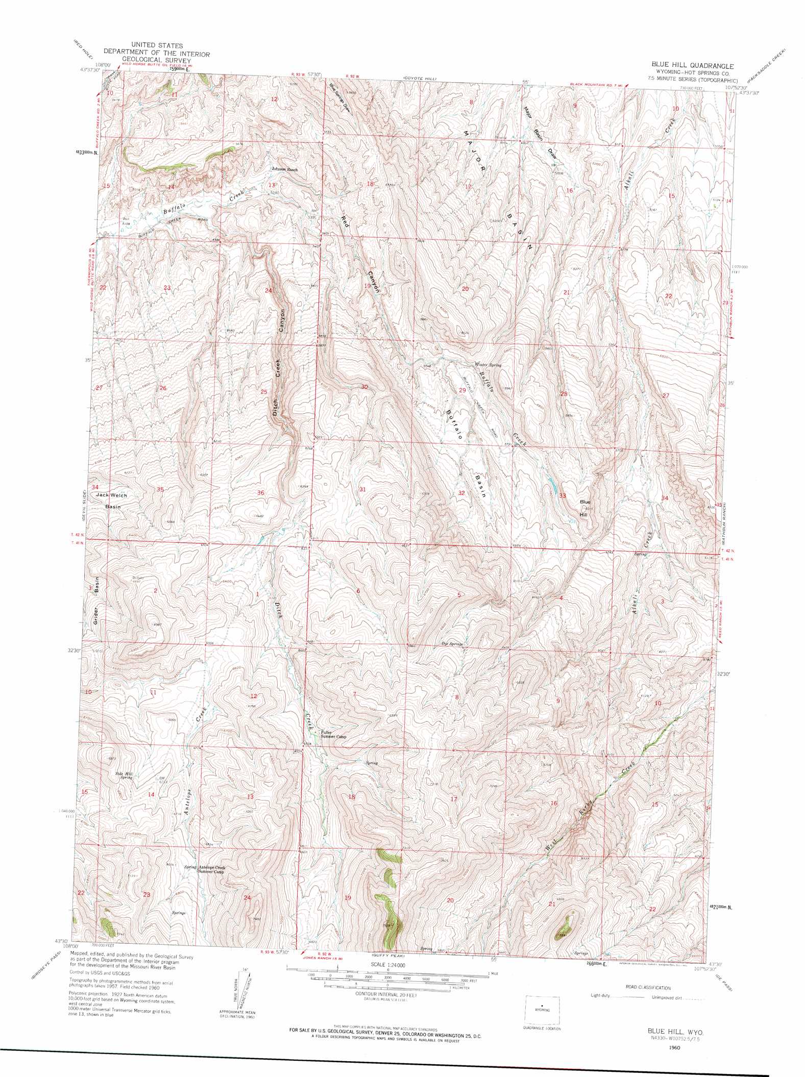
Blue Hill Topo Map Wyoming
To zoom in, hover over the map of Blue Hill
USGS Topo Quad 43107e8 - 1:24,000 scale
| Topo Map Name: | Blue Hill |
| USGS Topo Quad ID: | 43107e8 |
| Print Size: | ca. 21 1/4" wide x 27" high |
| Southeast Coordinates: | 43.5° N latitude / 107.875° W longitude |
| Map Center Coordinates: | 43.5625° N latitude / 107.9375° W longitude |
| U.S. State: | WY |
| Filename: | o43107e8.jpg |
| Download Map JPG Image: | Blue Hill topo map 1:24,000 scale |
| Map Type: | Topographic |
| Topo Series: | 7.5´ |
| Map Scale: | 1:24,000 |
| Source of Map Images: | United States Geological Survey (USGS) |
| Alternate Map Versions: |
Blue Hill WY 1960, updated 1962 Download PDF Buy paper map Blue Hill WY 2012 Download PDF Buy paper map Blue Hill WY 2015 Download PDF Buy paper map |
1:24,000 Topo Quads surrounding Blue Hill
Kirby |
Cedar Mountain |
Zimmerman Buttes |
Henry Draw |
Wagon Prong |
Thermoplis |
Red Hole |
Coyote Hill |
Packsaddle Creek |
Bader Draw |
Wedding Of The Waters |
Devil Slide |
Blue Hill |
Rathbun Ranch |
Bull Mountain |
Boysen |
Birdseye Pass |
Guffy Peak |
De Pass |
Arapahoe Butte |
Bonneville Sw |
Bonneville |
Picard Ranch |
Gates Butte |
Lysite |
> Back to 43107e1 at 1:100,000 scale
> Back to 43106a1 at 1:250,000 scale
> Back to U.S. Topo Maps home
Blue Hill topo map: Gazetteer
Blue Hill: Basins
Buffalo Basin elevation 1756m 5761′Jack Welch Basin elevation 1861m 6105′
Major Basin elevation 1587m 5206′
Blue Hill: Springs
Dye Springs elevation 2015m 6610′Side Hill Spring elevation 2036m 6679′
Winter Spring elevation 1702m 5583′
Blue Hill: Streams
Ditch Creek elevation 1568m 5144′Blue Hill: Summits
Blue Hill elevation 1833m 6013′Blue Hill: Valleys
Ditch Creek Canyon elevation 1568m 5144′Red Canyon elevation 1623m 5324′
Blue Hill digital topo map on disk
Buy this Blue Hill topo map showing relief, roads, GPS coordinates and other geographical features, as a high-resolution digital map file on DVD:
Eastern Wyoming & Western South Dakota
Buy digital topo maps: Eastern Wyoming & Western South Dakota