Zimmerman Buttes Topo Map Wyoming
To zoom in, hover over the map of Zimmerman Buttes
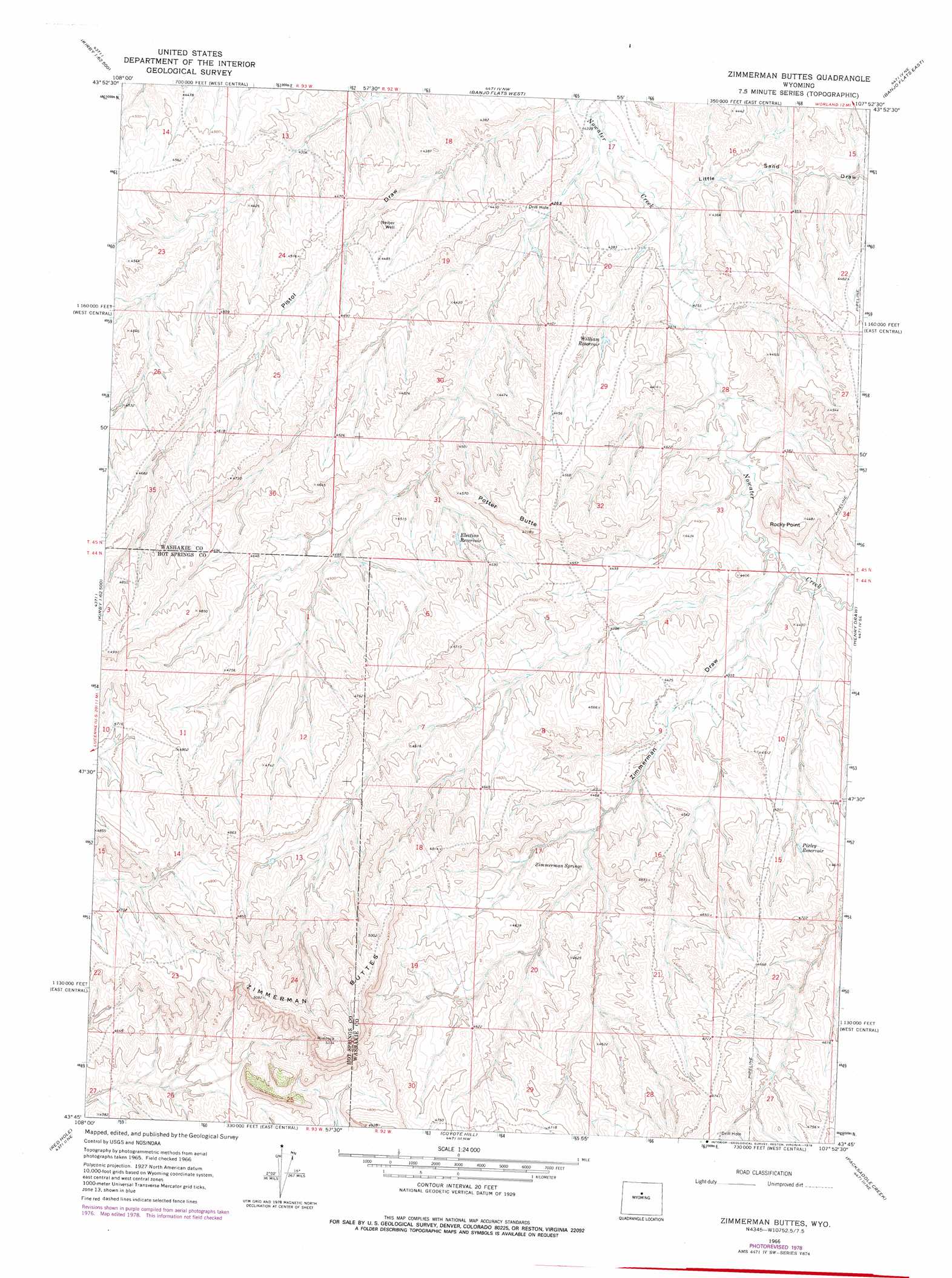
USGS Topo Quad 43107g8 - 1:24,000 scale
| Topo Map Name: | Zimmerman Buttes |
| USGS Topo Quad ID: | 43107g8 |
| Print Size: | ca. 21 1/4" wide x 27" high |
| Southeast Coordinates: | 43.75° N latitude / 107.875° W longitude |
| Map Center Coordinates: | 43.8125° N latitude / 107.9375° W longitude |
| U.S. State: | WY |
| Filename: | o43107g8.jpg |
| Download Map JPG Image: | Zimmerman Buttes topo map 1:24,000 scale |
| Map Type: | Topographic |
| Topo Series: | 7.5´ |
| Map Scale: | 1:24,000 |
| Source of Map Images: | United States Geological Survey (USGS) |
| Alternate Map Versions: |
Zimmerman Buttes WY 1966, updated 1971 Download PDF Buy paper map Zimmerman Buttes WY 1966, updated 1978 Download PDF Buy paper map Zimmerman Buttes WY 2012 Download PDF Buy paper map Zimmerman Buttes WY 2015 Download PDF Buy paper map |
1:24,000 Topo Quads surrounding Zimmerman Buttes
Schuster Flats |
Schuster Flats Se |
Worland |
Worland Se |
Broom Draw |
Chimney Gulch |
Neiber |
Banjo Flats West |
Banjo Flats East |
Cabin Fork |
Kirby |
Cedar Mountain |
Zimmerman Buttes |
Henry Draw |
Wagon Prong |
Thermoplis |
Red Hole |
Coyote Hill |
Packsaddle Creek |
Bader Draw |
Wedding Of The Waters |
Devil Slide |
Blue Hill |
Rathbun Ranch |
Bull Mountain |
> Back to 43107e1 at 1:100,000 scale
> Back to 43106a1 at 1:250,000 scale
> Back to U.S. Topo Maps home
Zimmerman Buttes topo map: Gazetteer
Zimmerman Buttes: Reservoirs
Election Reservoir elevation 1361m 4465′Pixley Reservoir elevation 1392m 4566′
William Reservoir elevation 1341m 4399′
Zimmerman Buttes: Springs
Zimmerman Springs elevation 1352m 4435′Zimmerman Buttes: Summits
Potter Butte elevation 1425m 4675′Rocky Point elevation 1372m 4501′
Zimmerman Buttes elevation 1594m 5229′
Zimmerman Buttes: Valleys
Little Sand Draw elevation 1293m 4242′Zimmerman Draw elevation 1312m 4304′
Zimmerman Buttes digital topo map on disk
Buy this Zimmerman Buttes topo map showing relief, roads, GPS coordinates and other geographical features, as a high-resolution digital map file on DVD:
Eastern Wyoming & Western South Dakota
Buy digital topo maps: Eastern Wyoming & Western South Dakota