Big Trails Ne Topo Map Wyoming
To zoom in, hover over the map of Big Trails Ne
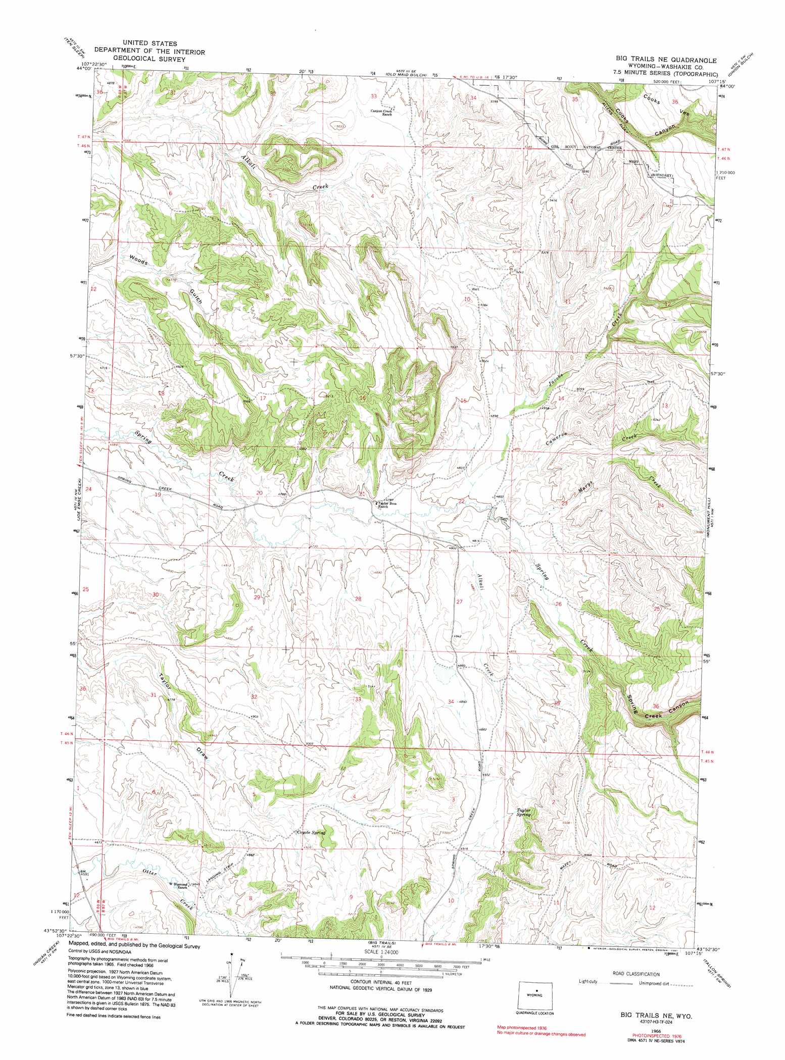
USGS Topo Quad 43107h3 - 1:24,000 scale
| Topo Map Name: | Big Trails Ne |
| USGS Topo Quad ID: | 43107h3 |
| Print Size: | ca. 21 1/4" wide x 27" high |
| Southeast Coordinates: | 43.875° N latitude / 107.25° W longitude |
| Map Center Coordinates: | 43.9375° N latitude / 107.3125° W longitude |
| U.S. State: | WY |
| Filename: | o43107h3.jpg |
| Download Map JPG Image: | Big Trails Ne topo map 1:24,000 scale |
| Map Type: | Topographic |
| Topo Series: | 7.5´ |
| Map Scale: | 1:24,000 |
| Source of Map Images: | United States Geological Survey (USGS) |
| Alternate Map Versions: |
Big Trails NE WY 1966, updated 1970 Download PDF Buy paper map Big Trails NE WY 1966, updated 1991 Download PDF Buy paper map Big Trails NE WY 2012 Download PDF Buy paper map Big Trails NE WY 2015 Download PDF Buy paper map |
1:24,000 Topo Quads surrounding Big Trails Ne
Hyattville |
Pierce Draw |
Brokenback Narrows |
Meadowlark Lake |
Powder River Pass |
Wild Horse Hill |
Ten Sleep |
Old Maid Gulch |
Onion Gulch |
Hazelton Peak |
Castle Gardens |
Joe Emge Creek |
Big Trails Ne |
Monument Hill |
Beartrap Meadows |
Deadline Draw |
Indian Creek |
Big Trails |
Tallon Spring |
Tabletop |
Sand Point |
Lightning Ridge |
Mahogany Butte |
Horse Butte |
Turk Springs |
> Back to 43107e1 at 1:100,000 scale
> Back to 43106a1 at 1:250,000 scale
> Back to U.S. Topo Maps home
Big Trails Ne topo map: Gazetteer
Big Trails Ne: Mines
Spring Creek Area Mine elevation 1468m 4816′Big Trails Ne: Springs
Coyote Spring elevation 1491m 4891′Taylor Spring elevation 1536m 5039′
Big Trails Ne: Streams
Alkali Creek elevation 1450m 4757′Cameron Creek elevation 1464m 4803′
Jacobs Creek elevation 1462m 4796′
Marys Creek elevation 1465m 4806′
Big Trails Ne: Valleys
Spring Creek Canyon elevation 1533m 5029′Big Trails Ne digital topo map on disk
Buy this Big Trails Ne topo map showing relief, roads, GPS coordinates and other geographical features, as a high-resolution digital map file on DVD:
Eastern Wyoming & Western South Dakota
Buy digital topo maps: Eastern Wyoming & Western South Dakota