Pavillion Topo Map Wyoming
To zoom in, hover over the map of Pavillion
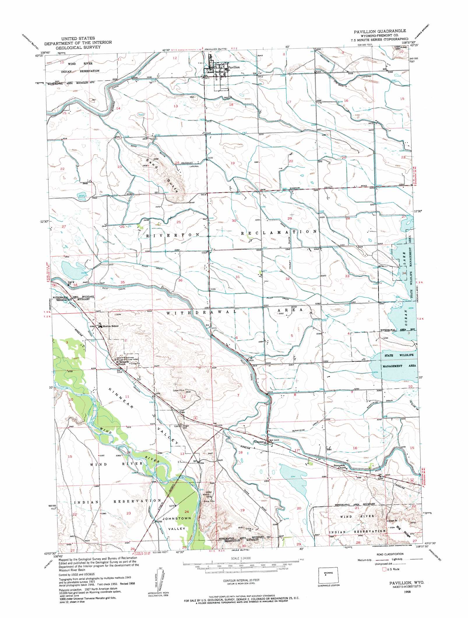
USGS Topo Quad 43108b6 - 1:24,000 scale
| Topo Map Name: | Pavillion |
| USGS Topo Quad ID: | 43108b6 |
| Print Size: | ca. 21 1/4" wide x 27" high |
| Southeast Coordinates: | 43.125° N latitude / 108.625° W longitude |
| Map Center Coordinates: | 43.1875° N latitude / 108.6875° W longitude |
| U.S. State: | WY |
| Filename: | o43108b6.jpg |
| Download Map JPG Image: | Pavillion topo map 1:24,000 scale |
| Map Type: | Topographic |
| Topo Series: | 7.5´ |
| Map Scale: | 1:24,000 |
| Source of Map Images: | United States Geological Survey (USGS) |
| Alternate Map Versions: |
Pavillion WY 1950, updated 1952 Download PDF Buy paper map Pavillion WY 1958, updated 1959 Download PDF Buy paper map Pavillion WY 1958, updated 1959 Download PDF Buy paper map Pavillion WY 2012 Download PDF Buy paper map Pavillion WY 2015 Download PDF Buy paper map |
1:24,000 Topo Quads surrounding Pavillion
Maverick Spring |
Eagle Point |
Shotgun Butte |
Jenkins Mountain |
Mexican Pass |
Lookout Butte Sw |
Lookout Butte |
Pavillion Butte |
Harris Bridge |
Mexican Pass Sw |
Argo Butte |
Morton |
Pavillion |
Ocean Lake |
Lost Wells Butte |
Fort Washakie |
Ethete |
Mule Butte |
Pavillion Se |
Riverton West |
Wind River |
Ray Lake |
Lander Nw |
Hudson |
Arapahoe |
> Back to 43108a1 at 1:100,000 scale
> Back to 43108a1 at 1:250,000 scale
> Back to U.S. Topo Maps home
Pavillion topo map: Gazetteer
Pavillion: Canals
Pilot Drain elevation 1623m 5324′Sand Butte Lateral elevation 1680m 5511′
Sunnyside Drain elevation 1623m 5324′
Wyoming Canal elevation 1696m 5564′
Pavillion: Populated Places
Kinnear elevation 1646m 5400′Pavillion elevation 1665m 5462′
Pavillion: Ridges
Big Ridge elevation 1741m 5711′Pavillion: Summits
Sand Butte elevation 1705m 5593′Pavillion: Valleys
Kinnear Valley elevation 1611m 5285′Pavillion digital topo map on disk
Buy this Pavillion topo map showing relief, roads, GPS coordinates and other geographical features, as a high-resolution digital map file on DVD: