Sheep Ridge Topo Map Wyoming
To zoom in, hover over the map of Sheep Ridge
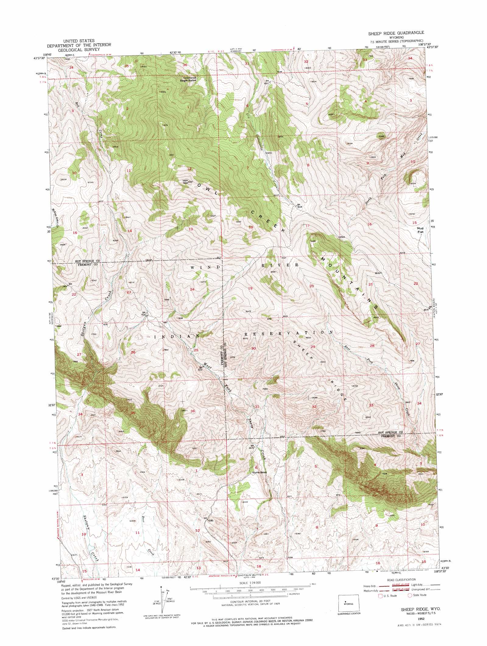
USGS Topo Quad 43108e6 - 1:24,000 scale
| Topo Map Name: | Sheep Ridge |
| USGS Topo Quad ID: | 43108e6 |
| Print Size: | ca. 21 1/4" wide x 27" high |
| Southeast Coordinates: | 43.5° N latitude / 108.625° W longitude |
| Map Center Coordinates: | 43.5625° N latitude / 108.6875° W longitude |
| U.S. State: | WY |
| Filename: | o43108e6.jpg |
| Download Map JPG Image: | Sheep Ridge topo map 1:24,000 scale |
| Map Type: | Topographic |
| Topo Series: | 7.5´ |
| Map Scale: | 1:24,000 |
| Source of Map Images: | United States Geological Survey (USGS) |
| Alternate Map Versions: |
Sheep Ridge WY 1952, updated 1953 Download PDF Buy paper map Sheep Ridge WY 1952, updated 1977 Download PDF Buy paper map Sheep Ridge WY 2012 Download PDF Buy paper map Sheep Ridge WY 2015 Download PDF Buy paper map |
1:24,000 Topo Quads surrounding Sheep Ridge
Milk Creek |
Twentyone Creek |
Crater Sink |
Hamilton Dome |
Gloin Reservoir |
Eagle Nest Ranch |
Anchor Reservoir |
Embar |
Arapahoe Ranch |
Thompson Reservoirs |
Antelope Ridge |
Bargee |
Sheep Ridge |
Kates Basin |
Potato Butte |
Maverick Spring |
Eagle Point |
Shotgun Butte |
Jenkins Mountain |
Mexican Pass |
Lookout Butte Sw |
Lookout Butte |
Pavillion Butte |
Harris Bridge |
Mexican Pass Sw |
> Back to 43108e1 at 1:100,000 scale
> Back to 43108a1 at 1:250,000 scale
> Back to U.S. Topo Maps home
Sheep Ridge topo map: Gazetteer
Sheep Ridge: Flats
Mud Flat elevation 2401m 7877′Sheep Ridge: Mines
East Fork Sheep Creek Number One Mine elevation 1941m 6368′East Fork Sheep Creek Number Two Mine elevation 1937m 6354′
Sheep Ridge: Ridges
Sheep Ridge elevation 2568m 8425′Sheep Ridge digital topo map on disk
Buy this Sheep Ridge topo map showing relief, roads, GPS coordinates and other geographical features, as a high-resolution digital map file on DVD: