Eagle Nest Ranch Topo Map Wyoming
To zoom in, hover over the map of Eagle Nest Ranch
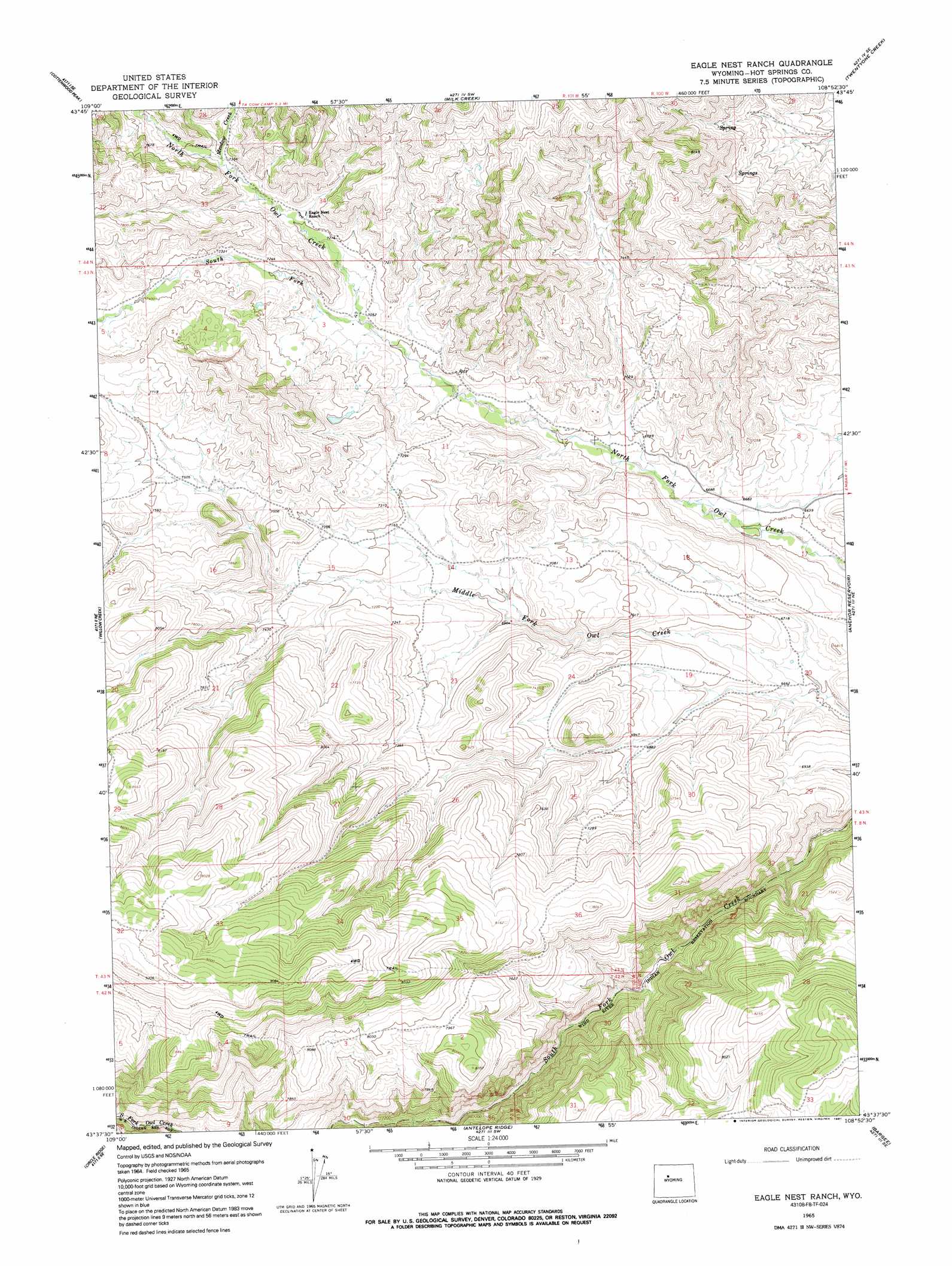
USGS Topo Quad 43108f8 - 1:24,000 scale
| Topo Map Name: | Eagle Nest Ranch |
| USGS Topo Quad ID: | 43108f8 |
| Print Size: | ca. 21 1/4" wide x 27" high |
| Southeast Coordinates: | 43.625° N latitude / 108.875° W longitude |
| Map Center Coordinates: | 43.6875° N latitude / 108.9375° W longitude |
| U.S. State: | WY |
| Filename: | o43108f8.jpg |
| Download Map JPG Image: | Eagle Nest Ranch topo map 1:24,000 scale |
| Map Type: | Topographic |
| Topo Series: | 7.5´ |
| Map Scale: | 1:24,000 |
| Source of Map Images: | United States Geological Survey (USGS) |
| Alternate Map Versions: |
Eagle Nest Ranch WY 1965, updated 1968 Download PDF Buy paper map Eagle Nest Ranch WY 1965, updated 1991 Download PDF Buy paper map Eagle Nest Ranch WY 2012 Download PDF Buy paper map Eagle Nest Ranch WY 2015 Download PDF Buy paper map |
1:24,000 Topo Quads surrounding Eagle Nest Ranch
Dick Creek Lakes |
Noon Point |
Soapy Dale Peak |
Adam Weiss Peak |
Grass Creek |
Twin Peaks |
Cottonwood Peak |
Milk Creek |
Twentyone Creek |
Crater Sink |
Monument Peak |
Willow Creek |
Eagle Nest Ranch |
Anchor Reservoir |
Embar |
Johnson Draw |
Circle Ridge |
Antelope Ridge |
Bargee |
Sheep Ridge |
Crowheart Nw |
Crowheart Ne |
Maverick Spring |
Eagle Point |
Shotgun Butte |
> Back to 43108e1 at 1:100,000 scale
> Back to 43108a1 at 1:250,000 scale
> Back to U.S. Topo Maps home
Eagle Nest Ranch topo map: Gazetteer
Eagle Nest Ranch: Streams
Meadow Creek elevation 2238m 7342′Middle Branch Middle Fork Owl Creek elevation 2301m 7549′
South Branch Middle Fork Owl Creek elevation 2301m 7549′
South Fork North Fork Owl Creek elevation 2147m 7043′
Eagle Nest Ranch digital topo map on disk
Buy this Eagle Nest Ranch topo map showing relief, roads, GPS coordinates and other geographical features, as a high-resolution digital map file on DVD: