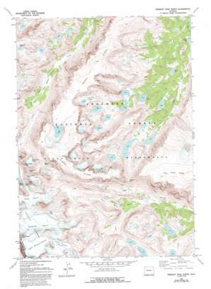
Fremont Peak North Topo Map Wyoming
To zoom in, hover over the map of Fremont Peak North
USGS Topo Quad 43109b5 - 1:24,000 scale
| Topo Map Name: | Fremont Peak North |
| USGS Topo Quad ID: | 43109b5 |
| Print Size: | ca. 21 1/4" wide x 27" high |
| Southeast Coordinates: | 43.125° N latitude / 109.5° W longitude |
| Map Center Coordinates: | 43.1875° N latitude / 109.5625° W longitude |
| U.S. State: | WY |
| Filename: | o43109b5.jpg |
| Download Map JPG Image: | Fremont Peak North topo map 1:24,000 scale |
| Map Type: | Topographic |
| Topo Series: | 7.5´ |
| Map Scale: | 1:24,000 |
| Source of Map Images: | United States Geological Survey (USGS) |
| Alternate Map Versions: |
Fremont Peak North WY 1968, updated 1973 Download PDF Buy paper map Fremont Peak North WY 1968, updated 1993 Download PDF Buy paper map Fremont Peak North WY 1991, updated 1997 Download PDF Buy paper map Fremont Peak North WY 2012 Download PDF Buy paper map Fremont Peak North WY 2015 Download PDF Buy paper map |
| FStopo: | US Forest Service topo Fremont Peak North is available: Download FStopo PDF Download FStopo TIF |
1:24,000 Topo Quads surrounding Fremont Peak North
> Back to 43109a1 at 1:100,000 scale
> Back to 43108a1 at 1:250,000 scale
> Back to U.S. Topo Maps home
Fremont Peak North topo map: Gazetteer
Fremont Peak North: Flats
Wilson Meadows elevation 2997m 9832′Fremont Peak North: Gaps
Backpackers Pass elevation 3921m 12864′Blaurock Pass elevation 3886m 12749′
Elsie Col elevation 3958m 12985′
Indian Pass elevation 3527m 11571′
Fremont Peak North: Glaciers
Fremont Glaciers elevation 3677m 12063′Heap Steep Glacier elevation 3561m 11683′
Helen Glacier elevation 3630m 11909′
Lower Fremont Glacier elevation 3685m 12089′
Sacagawea Glacier elevation 3653m 11984′
Upper Fremont Glacier elevation 3971m 13028′
Fremont Peak North: Lakes
Cub Lake elevation 3165m 10383′Don Lake elevation 3194m 10479′
Moose Lake elevation 3034m 9954′
Noel Lake elevation 3710m 12171′
Fremont Peak North: Pillars
Chimney Rock elevation 3981m 13061′Fremont Peak North: Ridges
Dry Creek Ridge elevation 3841m 12601′Horse Ridge elevation 3701m 12142′
Fremont Peak North: Streams
Gannett Creek elevation 3038m 9967′Klonkike Creek elevation 2943m 9655′
Fremont Peak North: Summits
East Sentinel elevation 3897m 12785′Fourts Horn elevation 3609m 11840′
Heap Steep Peak elevation 3917m 12851′
Mount Febbas elevation 4100m 13451′
Mount Sacagawea elevation 4119m 13513′
Sunbeam Peak elevation 4092m 13425′
Turret Peak elevation 4147m 13605′
Fremont Peak North digital topo map on disk
Buy this Fremont Peak North topo map showing relief, roads, GPS coordinates and other geographical features, as a high-resolution digital map file on DVD:


