Burris Topo Map Wyoming
To zoom in, hover over the map of Burris
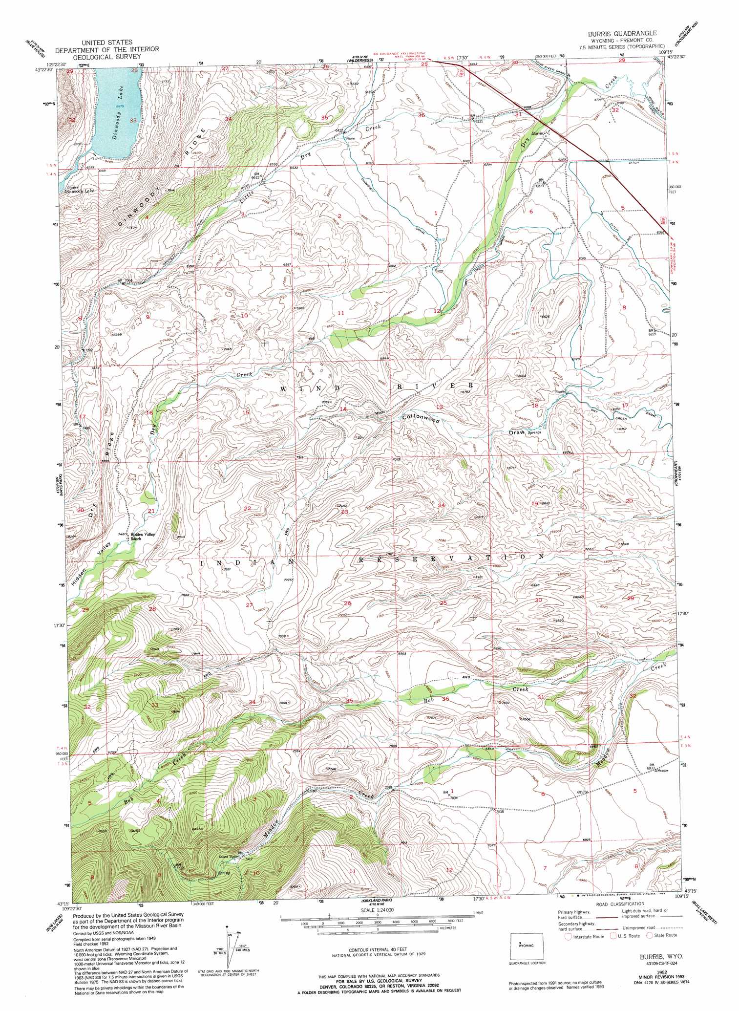
USGS Topo Quad 43109c3 - 1:24,000 scale
| Topo Map Name: | Burris |
| USGS Topo Quad ID: | 43109c3 |
| Print Size: | ca. 21 1/4" wide x 27" high |
| Southeast Coordinates: | 43.25° N latitude / 109.25° W longitude |
| Map Center Coordinates: | 43.3125° N latitude / 109.3125° W longitude |
| U.S. State: | WY |
| Filename: | o43109c3.jpg |
| Download Map JPG Image: | Burris topo map 1:24,000 scale |
| Map Type: | Topographic |
| Topo Series: | 7.5´ |
| Map Scale: | 1:24,000 |
| Source of Map Images: | United States Geological Survey (USGS) |
| Alternate Map Versions: |
Burris WY 1952, updated 1954 Download PDF Buy paper map Burris WY 1952, updated 1964 Download PDF Buy paper map Burris WY 1952, updated 1991 Download PDF Buy paper map Burris WY 1952, updated 1993 Download PDF Buy paper map Burris WY 2012 Download PDF Buy paper map Burris WY 2015 Download PDF Buy paper map |
1:24,000 Topo Quads surrounding Burris
Mason Draw |
Bain Draw |
Crow Mountain |
Johnson Draw |
Circle Ridge |
Torrey Lake |
Blue Holes |
Wilderness |
Crowheart Nw |
Crowheart Ne |
Ink Wells |
Hays Park |
Burris |
Crowheart |
Crowheart Butte |
Fremont Peak North |
Bob Lakes |
Kirkland Park |
Bull Lake West |
Bull Lake East |
Fremont Peak South |
Alpine Lake |
Paradise Basin |
Saint Lawrence Basin |
Wise Flat |
> Back to 43109a1 at 1:100,000 scale
> Back to 43108a1 at 1:250,000 scale
> Back to U.S. Topo Maps home
Burris topo map: Gazetteer
Burris: Canals
Dry Creek Canal elevation 1927m 6322′Burris: Lakes
Dinwoody Lake elevation 1975m 6479′Burris: Populated Places
Burris elevation 1871m 6138′Burris: Streams
Bob Creek elevation 1970m 6463′Little Dry Creek elevation 1853m 6079′
Burris: Valleys
Hidden Valley elevation 2251m 7385′Burris digital topo map on disk
Buy this Burris topo map showing relief, roads, GPS coordinates and other geographical features, as a high-resolution digital map file on DVD: