Wilderness Topo Map Wyoming
To zoom in, hover over the map of Wilderness
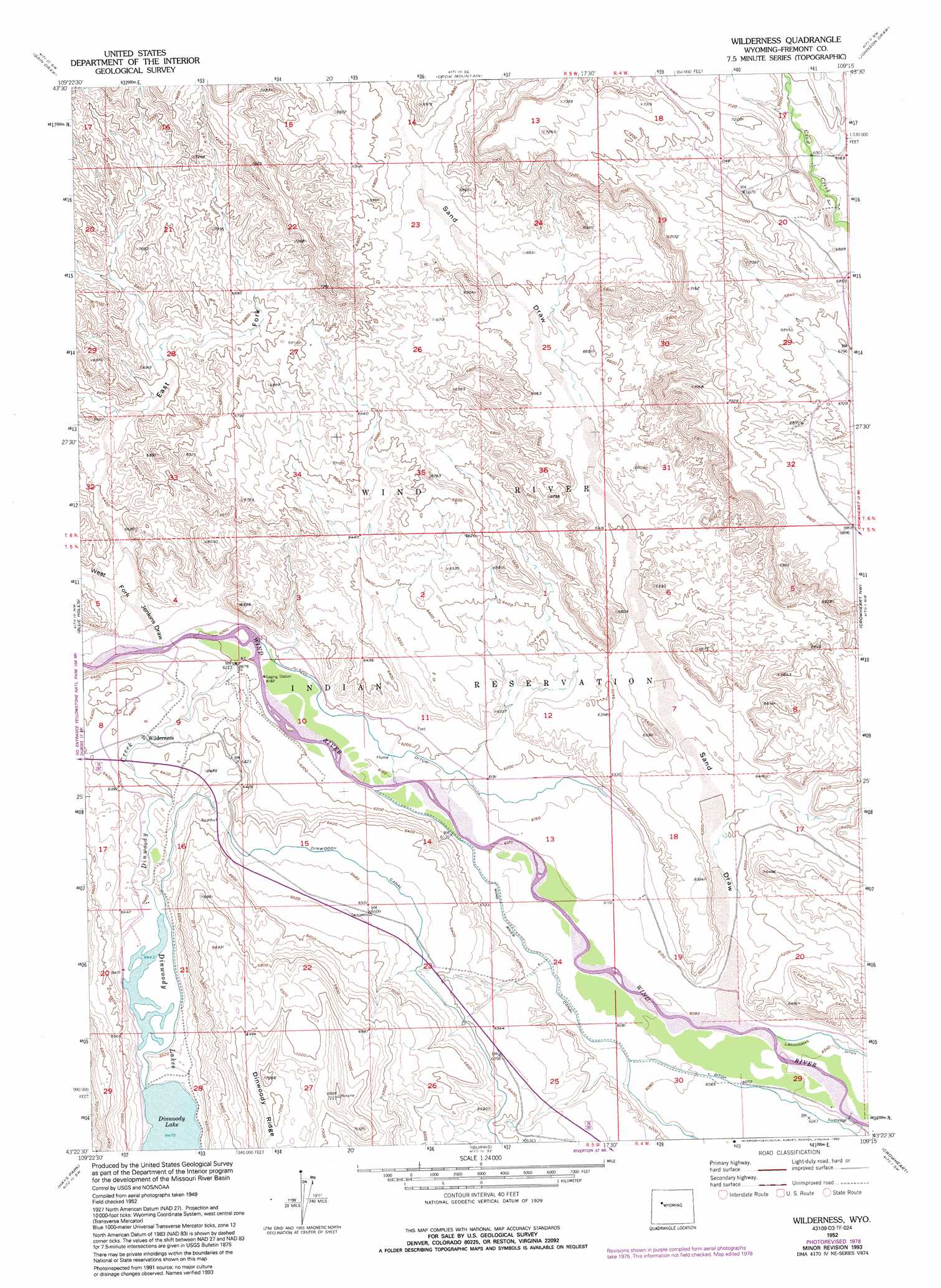
USGS Topo Quad 43109d3 - 1:24,000 scale
| Topo Map Name: | Wilderness |
| USGS Topo Quad ID: | 43109d3 |
| Print Size: | ca. 21 1/4" wide x 27" high |
| Southeast Coordinates: | 43.375° N latitude / 109.25° W longitude |
| Map Center Coordinates: | 43.4375° N latitude / 109.3125° W longitude |
| U.S. State: | WY |
| Filename: | o43109d3.jpg |
| Download Map JPG Image: | Wilderness topo map 1:24,000 scale |
| Map Type: | Topographic |
| Topo Series: | 7.5´ |
| Map Scale: | 1:24,000 |
| Source of Map Images: | United States Geological Survey (USGS) |
| Alternate Map Versions: |
Wilderness WY 1952, updated 1953 Download PDF Buy paper map Wilderness WY 1952, updated 1975 Download PDF Buy paper map Wilderness WY 1952, updated 1979 Download PDF Buy paper map Wilderness WY 1952, updated 1993 Download PDF Buy paper map Wilderness WY 2012 Download PDF Buy paper map Wilderness WY 2015 Download PDF Buy paper map |
1:24,000 Topo Quads surrounding Wilderness
Indian Point |
Castle Rock |
East Fork Basin |
Monument Peak |
Willow Creek |
Mason Draw |
Bain Draw |
Crow Mountain |
Johnson Draw |
Circle Ridge |
Torrey Lake |
Blue Holes |
Wilderness |
Crowheart Nw |
Crowheart Ne |
Ink Wells |
Hays Park |
Burris |
Crowheart |
Crowheart Butte |
Fremont Peak North |
Bob Lakes |
Kirkland Park |
Bull Lake West |
Bull Lake East |
> Back to 43109a1 at 1:100,000 scale
> Back to 43108a1 at 1:250,000 scale
> Back to U.S. Topo Maps home
Wilderness topo map: Gazetteer
Wilderness: Canals
Dinwoody Canal elevation 1962m 6437′Wind River Canal elevation 1869m 6131′
Wilderness: Lakes
Dinwoody Lakes elevation 1966m 6450′Wilderness: Mines
Sand Draw Mine elevation 1973m 6473′Wilderness: Streams
Dinwoody Creek elevation 1889m 6197′Wilderness: Valleys
Coal Draw elevation 1900m 6233′East Branch Sand Draw elevation 2072m 6797′
East Fork Jenkins Draw elevation 1912m 6272′
Jenkins Draw elevation 1894m 6213′
Sand Draw elevation 1849m 6066′
West Fork Jenkins Draw elevation 1911m 6269′
Wilderness digital topo map on disk
Buy this Wilderness topo map showing relief, roads, GPS coordinates and other geographical features, as a high-resolution digital map file on DVD: