Ferry Lake Topo Map Wyoming
To zoom in, hover over the map of Ferry Lake
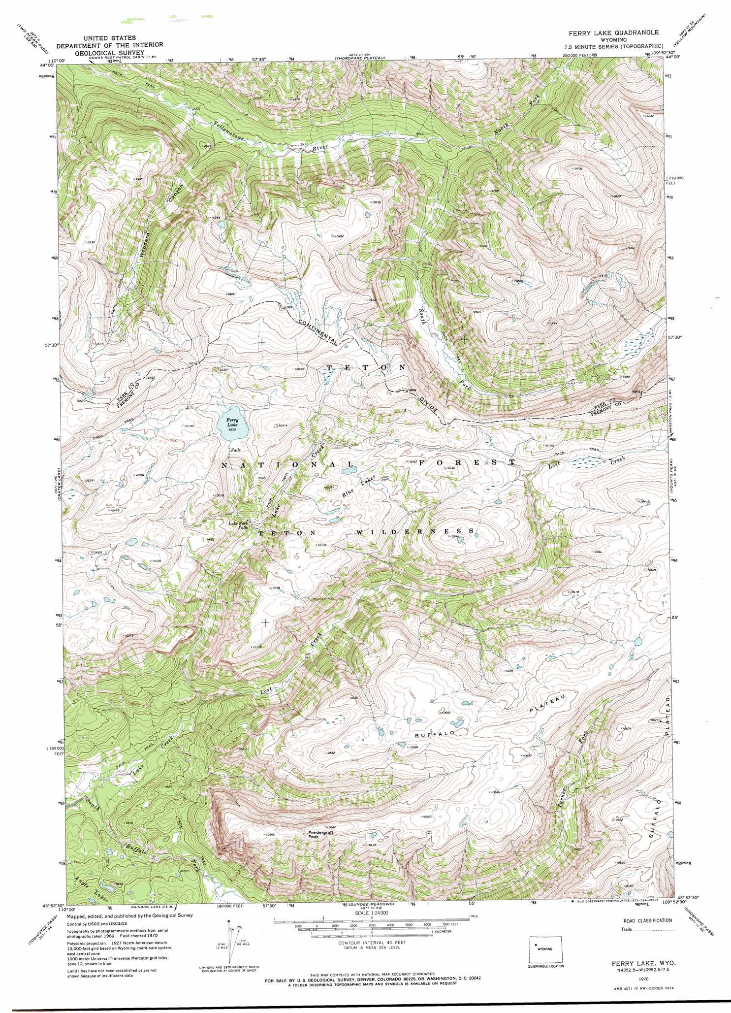
USGS Topo Quad 43109h8 - 1:24,000 scale
| Topo Map Name: | Ferry Lake |
| USGS Topo Quad ID: | 43109h8 |
| Print Size: | ca. 21 1/4" wide x 27" high |
| Southeast Coordinates: | 43.875° N latitude / 109.875° W longitude |
| Map Center Coordinates: | 43.9375° N latitude / 109.9375° W longitude |
| U.S. State: | WY |
| Filename: | o43109h8.jpg |
| Download Map JPG Image: | Ferry Lake topo map 1:24,000 scale |
| Map Type: | Topographic |
| Topo Series: | 7.5´ |
| Map Scale: | 1:24,000 |
| Source of Map Images: | United States Geological Survey (USGS) |
| Alternate Map Versions: |
Ferry Lake WY 1970, updated 1973 Download PDF Buy paper map Ferry Lake WY 1996, updated 1998 Download PDF Buy paper map Ferry Lake WY 1996, updated 1998 Download PDF Buy paper map Ferry Lake WY 2012 Download PDF Buy paper map Ferry Lake WY 2015 Download PDF Buy paper map |
| FStopo: | US Forest Service topo Ferry Lake is available: Download FStopo PDF Download FStopo TIF |
1:24,000 Topo Quads surrounding Ferry Lake
Badger Creek |
The Trident |
Open Creek |
Thorofare Buttes |
Clouds Home Peak |
Two Ocean Pass |
Yellowstone Point |
Thorofare Plateau |
Yellow Mountain |
Fall Creek |
Joy Peak |
Crater Lake |
Ferry Lake |
Younts Peak |
Hardluck Mountain |
Angle Mountain |
Togwotee Pass |
Dundee Meadows |
Shoshone Pass |
Five Pockets |
Tripod Peak |
Lava Mountain |
Kisinger Lakes |
Esmond Park |
Ramshorn Peak |
> Back to 43109e1 at 1:100,000 scale
> Back to 43108a1 at 1:250,000 scale
> Back to U.S. Topo Maps home
Ferry Lake topo map: Gazetteer
Ferry Lake: Falls
Lake Fork Falls elevation 2807m 9209′Ferry Lake: Flats
Pendergraft Meadow elevation 2465m 8087′Ferry Lake: Lakes
Blue Lakes elevation 3012m 9881′Ferry Lake elevation 3028m 9934′
Ferry Lake: Streams
Lake Creek elevation 2464m 8083′Lost Creek elevation 2498m 8195′
North Fork Yellowstone River elevation 2586m 8484′
South Fork Yellowstone River elevation 2586m 8484′
Ferry Lake: Summits
Pendergraft Peak elevation 3230m 10597′Ferry Lake: Trails
Marston Pass Trail elevation 3023m 9917′Ferry Lake: Valleys
Woodard Canyon elevation 2560m 8398′Ferry Lake digital topo map on disk
Buy this Ferry Lake topo map showing relief, roads, GPS coordinates and other geographical features, as a high-resolution digital map file on DVD: