Bailey Lake Topo Map Wyoming
To zoom in, hover over the map of Bailey Lake
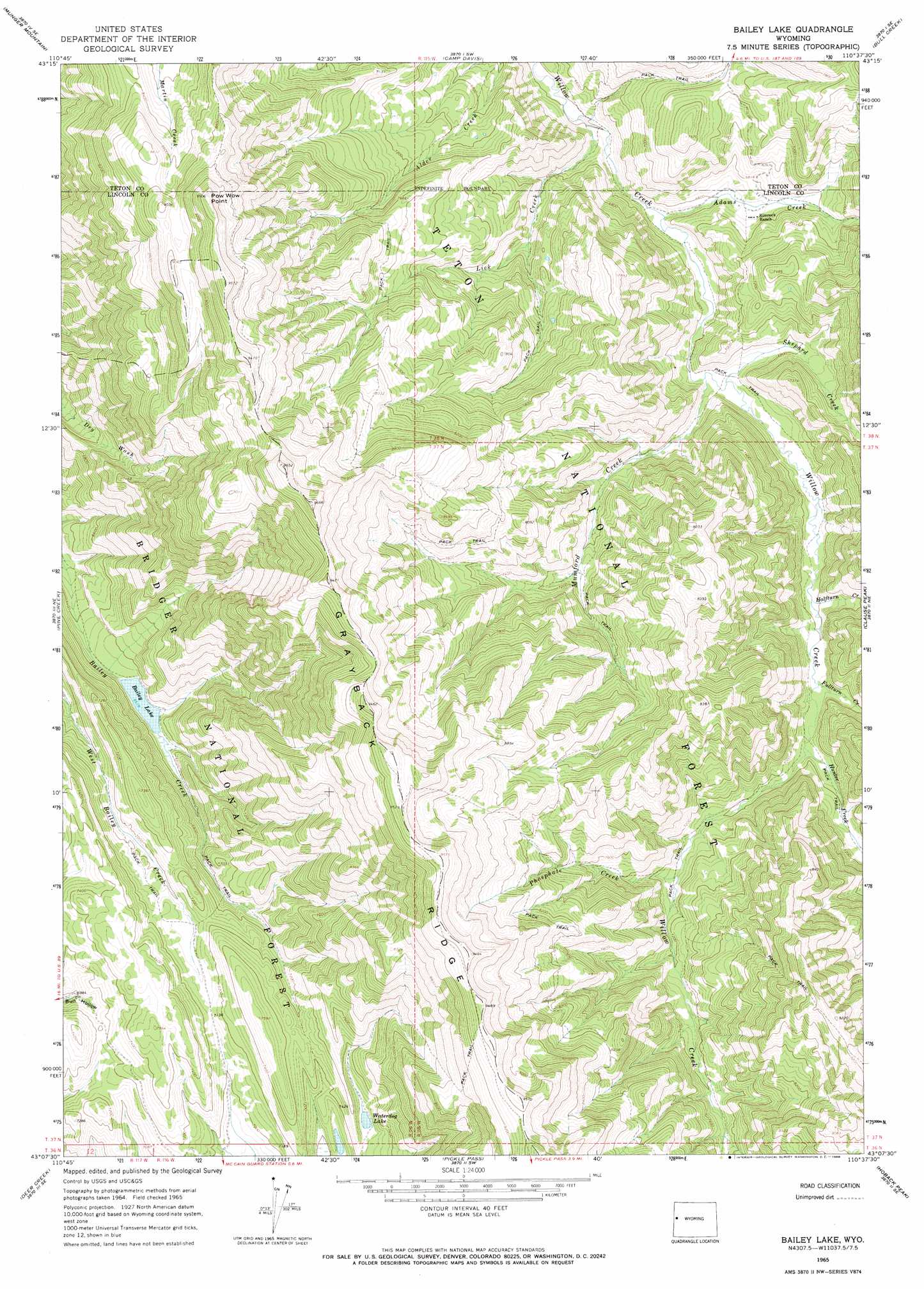
USGS Topo Quad 43110b6 - 1:24,000 scale
| Topo Map Name: | Bailey Lake |
| USGS Topo Quad ID: | 43110b6 |
| Print Size: | ca. 21 1/4" wide x 27" high |
| Southeast Coordinates: | 43.125° N latitude / 110.625° W longitude |
| Map Center Coordinates: | 43.1875° N latitude / 110.6875° W longitude |
| U.S. State: | WY |
| Filename: | o43110b6.jpg |
| Download Map JPG Image: | Bailey Lake topo map 1:24,000 scale |
| Map Type: | Topographic |
| Topo Series: | 7.5´ |
| Map Scale: | 1:24,000 |
| Source of Map Images: | United States Geological Survey (USGS) |
| Alternate Map Versions: |
Bailey Lake WY 1965, updated 1968 Download PDF Buy paper map Bailey Lake WY 1965, updated 1968 Download PDF Buy paper map Bailey Lake WY 1996, updated 1998 Download PDF Buy paper map Bailey Lake WY 2012 Download PDF Buy paper map Bailey Lake WY 2015 Download PDF Buy paper map |
| FStopo: | US Forest Service topo Bailey Lake is available: Download FStopo PDF Download FStopo TIF |
1:24,000 Topo Quads surrounding Bailey Lake
Teton Pass |
Jackson |
Cache Creek |
Turquoise Lake |
Crystal Peak |
Observation Peak |
Munger Mountain |
Camp Davis |
Bull Creek |
Granite Falls |
Ferry Peak |
Pine Creek |
Bailey Lake |
Clause Peak |
Bondurant |
Stewart Peak |
Deer Creek |
Pickle Pass |
Hoback Peak |
Noble Basin |
Thayne East |
Man Peak |
Blind Bull Creek |
Lookout Mountain |
Prospect Peak |
> Back to 43110a1 at 1:100,000 scale
> Back to 43110a1 at 1:250,000 scale
> Back to U.S. Topo Maps home
Bailey Lake topo map: Gazetteer
Bailey Lake: Cliffs
Pow Wow Point elevation 2893m 9491′Bailey Lake: Lakes
Bailey Lake elevation 1988m 6522′Waterdog Lake elevation 2203m 7227′
Bailey Lake: Mines
Budd Prospect Mine elevation 2402m 7880′Bailey Lake: Ridges
Grayback Ridge elevation 2897m 9504′Bailey Lake: Streams
Adams Creek elevation 1985m 6512′Fullturn Creek elevation 2086m 6843′
Halfturn Creek elevation 2065m 6774′
Hunter Creek elevation 2101m 6893′
Lick Creek elevation 1953m 6407′
Mumford Creek elevation 2017m 6617′
Phosphate Creek elevation 2158m 7080′
Shepard Creek elevation 2023m 6637′
Bailey Lake digital topo map on disk
Buy this Bailey Lake topo map showing relief, roads, GPS coordinates and other geographical features, as a high-resolution digital map file on DVD: