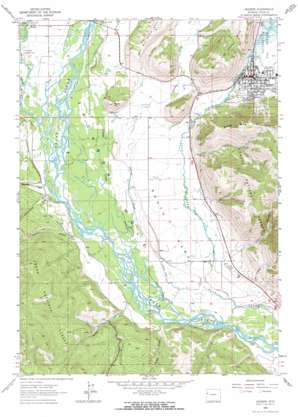
Jackson Topo Map Wyoming
To zoom in, hover over the map of Jackson
USGS Topo Quad 43110d7 - 1:24,000 scale
| Topo Map Name: | Jackson |
| USGS Topo Quad ID: | 43110d7 |
| Print Size: | ca. 21 1/4" wide x 27" high |
| Southeast Coordinates: | 43.375° N latitude / 110.75° W longitude |
| Map Center Coordinates: | 43.4375° N latitude / 110.8125° W longitude |
| U.S. State: | WY |
| Filename: | o43110d7.jpg |
| Download Map JPG Image: | Jackson topo map 1:24,000 scale |
| Map Type: | Topographic |
| Topo Series: | 7.5´ |
| Map Scale: | 1:24,000 |
| Source of Map Images: | United States Geological Survey (USGS) |
| Alternate Map Versions: |
Jackson WY 1963, updated 1966 Download PDF Buy paper map Jackson WY 1963, updated 1973 Download PDF Buy paper map Jackson WY 1963, updated 1984 Download PDF Buy paper map Jackson WY 1996, updated 1998 Download PDF Buy paper map Jackson WY 2012 Download PDF Buy paper map Jackson WY 2015 Download PDF Buy paper map |
| FStopo: | US Forest Service topo Jackson is available: Download FStopo PDF Download FStopo TIF |
1:24,000 Topo Quads surrounding Jackson
> Back to 43110a1 at 1:100,000 scale
> Back to 43110a1 at 1:250,000 scale
> Back to U.S. Topo Maps home
Jackson topo map: Gazetteer
Jackson: Airports
Fish Creek Landing Strip elevation 1870m 6135′Jackson Heliport elevation 1898m 6227′
Melody Ranch Airport elevation 1848m 6062′
Jackson: Flats
South Park elevation 1848m 6062′Jackson: Mines
Crescent H Fall Creek Pit Mine elevation 1917m 6289′Jackson: Populated Places
Jackson elevation 1901m 6236′Rafter J Ranch elevation 1848m 6062′
South Park elevation 1846m 6056′
Jackson: Springs
Boyles Hill Springs elevation 1866m 6122′Jackson: Streams
Butler Creek elevation 1830m 6003′Cache Creek elevation 1892m 6207′
Cottonwood Creek elevation 1850m 6069′
Crane Creek elevation 1839m 6033′
Mosquito Creek elevation 1852m 6076′
Spring Creek elevation 1838m 6030′
Squaw Creek elevation 1830m 6003′
Taylor Creek elevation 1845m 6053′
Trail Creek elevation 1866m 6122′
Jackson: Summits
Boyles Hill elevation 2018m 6620′East Gros Ventre Butte elevation 2259m 7411′
Green Mountain elevation 1888m 6194′
Snow King Mountain elevation 2378m 7801′
Jackson: Valleys
Horsethief Canyon elevation 1859m 6099′Leeks Canyon elevation 1871m 6138′
Little Horsethief Canyon elevation 1818m 5964′
Smith Canyon elevation 1853m 6079′
Wilson Canyon elevation 1819m 5967′
Jackson digital topo map on disk
Buy this Jackson topo map showing relief, roads, GPS coordinates and other geographical features, as a high-resolution digital map file on DVD:


