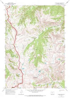
Ranger Peak Topo Map Wyoming
To zoom in, hover over the map of Ranger Peak
USGS Topo Quad 43110h7 - 1:24,000 scale
| Topo Map Name: | Ranger Peak |
| USGS Topo Quad ID: | 43110h7 |
| Print Size: | ca. 21 1/4" wide x 27" high |
| Southeast Coordinates: | 43.875° N latitude / 110.75° W longitude |
| Map Center Coordinates: | 43.9375° N latitude / 110.8125° W longitude |
| U.S. State: | WY |
| Filename: | o43110h7.jpg |
| Download Map JPG Image: | Ranger Peak topo map 1:24,000 scale |
| Map Type: | Topographic |
| Topo Series: | 7.5´ |
| Map Scale: | 1:24,000 |
| Source of Map Images: | United States Geological Survey (USGS) |
| Alternate Map Versions: |
Ranger Peak WY 1968, updated 1971 Download PDF Buy paper map Ranger Peak WY 1968, updated 1973 Download PDF Buy paper map Ranger Peak WY 1968, updated 1973 Download PDF Buy paper map Ranger Peak WY 2012 Download PDF Buy paper map Ranger Peak WY 2015 Download PDF Buy paper map |
| FStopo: | US Forest Service topo Ranger Peak is available: Download FStopo PDF Download FStopo TIF |
1:24,000 Topo Quads surrounding Ranger Peak
> Back to 43110e1 at 1:100,000 scale
> Back to 43110a1 at 1:250,000 scale
> Back to U.S. Topo Maps home
Ranger Peak topo map: Gazetteer
Ranger Peak: Basins
Moose Basin elevation 2769m 9084′Ranger Peak: Cliffs
Moose Mountain Slide elevation 2743m 8999′Ranger Peak: Falls
Wilderness Falls elevation 2794m 9166′Ranger Peak: Gaps
Nord Pass elevation 2866m 9402′Ranger Peak: Lakes
Camp Lake elevation 2717m 8914′Dudley Lake elevation 2514m 8248′
Talus Lake elevation 2949m 9675′
Ranger Peak: Ridges
Moose Basin Divide elevation 2962m 9717′Ranger Peak: Summits
Doane Peak elevation 3450m 11318′Eagle Rest Peak elevation 3407m 11177′
Eagles Rest Peak elevation 3332m 10931′
Elk Mountain elevation 3268m 10721′
Moose Mountain elevation 3050m 10006′
Owl Peak elevation 3229m 10593′
Ranger Peak elevation 3454m 11332′
Red Mountain elevation 3103m 10180′
Rolling Thunder Mountain elevation 3314m 10872′
Ranger Peak: Trails
Camp Lake Trail elevation 2624m 8608′Owl Creek Trail elevation 2478m 8129′
Ranger Peak: Valleys
North Fork Snowshoe Canyon elevation 2293m 7522′South Fork Snowshoe Canyon elevation 2295m 7529′
Ranger Peak digital topo map on disk
Buy this Ranger Peak topo map showing relief, roads, GPS coordinates and other geographical features, as a high-resolution digital map file on DVD:


