Miner Creek Topo Map Idaho
To zoom in, hover over the map of Miner Creek
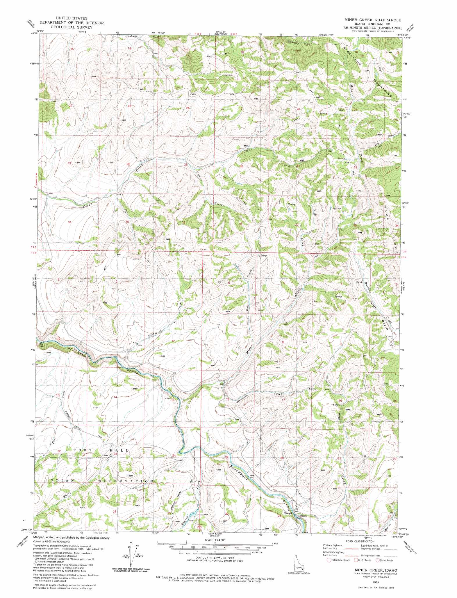
USGS Topo Quad 43111b8 - 1:24,000 scale
| Topo Map Name: | Miner Creek |
| USGS Topo Quad ID: | 43111b8 |
| Print Size: | ca. 21 1/4" wide x 27" high |
| Southeast Coordinates: | 43.125° N latitude / 111.875° W longitude |
| Map Center Coordinates: | 43.1875° N latitude / 111.9375° W longitude |
| U.S. State: | ID |
| Filename: | o43111b8.jpg |
| Download Map JPG Image: | Miner Creek topo map 1:24,000 scale |
| Map Type: | Topographic |
| Topo Series: | 7.5´ |
| Map Scale: | 1:24,000 |
| Source of Map Images: | United States Geological Survey (USGS) |
| Alternate Map Versions: |
Miner Creek ID 1981, updated 1981 Download PDF Buy paper map Miner Creek ID 2010 Download PDF Buy paper map Miner Creek ID 2013 Download PDF Buy paper map |
1:24,000 Topo Quads surrounding Miner Creek
Woodville |
Idaho Falls South |
Ammon |
Ozone |
Lone Pine Ridge |
Firth |
Goshen |
Wolverine |
Bone |
Jumpoff Hill |
Lincoln Creek |
Higham Peak |
Miner Creek |
Poison Creek |
Long Valley |
Yandell Springs |
Lincoln Peak |
Dunn Basin |
Paradise Valley |
Meadow Creek Mountain |
South Putnam Mountain |
Jeff Cabin Creek |
Chesterfield Res |
Grizzly Creek |
Reservoir Mountain |
> Back to 43111a1 at 1:100,000 scale
> Back to 43110a1 at 1:250,000 scale
> Back to U.S. Topo Maps home
Miner Creek topo map: Gazetteer
Miner Creek: Basins
High Basin elevation 1915m 6282′Miner Creek: Bridges
Trail Creek Bridge elevation 1676m 5498′Miner Creek: Populated Places
Trailton (historical) elevation 1682m 5518′Miner Creek: Post Offices
Trailton Post Office (historical) elevation 1682m 5518′Miner Creek: Streams
Beaver Creek elevation 1651m 5416′Bull Creek elevation 1732m 5682′
Cole Creek elevation 1671m 5482′
Colt Creek elevation 1778m 5833′
Deer Creek elevation 1557m 5108′
Dry Miner elevation 2034m 6673′
Menassa Creek elevation 1693m 5554′
Miner Creek elevation 1633m 5357′
Short Creek elevation 1629m 5344′
Spring Creek elevation 1631m 5351′
Trail Creek elevation 1686m 5531′
Miner Creek digital topo map on disk
Buy this Miner Creek topo map showing relief, roads, GPS coordinates and other geographical features, as a high-resolution digital map file on DVD: