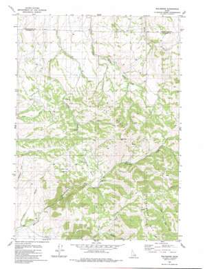
Wolverine Topo Map Idaho
To zoom in, hover over the map of Wolverine
USGS Topo Quad 43111c8 - 1:24,000 scale
| Topo Map Name: | Wolverine |
| USGS Topo Quad ID: | 43111c8 |
| Print Size: | ca. 21 1/4" wide x 27" high |
| Southeast Coordinates: | 43.25° N latitude / 111.875° W longitude |
| Map Center Coordinates: | 43.3125° N latitude / 111.9375° W longitude |
| U.S. State: | ID |
| Filename: | o43111c8.jpg |
| Download Map JPG Image: | Wolverine topo map 1:24,000 scale |
| Map Type: | Topographic |
| Topo Series: | 7.5´ |
| Map Scale: | 1:24,000 |
| Source of Map Images: | United States Geological Survey (USGS) |
| Alternate Map Versions: |
Wolverine ID 1981, updated 1981 Download PDF Buy paper map Wolverine ID 1981, updated 1981 Download PDF Buy paper map Wolverine ID 2011 Download PDF Buy paper map Wolverine ID 2013 Download PDF Buy paper map |
1:24,000 Topo Quads surrounding Wolverine
> Back to 43111a1 at 1:100,000 scale
> Back to 43110a1 at 1:250,000 scale
> Back to U.S. Topo Maps home
Wolverine topo map: Gazetteer
Wolverine: Basins
Saw Log Basin elevation 1791m 5875′Wolverine: Gaps
The Narrows elevation 1631m 5351′Wolverine: Populated Places
Wolverine elevation 1701m 5580′Wolverine: Streams
Jones Creek elevation 1520m 4986′Mackelroy Creek elevation 1803m 5915′
Wolverine: Summits
Taylor Mountain elevation 2254m 7395′Wolverine digital topo map on disk
Buy this Wolverine topo map showing relief, roads, GPS coordinates and other geographical features, as a high-resolution digital map file on DVD:


