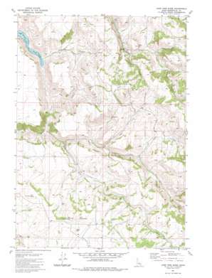
Lone Pine Ridge Topo Map Idaho
To zoom in, hover over the map of Lone Pine Ridge
USGS Topo Quad 43111d6 - 1:24,000 scale
| Topo Map Name: | Lone Pine Ridge |
| USGS Topo Quad ID: | 43111d6 |
| Print Size: | ca. 21 1/4" wide x 27" high |
| Southeast Coordinates: | 43.375° N latitude / 111.625° W longitude |
| Map Center Coordinates: | 43.4375° N latitude / 111.6875° W longitude |
| U.S. State: | ID |
| Filename: | o43111d6.jpg |
| Download Map JPG Image: | Lone Pine Ridge topo map 1:24,000 scale |
| Map Type: | Topographic |
| Topo Series: | 7.5´ |
| Map Scale: | 1:24,000 |
| Source of Map Images: | United States Geological Survey (USGS) |
| Alternate Map Versions: |
Lone Pine Ridge ID 1981, updated 1981 Download PDF Buy paper map Lone Pine Ridge ID 2010 Download PDF Buy paper map Lone Pine Ridge ID 2013 Download PDF Buy paper map |
1:24,000 Topo Quads surrounding Lone Pine Ridge
> Back to 43111a1 at 1:100,000 scale
> Back to 43110a1 at 1:250,000 scale
> Back to U.S. Topo Maps home
Lone Pine Ridge topo map: Gazetteer
Lone Pine Ridge: Populated Places
Dehlin elevation 1886m 6187′Guyaz elevation 1778m 5833′
Lone Pine Ridge: Post Offices
Dehlin Post Office (historical) elevation 1886m 6187′Lone Pine Ridge: Ridges
Lone Pine Ridge elevation 1995m 6545′Lone Pine Ridge: Streams
Bear Creek elevation 1561m 5121′Blue Creek elevation 1736m 5695′
Bulls Fork elevation 1633m 5357′
Deer Creek elevation 1568m 5144′
Indian Fork elevation 1718m 5636′
Pipe Creek elevation 1702m 5583′
Spring Creek elevation 1775m 5823′
Tex Creek elevation 1582m 5190′
Lone Pine Ridge: Summits
Big Horse Butte elevation 1985m 6512′Little Horse Butte elevation 1970m 6463′
Red Butte elevation 1892m 6207′
Skelly Hill elevation 1872m 6141′
Lone Pine Ridge: Valleys
Dogtooth Hollow elevation 1712m 5616′Lone Pine Ridge digital topo map on disk
Buy this Lone Pine Ridge topo map showing relief, roads, GPS coordinates and other geographical features, as a high-resolution digital map file on DVD:


