Temple Peak Topo Map Idaho
To zoom in, hover over the map of Temple Peak
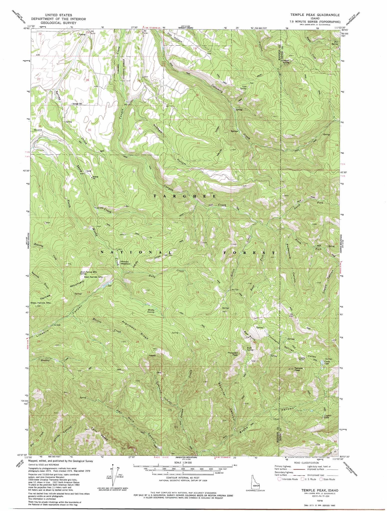
USGS Topo Quad 43111f4 - 1:24,000 scale
| Topo Map Name: | Temple Peak |
| USGS Topo Quad ID: | 43111f4 |
| Print Size: | ca. 21 1/4" wide x 27" high |
| Southeast Coordinates: | 43.625° N latitude / 111.375° W longitude |
| Map Center Coordinates: | 43.6875° N latitude / 111.4375° W longitude |
| U.S. State: | ID |
| Filename: | o43111f4.jpg |
| Download Map JPG Image: | Temple Peak topo map 1:24,000 scale |
| Map Type: | Topographic |
| Topo Series: | 7.5´ |
| Map Scale: | 1:24,000 |
| Source of Map Images: | United States Geological Survey (USGS) |
| Alternate Map Versions: |
Temple Peak ID 1979, updated 1985 Download PDF Buy paper map Temple Peak ID 2011 Download PDF Buy paper map Temple Peak ID 2013 Download PDF Buy paper map |
| FStopo: | US Forest Service topo Temple Peak is available: Download FStopo PDF Download FStopo TIF |
1:24,000 Topo Quads surrounding Temple Peak
Saint Anthony |
Newdale |
Linderman Dam |
Drummond |
Lamont |
Moody |
White Owl Butte |
Wright Creek |
Packsaddle Lake |
Tetonia |
Heise |
Hawley Gulch |
Temple Peak |
Garns Mountain |
Bates |
Poplar |
Heise Se |
Wheaton Mountain |
Stouts Mountain |
Fourth Of July Peak |
Lone Pine Ridge |
Point Lookout |
Conant Valley |
Swan Valley |
Thompson Peak |
> Back to 43111e1 at 1:100,000 scale
> Back to 43110a1 at 1:250,000 scale
> Back to U.S. Topo Maps home
Temple Peak topo map: Gazetteer
Temple Peak: Flats
Moody Meadow elevation 2061m 6761′Temple Peak: Lakes
Crystle Lake elevation 2170m 7119′Temple Peak: Ridges
Argument Ridge elevation 2348m 7703′Temple Peak: Springs
Bex Spring elevation 2440m 8005′East Farnes Mountain Spring elevation 2198m 7211′
Graham Spring elevation 2308m 7572′
Lost Spring elevation 2160m 7086′
Temple Peak: Streams
Coalmine Creek elevation 1854m 6082′Hilton Creek elevation 1999m 6558′
Marlow Creek elevation 2057m 6748′
North Fork Canyon Creek elevation 2025m 6643′
Ruby Creek elevation 2046m 6712′
Sheep Creek elevation 1891m 6204′
South Fork Canyon Creek elevation 2093m 6866′
Temple Peak: Summits
East Farnes Mountain elevation 2215m 7267′Farnes Mountain elevation 2248m 7375′
Prospect Peak elevation 2447m 8028′
Twin Peaks elevation 2350m 7709′
West Farnes Mountain elevation 2244m 7362′
Temple Peak: Swamps
Moody Swamp elevation 2181m 7155′Temple Peak: Trails
Carlton Cutoff Trail elevation 2162m 7093′Temple Peak: Valleys
Beartrap Canyon elevation 1854m 6082′Coalmine Canyon elevation 1837m 6026′
Flat Hollow elevation 1870m 6135′
Kirkham Hollow elevation 1915m 6282′
Little Burns Canyon elevation 1721m 5646′
Thousand Springs Valley elevation 2209m 7247′
Temple Peak digital topo map on disk
Buy this Temple Peak topo map showing relief, roads, GPS coordinates and other geographical features, as a high-resolution digital map file on DVD: