Rigby Topo Map Idaho
To zoom in, hover over the map of Rigby
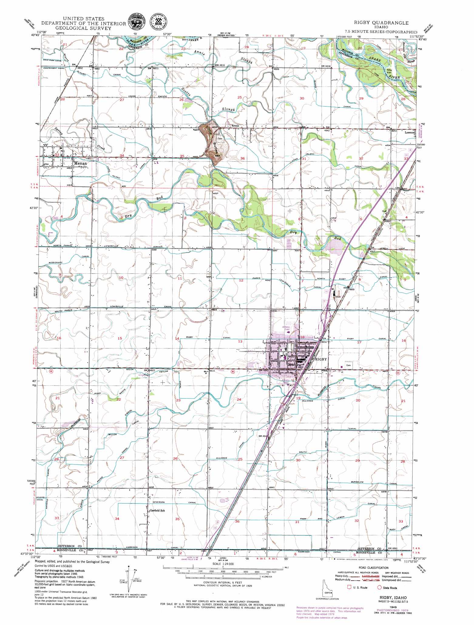
USGS Topo Quad 43111f8 - 1:24,000 scale
| Topo Map Name: | Rigby |
| USGS Topo Quad ID: | 43111f8 |
| Print Size: | ca. 21 1/4" wide x 27" high |
| Southeast Coordinates: | 43.625° N latitude / 111.875° W longitude |
| Map Center Coordinates: | 43.6875° N latitude / 111.9375° W longitude |
| U.S. State: | ID |
| Filename: | o43111f8.jpg |
| Download Map JPG Image: | Rigby topo map 1:24,000 scale |
| Map Type: | Topographic |
| Topo Series: | 7.5´ |
| Map Scale: | 1:24,000 |
| Source of Map Images: | United States Geological Survey (USGS) |
| Alternate Map Versions: |
Rigby ID 1948, updated 1959 Download PDF Buy paper map Rigby ID 1949 Download PDF Buy paper map Rigby ID 1949, updated 1979 Download PDF Buy paper map Rigby ID 1949, updated 1979 Download PDF Buy paper map Rigby ID 2010 Download PDF Buy paper map Rigby ID 2013 Download PDF Buy paper map |
1:24,000 Topo Quads surrounding Rigby
Hamer |
Market Lake Ne |
Plano |
Parker |
Saint Anthony |
Market Lake |
Deer Parks |
Menan Buttes |
Rexburg |
Moody |
Roberts |
Lewisville |
Rigby |
Ririe |
Heise |
Shattuck Butte |
Idaho Falls North |
Ucon |
Rigby Se |
Poplar |
Woodville |
Idaho Falls South |
Ammon |
Ozone |
Lone Pine Ridge |
> Back to 43111e1 at 1:100,000 scale
> Back to 43110a1 at 1:250,000 scale
> Back to U.S. Topo Maps home
Rigby topo map: Gazetteer
Rigby: Airports
Rigby Airport elevation 1478m 4849′Rigby: Canals
Alliance Canal elevation 1478m 4849′Bungalow Canal elevation 1487m 4878′
Burgess Canal elevation 1478m 4849′
Garfield Ucon Canal elevation 1476m 4842′
Harrison Canal elevation 1485m 4872′
Long Island Canal elevation 1474m 4835′
Miller Canal elevation 1467m 4812′
North Parks Lewisville Canal elevation 1464m 4803′
North Rigby Canal elevation 1478m 4849′
Park and Lemon Canal elevation 1484m 4868′
Parks Lewisville Canal elevation 1483m 4865′
Randall Canal elevation 1463m 4799′
Rigby Canal elevation 1482m 4862′
Rigby Waste elevation 1467m 4812′
Scotts Slough Canal elevation 1465m 4806′
Selck and Taylor Canal elevation 1472m 4829′
Severson Canal elevation 1472m 4829′
South Parks Lewisville Canal elevation 1464m 4803′
South Rigby Canal elevation 1488m 4881′
Vance Payne Canal elevation 1467m 4812′
Rigby: Populated Places
Annis elevation 1472m 4829′Garfield elevation 1470m 4822′
Menan elevation 1465m 4806′
Rigby elevation 1480m 4855′
Rigby: Streams
Annis Slough elevation 1466m 4809′Rigby: Summits
Little Buttes elevation 1510m 4954′Rigby digital topo map on disk
Buy this Rigby topo map showing relief, roads, GPS coordinates and other geographical features, as a high-resolution digital map file on DVD: