Clawson Topo Map Idaho
To zoom in, hover over the map of Clawson
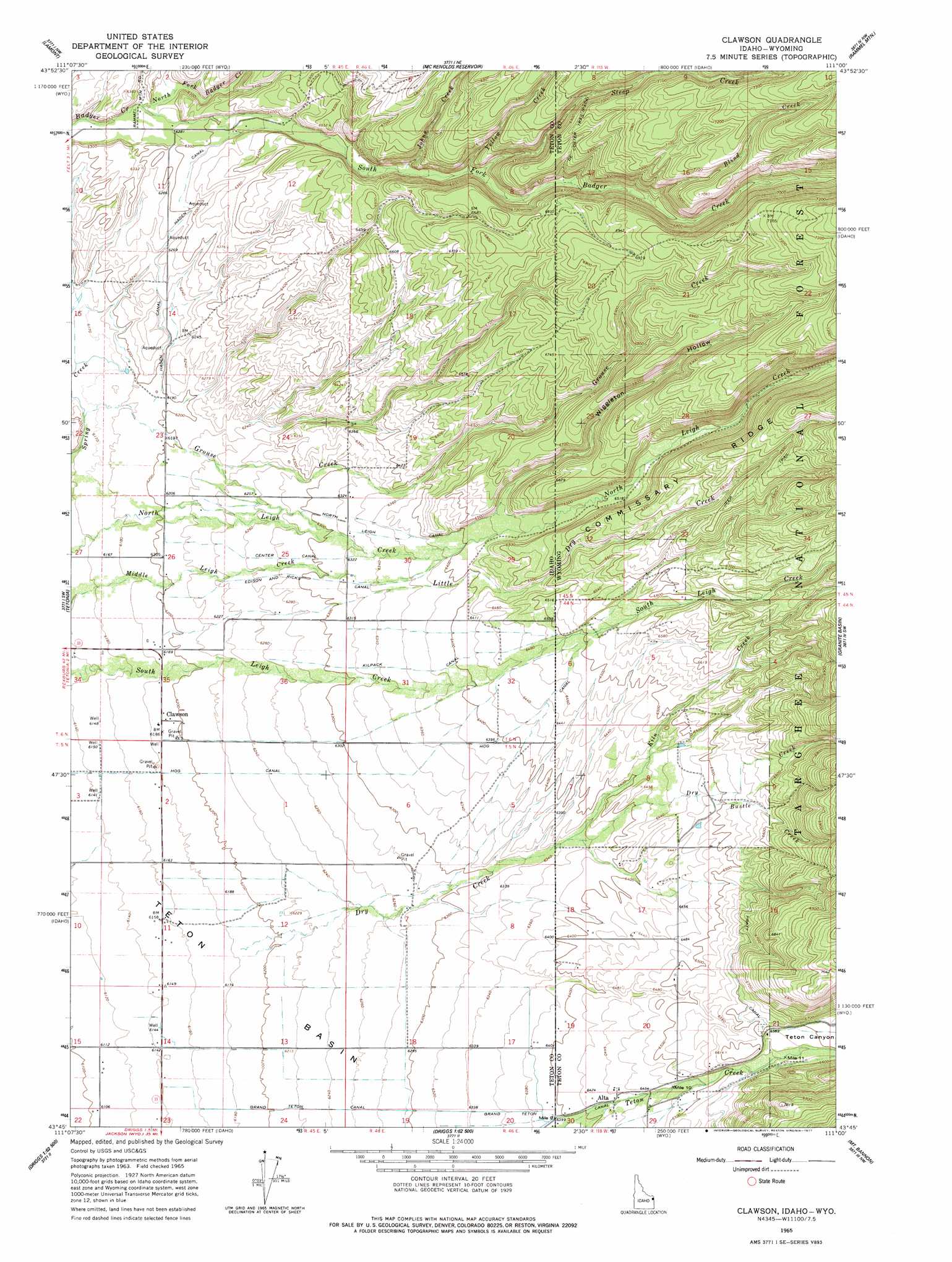
USGS Topo Quad 43111g1 - 1:24,000 scale
| Topo Map Name: | Clawson |
| USGS Topo Quad ID: | 43111g1 |
| Print Size: | ca. 21 1/4" wide x 27" high |
| Southeast Coordinates: | 43.75° N latitude / 111° W longitude |
| Map Center Coordinates: | 43.8125° N latitude / 111.0625° W longitude |
| U.S. States: | ID, WY |
| Filename: | o43111g1.jpg |
| Download Map JPG Image: | Clawson topo map 1:24,000 scale |
| Map Type: | Topographic |
| Topo Series: | 7.5´ |
| Map Scale: | 1:24,000 |
| Source of Map Images: | United States Geological Survey (USGS) |
| Alternate Map Versions: |
Clawson ID 1965, updated 1967 Download PDF Buy paper map Clawson ID 1965, updated 1977 Download PDF Buy paper map Clawson ID 1965, updated 1977 Download PDF Buy paper map Clawson ID 2011 Download PDF Buy paper map Clawson ID 2013 Download PDF Buy paper map |
| FStopo: | US Forest Service topo Clawson is available: Download FStopo PDF Download FStopo TIF |
1:24,000 Topo Quads surrounding Clawson
Warm River |
Porcupine Lake |
Sheep Falls |
Hominy Peak |
Survey Peak |
Drummond |
Lamont |
Mcrenolds Reservoir |
Rammel Mountain |
Ranger Peak |
Packsaddle Lake |
Tetonia |
Clawson |
Granite Basin |
Mount Moran |
Garns Mountain |
Bates |
Driggs |
Mount Bannon |
Grand Teton |
Stouts Mountain |
Fourth Of July Peak |
Victor |
Rendezvous Peak |
Teton Village |
> Back to 43111e1 at 1:100,000 scale
> Back to 43110a1 at 1:250,000 scale
> Back to U.S. Topo Maps home
Clawson topo map: Gazetteer
Clawson: Canals
Center Canal elevation 1906m 6253′Edison and Ricks Canal elevation 1924m 6312′
Grand Teton Canal elevation 1921m 6302′
Grand Teton Canal elevation 1954m 6410′
Haden Canal elevation 1903m 6243′
Hog Canal elevation 1879m 6164′
Kilpack Canal elevation 1940m 6364′
North Leigh Canal elevation 1938m 6358′
Pratt Canal elevation 2008m 6587′
Clawson: Populated Places
Alta elevation 1963m 6440′Clawson elevation 1887m 6190′
Clawson: Streams
Blind Creek elevation 2035m 6676′Bustle Creek elevation 1972m 6469′
Dry Creek elevation 1886m 6187′
Dry Creek elevation 1888m 6194′
Grouse Creek elevation 1882m 6174′
Grouse Creek elevation 1882m 6174′
Johns Creek elevation 1963m 6440′
Kiln Creek elevation 1935m 6348′
Little Dry Creek elevation 1889m 6197′
North Badger Creek elevation 1909m 6263′
South Badger Creek elevation 1909m 6263′
Steep Creek elevation 1984m 6509′
Steep Creek elevation 1986m 6515′
Yellow Creek elevation 1980m 6496′
Clawson: Trails
DeCoster Trail elevation 2114m 6935′Clawson: Valleys
Dry Canyon elevation 2007m 6584′Teton Canyon elevation 2001m 6564′
Wiggleton Hollow elevation 1964m 6443′
Clawson digital topo map on disk
Buy this Clawson topo map showing relief, roads, GPS coordinates and other geographical features, as a high-resolution digital map file on DVD: