Yandell Springs Topo Map Idaho
To zoom in, hover over the map of Yandell Springs
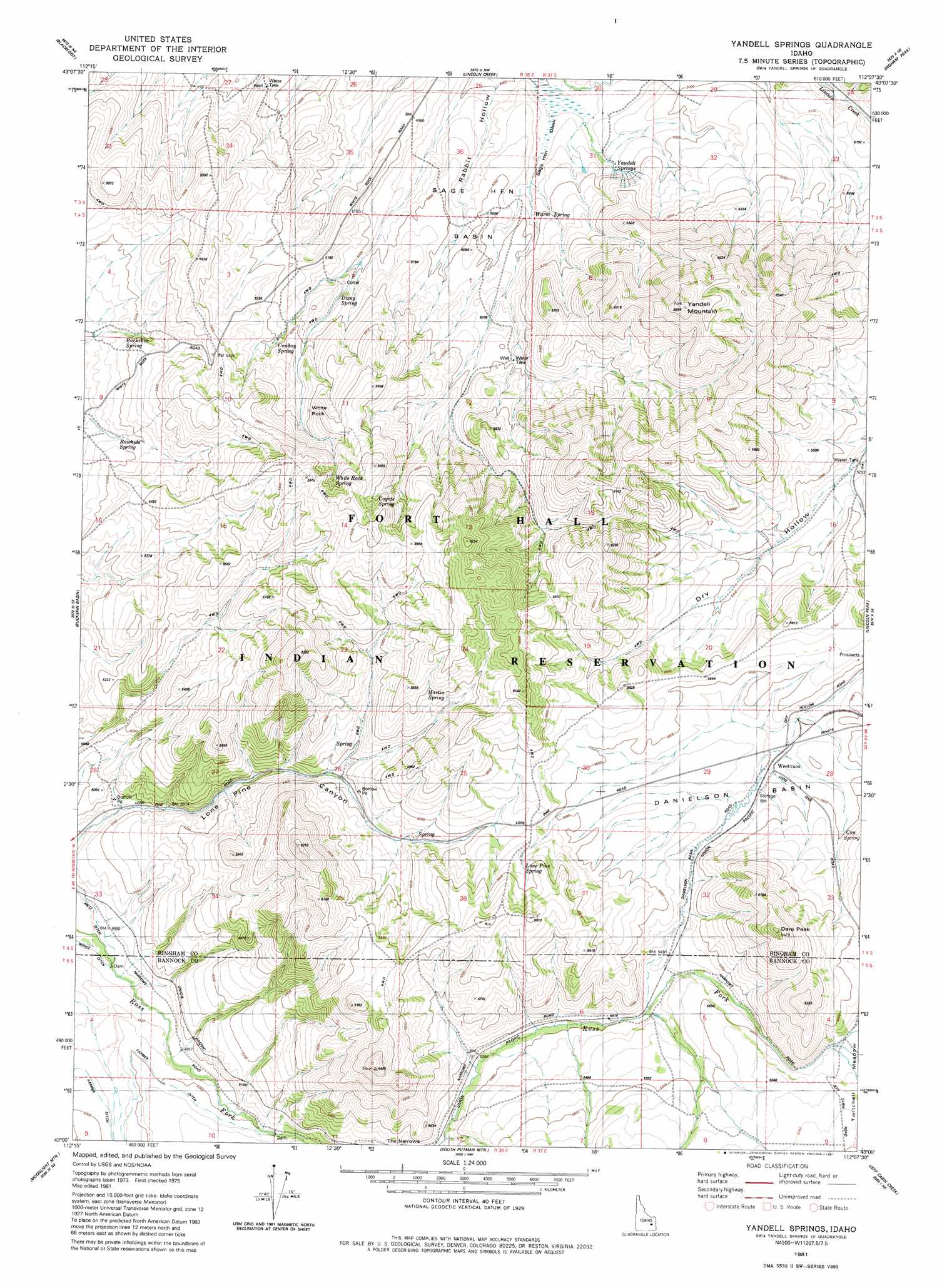
USGS Topo Quad 43112a2 - 1:24,000 scale
| Topo Map Name: | Yandell Springs |
| USGS Topo Quad ID: | 43112a2 |
| Print Size: | ca. 21 1/4" wide x 27" high |
| Southeast Coordinates: | 43° N latitude / 112.125° W longitude |
| Map Center Coordinates: | 43.0625° N latitude / 112.1875° W longitude |
| U.S. State: | ID |
| Filename: | o43112a2.jpg |
| Download Map JPG Image: | Yandell Springs topo map 1:24,000 scale |
| Map Type: | Topographic |
| Topo Series: | 7.5´ |
| Map Scale: | 1:24,000 |
| Source of Map Images: | United States Geological Survey (USGS) |
| Alternate Map Versions: |
Yandell Springs ID 1981, updated 1981 Download PDF Buy paper map Yandell Springs ID 2010 Download PDF Buy paper map Yandell Springs ID 2013 Download PDF Buy paper map |
1:24,000 Topo Quads surrounding Yandell Springs
Baldy Knoll |
Rose |
Firth |
Goshen |
Wolverine |
Moreland |
Blackfoot |
Lincoln Creek |
Higham Peak |
Miner Creek |
Fort Hall |
Buckskin Basin |
Yandell Springs |
Lincoln Peak |
Dunn Basin |
Pocatello North |
Moonlight Mountain |
South Putnam Mountain |
Jeff Cabin Creek |
Chesterfield Res |
Pocatello South |
Inkom |
Bonneville Peak |
Bear Camp Gulch |
Chesterfield |
> Back to 43112a1 at 1:100,000 scale
> Back to 43112a1 at 1:250,000 scale
> Back to U.S. Topo Maps home
Yandell Springs topo map: Gazetteer
Yandell Springs: Basins
Danielson Basin elevation 1696m 5564′Sage Hen Basin elevation 1516m 4973′
Yandell Springs: Pillars
White Rock elevation 1642m 5387′Yandell Springs: Springs
Buckskin Spring elevation 1566m 5137′Cow Spring elevation 1707m 5600′
Cowboy Spring elevation 1584m 5196′
Coyote Spring elevation 1783m 5849′
Dixey Spring elevation 1546m 5072′
Lone Pine Spring elevation 1758m 5767′
Martin Spring elevation 1741m 5711′
Rawhide Spring elevation 1564m 5131′
White Rock Spring elevation 1732m 5682′
Yandell Springs elevation 1493m 4898′
Yandell Springs: Summits
Dare Peak elevation 1952m 6404′Yandell Mountain elevation 1945m 6381′
Yandell Springs: Valleys
Rabbit Hollow elevation 1469m 4819′Sage Hen Draw elevation 1477m 4845′
Yandell Springs: Wells
Dry Hollow Well elevation 1619m 5311′Yandell Springs digital topo map on disk
Buy this Yandell Springs topo map showing relief, roads, GPS coordinates and other geographical features, as a high-resolution digital map file on DVD: