Pingree Topo Map Idaho
To zoom in, hover over the map of Pingree
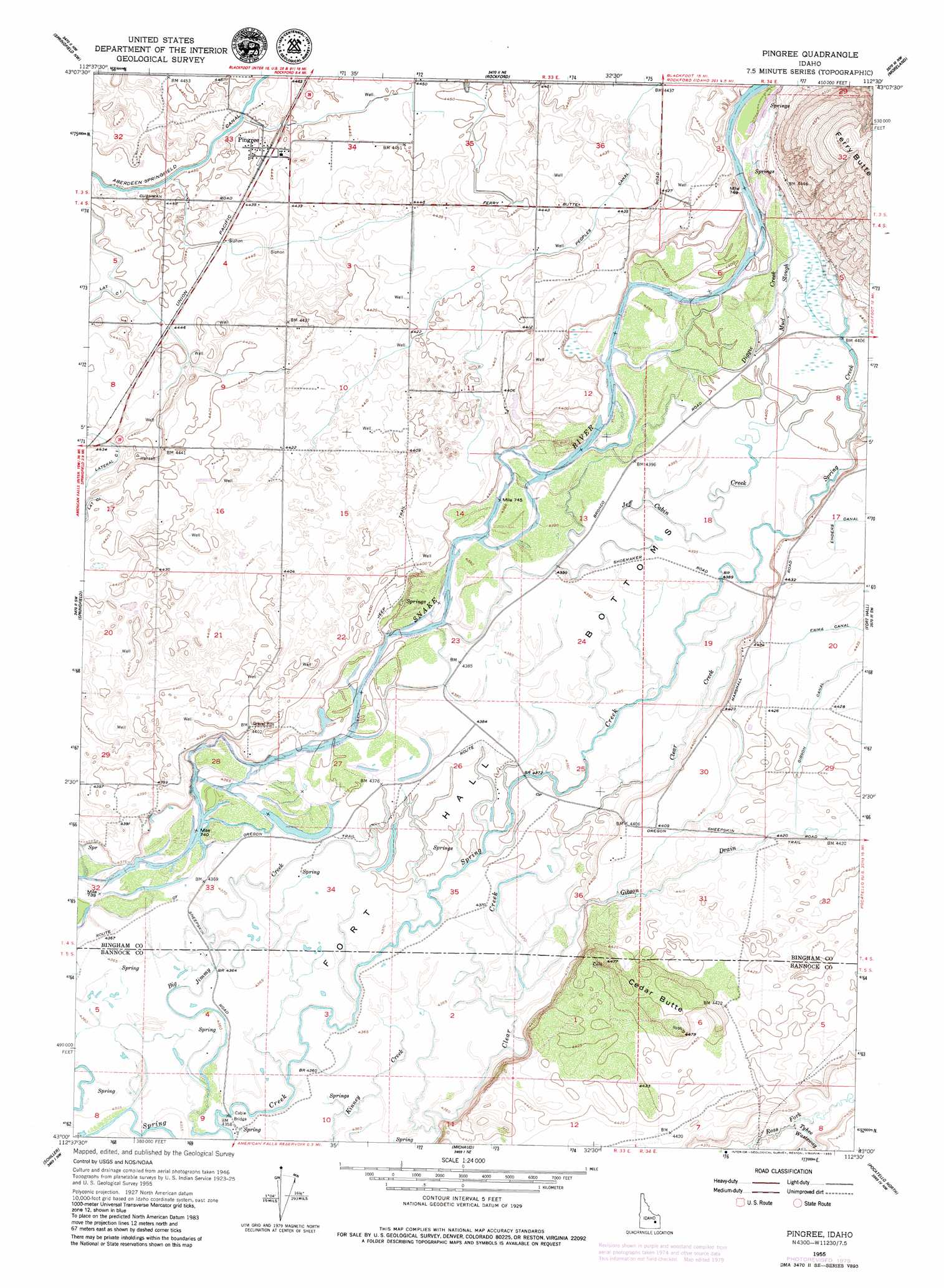
USGS Topo Quad 43112a5 - 1:24,000 scale
| Topo Map Name: | Pingree |
| USGS Topo Quad ID: | 43112a5 |
| Print Size: | ca. 21 1/4" wide x 27" high |
| Southeast Coordinates: | 43° N latitude / 112.5° W longitude |
| Map Center Coordinates: | 43.0625° N latitude / 112.5625° W longitude |
| U.S. State: | ID |
| Filename: | o43112a5.jpg |
| Download Map JPG Image: | Pingree topo map 1:24,000 scale |
| Map Type: | Topographic |
| Topo Series: | 7.5´ |
| Map Scale: | 1:24,000 |
| Source of Map Images: | United States Geological Survey (USGS) |
| Alternate Map Versions: |
Pingree ID 1955, updated 1957 Download PDF Buy paper map Pingree ID 1955, updated 1976 Download PDF Buy paper map Pingree ID 1955, updated 1980 Download PDF Buy paper map Pingree ID 1955, updated 1980 Download PDF Buy paper map Pingree ID 2010 Download PDF Buy paper map Pingree ID 2013 Download PDF Buy paper map |
1:24,000 Topo Quads surrounding Pingree
Lava Lake Reservoir |
Taber |
Olsen |
Baldy Knoll |
Rose |
Coffee Point Ne |
Springfield Nw |
Rockford |
Moreland |
Blackfoot |
Big Fill Reservoir |
Springfield |
Pingree |
Fort Hall |
Buckskin Basin |
Aberdeen |
Schiller |
Michaud |
Pocatello North |
Moonlight Mountain |
American Falls |
Wheatgrass Bench |
Michaud Creek |
Pocatello South |
Inkom |
> Back to 43112a1 at 1:100,000 scale
> Back to 43112a1 at 1:250,000 scale
> Back to U.S. Topo Maps home
Pingree topo map: Gazetteer
Pingree: Canals
Emma Canal elevation 1351m 4432′Lateral 45 elevation 1357m 4452′
Lateral B elevation 1358m 4455′
Lateral C2 elevation 1356m 4448′
Pingree: Flats
Fort Hall Bottoms elevation 1338m 4389′Pingree: Populated Places
Pingree elevation 1357m 4452′Pingree: Streams
Big Jimmy Creek elevation 1328m 4356′Diggie Creek elevation 1341m 4399′
Gibson Drain elevation 1332m 4370′
Jeff Cabin Creek elevation 1339m 4393′
Mud Slough elevation 1342m 4402′
Pingree: Summits
Cedar Butte elevation 1362m 4468′Pingree digital topo map on disk
Buy this Pingree topo map showing relief, roads, GPS coordinates and other geographical features, as a high-resolution digital map file on DVD: