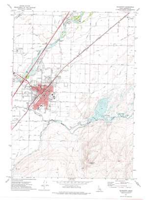
Blackfoot Topo Map Idaho
To zoom in, hover over the map of Blackfoot
USGS Topo Quad 43112b3 - 1:24,000 scale
| Topo Map Name: | Blackfoot |
| USGS Topo Quad ID: | 43112b3 |
| Print Size: | ca. 21 1/4" wide x 27" high |
| Southeast Coordinates: | 43.125° N latitude / 112.25° W longitude |
| Map Center Coordinates: | 43.1875° N latitude / 112.3125° W longitude |
| U.S. State: | ID |
| Filename: | o43112b3.jpg |
| Download Map JPG Image: | Blackfoot topo map 1:24,000 scale |
| Map Type: | Topographic |
| Topo Series: | 7.5´ |
| Map Scale: | 1:24,000 |
| Source of Map Images: | United States Geological Survey (USGS) |
| Alternate Map Versions: |
Blackfoot ID 1971, updated 1974 Download PDF Buy paper map Blackfoot ID 1974, updated 1975 Download PDF Buy paper map Blackfoot ID 2010 Download PDF Buy paper map Blackfoot ID 2013 Download PDF Buy paper map |
1:24,000 Topo Quads surrounding Blackfoot
> Back to 43112a1 at 1:100,000 scale
> Back to 43112a1 at 1:250,000 scale
> Back to U.S. Topo Maps home
Blackfoot topo map: Gazetteer
Blackfoot: Airports
McCarley Field elevation 1368m 4488′Blackfoot: Bridges
Porterville Bridge elevation 1369m 4491′Blackfoot: Canals
Apex Lateral elevation 1369m 4491′Arc Lateral elevation 1368m 4488′
Arrow Lateral elevation 1367m 4484′
Ash Lateral elevation 1367m 4484′
Blackfoot Slough elevation 1384m 4540′
Centerville Ditch elevation 1373m 4504′
Corbett Slough Canal elevation 1377m 4517′
Divide Ditch elevation 1380m 4527′
Dixie Lateral elevation 1369m 4491′
Ensign Lateral elevation 1365m 4478′
Little Butte Canal elevation 1376m 4514′
Lloyd Ditch elevation 1380m 4527′
Nebo Lateral elevation 1369m 4491′
Neva Lateral elevation 1368m 4488′
Trego Ditch elevation 1367m 4484′
West Branch Blackfoot Canal elevation 1381m 4530′
West Side Ditch elevation 1370m 4494′
Younnie Ditch elevation 1369m 4491′
Blackfoot: Dams
Blackfoot-Equalizing Dam elevation 1379m 4524′Blackfoot: Lakes
Equalizing Reservoir elevation 1380m 4527′Jensens Lake elevation 1366m 4481′
Blackfoot: Parks
Airport Park elevation 1367m 4484′Jensen Grove Park elevation 1367m 4484′
Blackfoot: Populated Places
Blackfoot elevation 1371m 4498′Groveland elevation 1370m 4494′
Wapello elevation 1386m 4547′
Blackfoot: Reservoirs
Equalizing Reservoir elevation 1379m 4524′Blackfoot: Summits
Stevens Peak elevation 1631m 5351′Blackfoot digital topo map on disk
Buy this Blackfoot topo map showing relief, roads, GPS coordinates and other geographical features, as a high-resolution digital map file on DVD:


