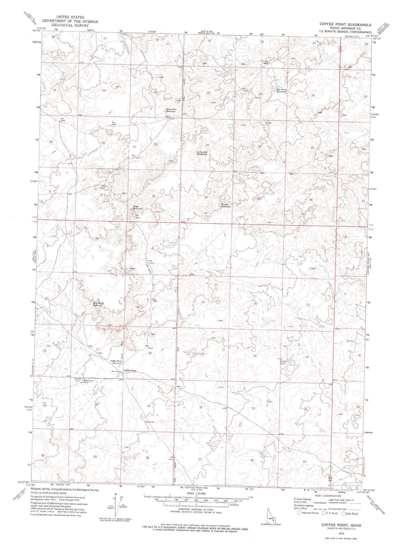
Coffee Point Topo Map Idaho
To zoom in, hover over the map of Coffee Point
USGS Topo Quad 43112b8 - 1:24,000 scale
| Topo Map Name: | Coffee Point |
| USGS Topo Quad ID: | 43112b8 |
| Print Size: | ca. 21 1/4" wide x 27" high |
| Southeast Coordinates: | 43.125° N latitude / 112.875° W longitude |
| Map Center Coordinates: | 43.1875° N latitude / 112.9375° W longitude |
| U.S. State: | ID |
| Filename: | o43112b8.jpg |
| Download Map JPG Image: | Coffee Point topo map 1:24,000 scale |
| Map Type: | Topographic |
| Topo Series: | 7.5´ |
| Map Scale: | 1:24,000 |
| Source of Map Images: | United States Geological Survey (USGS) |
| Alternate Map Versions: |
Coffee Point ID 1973, updated 1976 Download PDF Buy paper map Coffee Point ID 2010 Download PDF Buy paper map Coffee Point ID 2013 Download PDF Buy paper map |
1:24,000 Topo Quads surrounding Coffee Point
Quaking Aspen Butte |
Big Southern Butte |
Scoville |
Atomic City |
Middle Butte |
Serviceberry Butte |
Sunset Lake |
Rock Butte |
Lava Lake Reservoir |
Taber |
Antelope Lake |
Split Top |
Coffee Point |
Coffee Point Ne |
Springfield Nw |
Mosby Butte |
Mosby Well |
Coffee Point Sw |
Big Fill Reservoir |
Springfield |
Pillar Butte |
Pillar Butte Ne |
American Falls Nw |
Aberdeen |
Schiller |
> Back to 43112a1 at 1:100,000 scale
> Back to 43112a1 at 1:250,000 scale
> Back to U.S. Topo Maps home
Coffee Point topo map: Gazetteer
Coffee Point: Lakes
Cottontail Waterhole elevation 1518m 4980′Lau Lakes elevation 1498m 4914′
Coffee Point: Populated Places
Coffee Point elevation 1477m 4845′Coffee Point: Reservoirs
Coffee Point Reservoir elevation 1477m 4845′Dry Wash Reservoir elevation 1502m 4927′
Eagle Reservoir elevation 1511m 4957′
Ripples Reservoir elevation 1496m 4908′
Rye Grass Reservoir elevation 1491m 4891′
Sauce Pan Reservoir elevation 1531m 5022′
Coffee Point: Wells
Well Number 3 elevation 1480m 4855′Coffee Point digital topo map on disk
Buy this Coffee Point topo map showing relief, roads, GPS coordinates and other geographical features, as a high-resolution digital map file on DVD: