Roberts Topo Map Idaho
To zoom in, hover over the map of Roberts
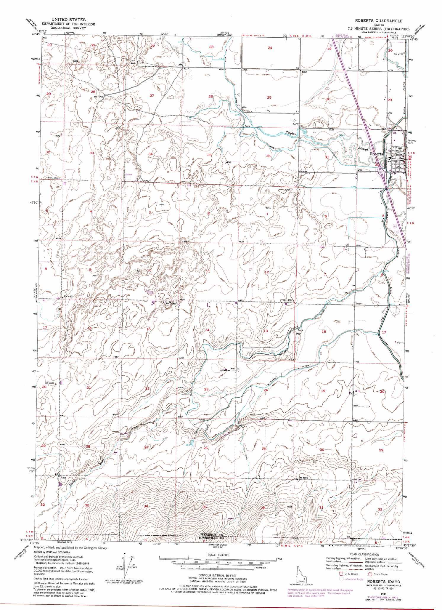
USGS Topo Quad 43112f2 - 1:24,000 scale
| Topo Map Name: | Roberts |
| USGS Topo Quad ID: | 43112f2 |
| Print Size: | ca. 21 1/4" wide x 27" high |
| Southeast Coordinates: | 43.625° N latitude / 112.125° W longitude |
| Map Center Coordinates: | 43.6875° N latitude / 112.1875° W longitude |
| U.S. State: | ID |
| Filename: | o43112f2.jpg |
| Download Map JPG Image: | Roberts topo map 1:24,000 scale |
| Map Type: | Topographic |
| Topo Series: | 7.5´ |
| Map Scale: | 1:24,000 |
| Source of Map Images: | United States Geological Survey (USGS) |
| Alternate Map Versions: |
Roberts ID 1949, updated 1966 Download PDF Buy paper map Roberts ID 1949, updated 1975 Download PDF Buy paper map Roberts ID 1949, updated 1979 Download PDF Buy paper map Roberts ID 1949, updated 1986 Download PDF Buy paper map Roberts ID 1950 Download PDF Buy paper map Roberts ID 2010 Download PDF Buy paper map Roberts ID 2013 Download PDF Buy paper map |
1:24,000 Topo Quads surrounding Roberts
Mud Lake Nw |
Rays Lake |
Hamer |
Market Lake Ne |
Plano |
Terreton |
Mud Lake Se |
Market Lake |
Deer Parks |
Menan Buttes |
Kettle Butte Nw |
Kettle Butte Ne |
Roberts |
Lewisville |
Rigby |
Kettle Butte |
Butterfly Butte |
Shattuck Butte |
Idaho Falls North |
Ucon |
Morgans Pasture Nw |
Morgans Pasture Ne |
Woodville |
Idaho Falls South |
Ammon |
> Back to 43112e1 at 1:100,000 scale
> Back to 43112a1 at 1:250,000 scale
> Back to U.S. Topo Maps home
Roberts topo map: Gazetteer
Roberts: Canals
Bell Larsen Canal elevation 1452m 4763′McCarthy Ditch elevation 1455m 4773′
Poitevin Ditch elevation 1455m 4773′
Roberts: Guts
Taylor Slough elevation 1455m 4773′Roberts: Populated Places
Roberts elevation 1456m 4776′Roberts: Streams
Kettle Butte Drain elevation 1460m 4790′Roberts digital topo map on disk
Buy this Roberts topo map showing relief, roads, GPS coordinates and other geographical features, as a high-resolution digital map file on DVD: