Kettle Butte Ne Topo Map Idaho
To zoom in, hover over the map of Kettle Butte Ne
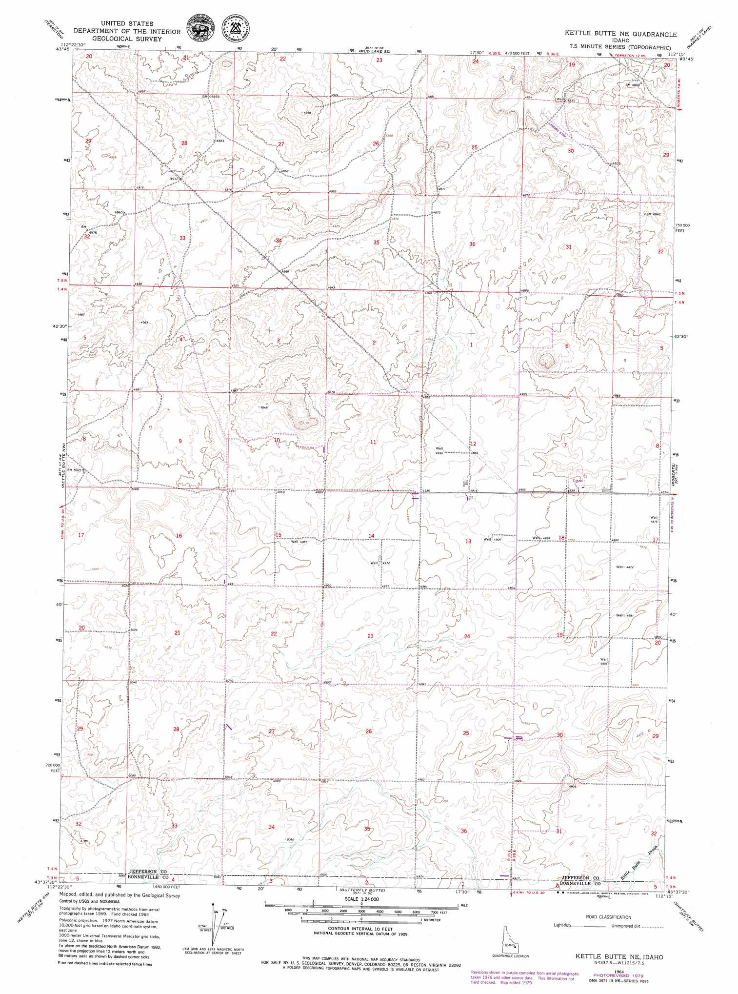
USGS Topo Quad 43112f3 - 1:24,000 scale
| Topo Map Name: | Kettle Butte Ne |
| USGS Topo Quad ID: | 43112f3 |
| Print Size: | ca. 21 1/4" wide x 27" high |
| Southeast Coordinates: | 43.625° N latitude / 112.25° W longitude |
| Map Center Coordinates: | 43.6875° N latitude / 112.3125° W longitude |
| U.S. State: | ID |
| Filename: | o43112f3.jpg |
| Download Map JPG Image: | Kettle Butte Ne topo map 1:24,000 scale |
| Map Type: | Topographic |
| Topo Series: | 7.5´ |
| Map Scale: | 1:24,000 |
| Source of Map Images: | United States Geological Survey (USGS) |
| Alternate Map Versions: |
Kettle Butte NE ID 1964, updated 1965 Download PDF Buy paper map Kettle Butte NE ID 1964, updated 1979 Download PDF Buy paper map Kettle Butte NE ID 2010 Download PDF Buy paper map Kettle Butte NE ID 2013 Download PDF Buy paper map |
1:24,000 Topo Quads surrounding Kettle Butte Ne
Monteview |
Mud Lake Nw |
Rays Lake |
Hamer |
Market Lake Ne |
Antelope Butte |
Terreton |
Mud Lake Se |
Market Lake |
Deer Parks |
Little Butte Ne |
Kettle Butte Nw |
Kettle Butte Ne |
Roberts |
Lewisville |
Little Butte |
Kettle Butte |
Butterfly Butte |
Shattuck Butte |
Idaho Falls North |
Taber Ne |
Morgans Pasture Nw |
Morgans Pasture Ne |
Woodville |
Idaho Falls South |
> Back to 43112e1 at 1:100,000 scale
> Back to 43112a1 at 1:250,000 scale
> Back to U.S. Topo Maps home
No gazetteer data is available for the Kettle Butte Ne topo map sheet.
Kettle Butte Ne digital topo map on disk
Buy this Kettle Butte Ne topo map showing relief, roads, GPS coordinates and other geographical features, as a high-resolution digital map file on DVD: