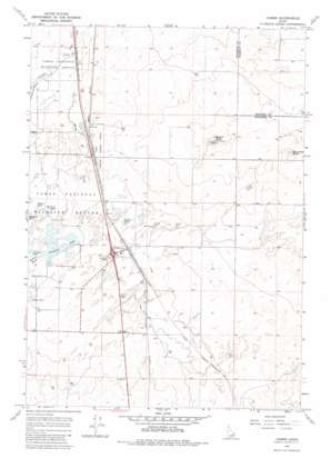
Hamer Topo Map Idaho
To zoom in, hover over the map of Hamer
USGS Topo Quad 43112h2 - 1:24,000 scale
| Topo Map Name: | Hamer |
| USGS Topo Quad ID: | 43112h2 |
| Print Size: | ca. 21 1/4" wide x 27" high |
| Southeast Coordinates: | 43.875° N latitude / 112.125° W longitude |
| Map Center Coordinates: | 43.9375° N latitude / 112.1875° W longitude |
| U.S. State: | ID |
| Filename: | o43112h2.jpg |
| Download Map JPG Image: | Hamer topo map 1:24,000 scale |
| Map Type: | Topographic |
| Topo Series: | 7.5´ |
| Map Scale: | 1:24,000 |
| Source of Map Images: | United States Geological Survey (USGS) |
| Alternate Map Versions: |
Hamer ID 1964, updated 1966 Download PDF Buy paper map Hamer ID 1964, updated 1983 Download PDF Buy paper map Hamer ID 2010 Download PDF Buy paper map Hamer ID 2013 Download PDF Buy paper map |
1:24,000 Topo Quads surrounding Hamer
> Back to 43112e1 at 1:100,000 scale
> Back to 43112a1 at 1:250,000 scale
> Back to U.S. Topo Maps home
Hamer topo map: Gazetteer
Hamer: Canals
Hamer Ditch elevation 1465m 4806′Hamer: Guts
Mallard Slough elevation 1459m 4786′Hamer: Lakes
Hamer Lake elevation 1461m 4793′Leavitz Pond elevation 1459m 4786′
Rat Farm Pond elevation 1461m 4793′
Willow Pond elevation 1460m 4790′
Hamer: Parks
Camas National Wildlife Refuge elevation 1463m 4799′Hamer: Populated Places
Hamer elevation 1464m 4803′Hamer: Reservoirs
Sandhole Lake elevation 1460m 4790′Hamer: Streams
Beaver Creek elevation 1466m 4809′Warm Creek elevation 1460m 4790′
Hamer: Summits
Beacon Butte elevation 1541m 5055′Raumaker Butte elevation 1531m 5022′
Hamer digital topo map on disk
Buy this Hamer topo map showing relief, roads, GPS coordinates and other geographical features, as a high-resolution digital map file on DVD:


